- Malmberget
-
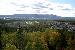
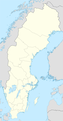
Malmberget Malmberget. "The Pit" is visible in the center-left of the image. In the background Gällivare and the Dundret mountain. Coordinates: 67°10′N 20°40′E / 67.167°N 20.667°ECoordinates: 67°10′N 20°40′E / 67.167°N 20.667°E Country Sweden Province Lapland County Norrbotten County Municipality Gällivare Municipality Area[1] - Total 7.45 km2 (2.9 sq mi) Population (2005-12-31)[1] - Total 6,017 - Density 808/km2 (2,092.7/sq mi) Time zone CET (UTC+1) - Summer (DST) CEST (UTC+2) Malmberget ("The Ore Mountain") is a locality and mining town situated in Gällivare Municipality, Norrbotten County, Sweden with 6,017 inhabitants in 2005.[1] It is situated 5 kilometres from the municipal seat Gällivare.
Malmberget is known as a major site for the extraction of iron ore from deep mines by the company LKAB. The iron ore mining started in 1741 at the Illuvaara mountain, later known as Gellivare malmberg and eventually just Malmberget. The first train transporting iron ore was loaded in 1888 - this was the beginning of the great iron ore rush which would change the entire area of Northern Lapland. In Malmberget there were lots of job opportunities but no dwellings - a striking resemblance to the conditions during the gold rush in North America. During the first years, workers lived in shacks built from wasted dynamite crates.
Right down the center of Malmberget, the deep mine has reached daylight and thus created a huge hole called Gropen ("The Pit"). Gropen has grown southwards as the deep mining continued, and thus divided the town while making the old town centre uninhabitable and forcing many institutions (e.g. the two existing cinemas and the church) to move to the western part of Malmberget or, even more commonly, to the neighbouring town of Gällivare.
Today Gropen is being filled up with stone which is dug up as a by-product from the underground mines. Gropen will eventually be filled in, but the uninhabitable area is continually growing as underground mining undermines the area and seismic events caused by the mining regularly shake the remaining parts of Malmberget. The future of Malmberget is currently uncertain, but prospecting by LKAB indicates that even more of Malmberget may have to move in the future. The moving of several large residential houses owned by the mining company, as well as private villas, has been a major issue locally for the past few years. The iron ore extracted from Malmberget is mainly transported by rail southeast to the port of Luleå. (See Swedish iron ore during World War II).
Sports
Malmberget's largest sports association is named Malmbergets Allmänna IdrottsFörening (MAIF). MAIF's colors are green and white and has an athletic tradition spanning more than a hundred years.
The local football club is Gällivare Malmbergets FF.
References
- ^ a b c "Tätorternas landareal, folkmängd och invånare per km2 2000 och 2005" (in Swedish) (xls). Statistics Sweden. http://www.scb.se/statistik/MI/MI0810/2005A01B/T%c3%a4torternami0810tab1.xls. Retrieved 2009-04-19.
Localities in Gällivare Municipality, Norrbotten County, Sweden Localities: Categories:- Norrbotten County geography stubs
- Populated places in Norrbotten County
- Populated places in Arctic Sweden
Wikimedia Foundation. 2010.


