- Magé
-
Coordinates: 22°39′10″S 43°02′27″W / 22.65278°S 43.04083°W
Magé Coordinates: 22°39′10″S 43°02′27″W / 22.65278°S 43.04083°W Country Brazil Region Southeast State Rio de Janeiro Founded 1566[citation needed] Government - Mayor Nestor Vidal (PMDB) Area - Total 385.7 km2 (148.9 sq mi) Elevation 5 m (16 ft) Population (2009)[1] - Total 244,334 Time zone UTC-3 Coordinates: 22°39′10″S 43°02′27″W / 22.65278°S 43.04083°W Magé is a city and a municipality located in the Brazilian state of Rio de Janeiro.
Magepe-Mirim was established in 1566 by Portuguese colonists. It is a very calm place, especially compared to nearby Rio.
International Football player Garrincha was born in Magé (Pau Grande).
In elections of October 5, 2008 Núbia Cozzolino was re-elected mayor with 51% of the vote but had her mandate revoked in 2009 after being impeached on various corruption charges. She was succeeded by her deputy Rozan Gomes who was also impeached resulting in a by-election on 31st July 2011, won by Nestor Vidal of the PMDB with 68.62% of the vote.[2]
Geography
Magé borders Petrópolis to the north, Duque de Caxias to west, Guapimirim to the east and Guanabara bay to the south.
The climate is tropical throughout the municipality, except in areas near the Serra dos Órgãos with a tropical climate of altitude.
The average minimum temperature is 18 °C (64 °F) in the month of July[citation needed]. In Inhomirim temperatures can easily reach down to 6 °C (43 °F) at night during the months of June, July and August.[citation needed]
References
- ^ "Estimativas da população para 1º de julho de 2009" (PDF). Instituto Brasileiro de Geografia e Estatística (IBGE). 29 Oct 2010. http://www.ibge.gov.br/home/estatistica/populacao/estimativa2009/.
- ^ R7 (04/08/2011). "Novo prefeito de Magé tomará posse na próxima quarta-feira". http://noticias.r7.com/rio-de-janeiro/noticias/novo-prefeito-de-mage-tomara-posse-na-proxima-quarta-feira-20110804.html.
 Municipalities of Rio de Janeiro
Capital: Rio de Janeiro Mesoregion
BaixadasBacia de São JoãoLagos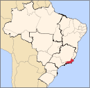
Mesoregion
Centro FluminenseCantagalo-CordeiroNova FriburgoSanta Maria MadalenaTrês RiosMesoregion
Metropolitana do
Rio de JaneiroItaguaíMacacu-CaceribuMicroregion
Rio de JaneiroBelford Roxo · Duque de Caxias · Guapimirim · Itaboraí · Japeri · Magé · Maricá · Nilópolis · Niterói · Mesquita · Nova Iguaçu · Queimados · Rio de Janeiro · São Gonçalo · São João de Meriti · TanguáSerranaVassourasMesoregion
Noroeste FluminenseItaperunaSanto Antônio de PáduaMesoregion
Norte FluminenseCampos dos GoytacazesMacaéMesoregion
Sul FluminenseBaía da Ilha GrandeBarra do PiraíVale do Paraíba FluminenseBarra Mansa · Itatiaia · Pinheiral · Piraí · Porto Real · Quatis · Resende · Rio Claro · Volta RedondaCategories:- Municipalities of Brazil
- Populated places established in 1566
- Populated coastal places in Rio de Janeiro (state)
- Rio de Janeiro (state) geography stubs

Wikimedia Foundation. 2010.