- California State Route 28
Infobox road
state=CA
type=SR
route=28
section=328
maint=Caltrans 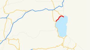
length_mi=11
length_round=0
length_ref= [ [http://www.dot.ca.gov/hq/structur/strmaint/brlog2.htm January 1, 2006 California Log of Bridges on State Highways] ]
direction_a=West
terminus_a=jct|state=CA|SR|89 in Tahoe City
junction=jct|state=CA|SR|267 at Kings Beach
direction_b=East
terminus_b=jct|state=NV|SR|28 towardsCarson City, NV
previous_type=SR
previous_route=27
next_type=SR
next_route=29State Route 28 is a
state highway in theU.S. State ofCalifornia that travels along the northern shore ofLake Tahoe , starting at Route 89 in Tahoe City and ending at theNevada state border, whereupon it becomesNevada State Route 28 . Route 28 is one of only three state routes that keep the same number in Nevada, along with Route 88 and Route 266.This route is part of the
California Freeway and Expressway System [http://www.leginfo.ca.gov/cgi-bin/displaycode?section=shc&group=00001-01000&file=250-257 CA Codes (shc:250-257)] ] and is eligible for the State Scenic Highway System [http://www.leginfo.ca.gov/cgi-bin/displaycode?section=shc&group=00001-01000&file=260-284 CA Codes (shc:260-284)] ] .Major intersections
:"Note: Except where prefixed with a letter,
postmile s were measured in 1964, based on the alignment as it existed at that time, and do not necessarily reflect current mileage."The entire route is in Placer County.External links
* [http://www.dot.ca.gov/hq/roadinfo/sr28 Caltrans: Route 28 highway conditions]
* [http://www.cahighways.org/025-032.html#028 California Highways: SR 28]References

Wikimedia Foundation. 2010.