- Drumul Taberei
-
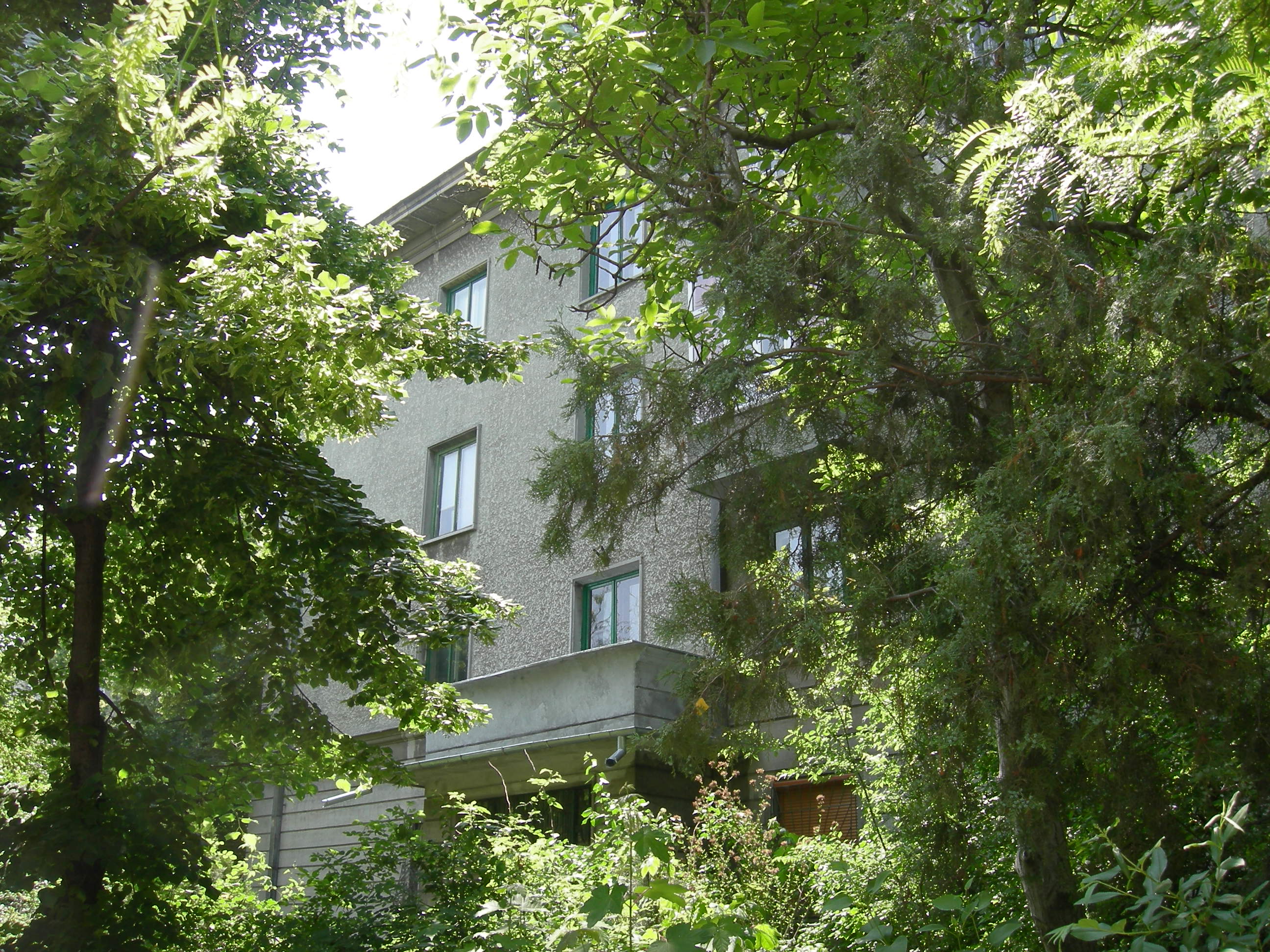
 Apartment building in a leafy setting typical of Drumul Taberei
Drumul Taberei (approx. Road of the Camp) is a neighbourhood located in the south-west of Bucharest, Romania, roughly between Timişoara Avenue (south of Plaza România and the Cotroceni Railway Station) and Ghencea Avenue, neighboring Militari to the North, Panduri to the East and Ghencea and Rahova to the South and South-East.
It is one of the few examples of successful urban planning during Communist Romania, despite it being built in the Eastern European tradition of "dormitory neighborhoods". This success is mostly due to the unique approach of the architects and planners to the concept of high-density urban living, an approach that was not used elsewhere in Bucharest.
Contents
History
The neighbourhood was built in the mid-to-late 1960s, on former agricultural fields and marshland, using an old road as a backbone. It was called Road of the Camp because Tudor Vladimirescu set there his Pandur camp before entering Bucharest in 1821[1].
Urban planning
The central concept of the area was providing for a comfortable living environment in a high density urban area. The main concepts used were standardization of buildings (most of the residential buildings are standard Eastern European tower blocks - "cutii de chibrituri", literally "matchboxes"), providing for quick and efficient mass transit to the center of the city but also inside the neighbourhood and creating large, green spaces to counterbalance the massiveness and bleakness of the standardized apartment buildings.
The heart of the quarter is Drumul Taberei Park, a small park, complete with an artificial lake and a public swimming pool. The main avenue of the quarter circles the park forming a "U" shape, extending outwards to the east, and linking the quarter to the center of the city. Immediately east of the park, a large North-South street (Braşov Street) cuts across the U-shaped avenues in order to provide quick access to Militari and Ghencea. Next to the park, a large open-air market (Drumul Taberei) was built.
Public transport was constructed to be an integral part of the neighbourhood. As such, even today, the neighbourhood is extremely well connected to all parts of the city, even though it is not served by the Metro. Around each trolleybus stop, commercial areas were planned and built, to include stores, restaurants and cinemas, to serve for each small community served by that stop (many of these commercial areas still keep their original names - "Favorit", "Orizont", "Drumul Taberei 34"). The design of the neighbourhood was influenced by the then-fashionable brutalism, visible especially in the design of the commercial areas. This design, despite being very popular and very efficient, was not adopted anywhere else in Bucharest, partly because most other high-density neighbourhoods were built over a pre-existing layout, with old buildings being razed and rebuilt, and partly because the process of designing and planning such a complex layout all over again was rather slow (Drumul Taberei was completed around 1974). In all, 63,000 apartments were built.
Transportation
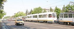
The design of the neighbourhood placed a great importance on mass transit. Trolleybuses connect all parts of the quarter with Gara de Nord, Eroilor and Universitate, while Light Rail 41 links the neighbourhood to Ghencea, Militari, Crângaşi, Ion Mihalache Herăstrău and Băneasa. The network also features a number of bus lines, serving additional routes inside the neighborhood. An extension of the metro to Drumul Taberei is planned, with work scheduled to commence in autumn 2015, and an estimated completion date of 2020. As the neighbourhood was heavily designed around public transport, parking spaces are rather scarce, and traffic jams and gridlock are quite common occurrences, especially at the Răzoare intersection, where one of the three center-bound roads out of Rahova meets two of the centerbound roads out of Drumul Taberei.
Notes
- ^ City Hall of the Bucharest's 6th District, Brief history of the 6th District, accessed on January 7, 2007
Geography of Bucharest, Romania Sectors of Bucharest 
Districts (quarters): Aviaţiei • Băneasa • Berceni • Bucureştii Noi • Centrul Civic • Colentina • Cotroceni • Crângaşi • Dămăroaia • Dealul Spirii • Dorobanţi • Dristor • Drumul Taberei • Dudeşti • Ferentari • Floreasca • Ghencea • Giuleşti • Giurgiului • Griviţa • Iancului • Lipscani • Militari • Moşilor • Obor • Odăi • Olteniţei • Pantelimon • Pipera • Primăverii • Progresul • Rahova • Regie • Tei • Titan • Vitan • VăcăreştiSquares: Charles de Gaulle • Constituţiei • Revoluţiei • Romană • Rosetti • Unirii • University Square • Victory Square • Quito SquareMajor streets: Şoseaua Kiseleff • Lipscani • Bulevardul Magheru • Calea Moşilor • Bulevardul Unirii • Calea VictorieiHills: Rivers: Lakes: listParks and forests: Băneasa Forest (Codrii Vlăsiei) • Bordei Park • Botanical Garden • Carol Park • Cişmigiu Gardens • Giuleşti Park • Herăstrău Park • Grădina Icoanei • Tineretului Park • Vitan ParkSee also: Coordinates: 44°25′12.18″N 26°1′28.33″E / 44.42005°N 26.0245361°E
Categories:- Districts of Bucharest

Wikimedia Foundation. 2010.