- Cotroceni
-
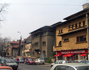 Most houses of Cotroceni area were built between the two World Wars
Cotroceni is a neighbourhood in western Bucharest, Romania located around the Cotroceni hill, in Bucharest's Sector 6.
The Hill of Cotroceni was once covered by the forest of Vlăsia, which covered most of today's Bucharest. Here, in 1679 a monastery was built by Şerban Cantacuzino, later to be transformed into a palace in 1888.
The nearest Metro stations are Eroilor and Politehnica.
Landmarks
- Cotroceni Palace, the official residence of the Romanian president, is located in this neighbourhood
- Botanical Garden of Bucharest
- Carol Davila University of Medicine and Pharmacy
- The Bucharest Opera building
- Bucharest Municipal Hospital
- Cotroceni Stadium
- St. Elefterie Church
- Casa Radio
-
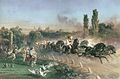
Carol I in the Royal coach in Cotroceni, 1860s
-
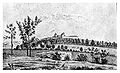
Cotroceni Monastery, 1860
-
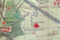
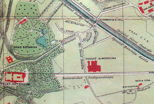
Map of Cotroceni area, circa 1895
Coordinates: 44°26′7.67″N 26°4′4.03″E / 44.4354639°N 26.0677861°E
Categories:- Districts of Bucharest
- Hills of Bucharest


Wikimedia Foundation. 2010.