- Old Moss Lead Vein
-
Old Moss Lead Vein Site of Special Scientific Interest Country England Region North East District Wear Valley Location NY820433 - coordinates 54°47′5″N 2°16′50″W / 54.78472°N 2.28056°W Area 0.6 ha (1.5 acres) Notification 1961 Management Natural England Area of Search County Durham Interest Geological 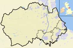
 Location of Old Moss Lead Vein SSSI, Co Durham
Website: Map of site Old Moss Lead Vein, also known as Killhope Head, is a Site of Special Scientific Interest in the Wear Valley district of County Durham, England. It consists of an exposure of a mineral vein in the valley of the Killhope Burn, just upstream from the North of England Lead Mining Museum.
The vein is visible as a 5-metre thick intrusion trending northeast-southwest through the Great Limestone. Mineralisation in the vein typifies the inner fluorite zone of the North Pennines Orefield,[1] with galena and sphalerite in the centre of the vein giving way to fluorite and siderite toward the periphery. The site, under the name Killhope Head, has been designated of national importance in the Geological Conservation Review.[2]
References
- ^ Dunham, Kingsley C (1990). Geology of the North Pennine Orefield, vol 1, Tyne to Stainmore. HMSO. ISBN 0 11 884471 7.
- ^ "Old Moss Lead Vein". English Nature. 1989. http://www.english-nature.org.uk/citation/citation_photo/1000465.pdf. Retrieved 27 July 2010.
Backstone Bank and Baal Hill Woods • Baldersdale Woodlands • Bishop Middleham Quarry • Bollihope, Pikestone, Eggleston and Woodland Fells • Botany Hill • Bowes Moor • Bowlees and Friar House Meadows • Brasside Pond • Brignall Banks • Burnhope Burn • Butterby Oxbow • Cassop Vale • Castle Eden Dene • Causey Bank Mires • Charity Land • Close House Mine • Cornriggs Meadows • Cotherstone Moor • Crag Gill • Crime Rigg and Sherburn Hill Quarries • Dabble Bank • Derwent Gorge and Horsleyhope Ravine • Durham Coast • Fairy Holes Cave • Far High House Meadows • Fishburn Grassland • Foster's Hush • Frog Wood Bog • God's Bridge • Grains o' th' Beck Meadows • Green Croft and Langley Moor • Greenfoot Quarry • Hannah's Meadows • Hawthorn Dene • Hawthorn Quarry • Hell Kettles • Hesledon Moor East • Hesledon Moor West • Hexhamshire Moors • Hisehope Burn Valley • Hulam Fen • Hunder Beck Juniper • Kilmond Scar • Low Redford Meadows • Lune Forest • Mere Beck Meadows • Middle Crossthwaite • Middle Side and Stonygill Meadows • Middleton Quarry • Middridge Quarry • Moorhouse and Cross Fell • Muggleswick, Stanhope and Edmundbyers Commons and Blanchland Moor • Neasham Fen • Newton Ketton Meadow • Old Moss Lead Vein • Park End Wood • Pig Hill • Pike Whin Bog • Pittington Hill • Pow Hill Bog • Quarrington Hill Grasslands • Railway Stell West • Raisby Hill Grassland • Raisby Hill Quarry • Redcar Field • Rigg Farm and Stake Hill Meadows • Rogerley Quarry • Sherburn Hill • Shipley and Great Woods • Sleightholme Beck Gorge - The Troughs • Slit Woods • Stony Cut, Cold Hesledon • Teesdale Allotments • The Bottoms • The Carrs • Thrislington Plantation • Town Kelloe Bank • Trimdon Limestone Quarry • Tuthill Quarry • Upper Teesdale • Waldridge Fell • West Newlandside Meadows • West Park Meadows • West Rigg Open Cutting • Westernhope Burn Wood • Wingate Quarry • Witton-le-Wear • Yoden Village QuarryCategories:- Sites of Special Scientific Interest in County Durham
- United Kingdom Site of Special Scientific Interest stubs
- County Durham geography stubs

Wikimedia Foundation. 2010.