- Cotherstone Moor
-
Cotherstone Moor Site of Special Scientific Interest Country England Region North East District Teesdale Location NY940170 - coordinates 54°32′55″N 2°5′37″W / 54.54861°N 2.09361°W Area 2,449.45 ha (6,052.72 acres) Notification 1955 Management Natural England Area of Search County Durham Interest Biological 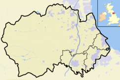
 Location of Cotherstone Moor SSSI, Co Durham
Website: Map of site Cotherstone Moor is a Site of Special Scientific Interest in the Teesdale district in south-west County Durham, England. It is an extensive area of moorland which extends almost the entire length of Baldersdale, from the confluence of the River Balder with the Tees at Cotherstone. It runs parallel to Bowes Moor SSSI, which lies a short distance to the south.
The area includes a variety of upland vegetation types, much of it blanket bog, including one area that is found nowhere else in County Durham and which is unusual for being transitional between northern upland and lowland bogs. Other habitats include dry heath, acid grassland, flushes, and rock and block scree.
The area supports breeding populations of a number of species of birds that are listed in the United Kingdom's Red Data Book (Birds), including four that are listed in Annex 1 of the European Commission's Birds Directive as requiring special protection.[1]
The Pennine Way National Trail passes through the area.
References
- ^ "Cotherstone Moor". English Nature. 1993. http://www.english-nature.org.uk/citation/citation_photo/1000598.pdf. Retrieved 19 July 2010.
Backstone Bank and Baal Hill Woods • Baldersdale Woodlands • Bishop Middleham Quarry • Bollihope, Pikestone, Eggleston and Woodland Fells • Botany Hill • Bowes Moor • Bowlees and Friar House Meadows • Brasside Pond • Brignall Banks • Burnhope Burn • Butterby Oxbow • Cassop Vale • Castle Eden Dene • Causey Bank Mires • Charity Land • Close House Mine • Cornriggs Meadows • Cotherstone Moor • Crag Gill • Crime Rigg and Sherburn Hill Quarries • Dabble Bank • Derwent Gorge and Horsleyhope Ravine • Durham Coast • Fairy Holes Cave • Far High House Meadows • Fishburn Grassland • Foster's Hush • Frog Wood Bog • God's Bridge • Grains o' th' Beck Meadows • Green Croft and Langley Moor • Greenfoot Quarry • Hannah's Meadows • Hawthorn Dene • Hawthorn Quarry • Hell Kettles • Hesledon Moor East • Hesledon Moor West • Hexhamshire Moors • Hisehope Burn Valley • Hulam Fen • Hunder Beck Juniper • Kilmond Scar • Low Redford Meadows • Lune Forest • Mere Beck Meadows • Middle Crossthwaite • Middle Side and Stonygill Meadows • Middleton Quarry • Middridge Quarry • Moorhouse and Cross Fell • Muggleswick, Stanhope and Edmundbyers Commons and Blanchland Moor • Neasham Fen • Newton Ketton Meadow • Old Moss Lead Vein • Park End Wood • Pig Hill • Pike Whin Bog • Pittington Hill • Pow Hill Bog • Quarrington Hill Grasslands • Railway Stell West • Raisby Hill Grassland • Raisby Hill Quarry • Redcar Field • Rigg Farm and Stake Hill Meadows • Rogerley Quarry • Sherburn Hill • Shipley and Great Woods • Sleightholme Beck Gorge - The Troughs • Slit Woods • Stony Cut, Cold Hesledon • Teesdale Allotments • The Bottoms • The Carrs • Thrislington Plantation • Town Kelloe Bank • Trimdon Limestone Quarry • Tuthill Quarry • Upper Teesdale • Waldridge Fell • West Newlandside Meadows • West Park Meadows • West Rigg Open Cutting • Westernhope Burn Wood • Wingate Quarry • Witton-le-Wear • Yoden Village QuarryNeighbouring areas: Cleveland • Northumberland • Tyne and Wear Categories:- Sites of Special Scientific Interest in County Durham
- United Kingdom Site of Special Scientific Interest stubs
- County Durham geography stubs

Wikimedia Foundation. 2010.