River Balder

River Balder

Infobox River | river_name = River Balder
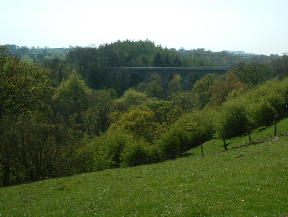


caption = The Balder Railway Viaduct over the River Balder
origin = Stainmore Common
mouth = River Tees
basin_countries = England
length = 21 km (13 mi)
elevation = 480 m (1575 ft)
discharge =
watershed =
The Balder is an English river that rises on the eastern slope of Stainmore Common in the Pennine Chain and flows eastwards for about 13 miles (21 km) to the River Tees at Cotherstone.

The River Balder is in County Durham. The head of the valley is a bleak moorland, with hills around it exceeding 500 m (1640 ft).

The River Balder enters Balderhead Reservoir about 7 km from the source, at around 330 m (1080 ft). It spills into two more reservoirs further down Baldersdale: Blackton Reservoir and Hury Reservoir.

The scenery becomes gentler as it descends past Baldersdale Youth Hostel. The distinctive flat peak of Goldsborough to the south is passed before the valley begins to open out as the river enters Blackton Reservoir at around 280 m (920 ft).

The course of the valley carries on at a virtually exactly east direction as the River Balder enters Hury Reservoir at about 260 m (850 ft), passing the village of Hury which lies to the north.

The river now begins to twist and turn and is crossed by the Balder Railway Viaduct, which was used by the Barnard Castle to Middleton-in-Teesdale railway line before it was closed.

It finally joins the River Tees at Cotherstone, at a height of about 160 m (520 ft).

ee also

*Baldersdale

*Rivers of the United Kingdom


Wikimedia Foundation. 2010.

Игры ⚽ Нужна курсовая?

Look at other dictionaries:

  • Tees, River — ▪ river, England, United Kingdom       river in northeastern England, rising on Cross Fell in the northern Pennines and flowing 70 miles (110 km) east to the North Sea. It forms the boundary between the historic counties of Yorkshire and Durham.… …   Universalium

  • Cotherstone — Coordinates: 54°34′21″N 1°59′00″W / 54.57254°N 1.9832°W / 54.57254; 1.9832 …   Wikipedia

  • Baldersdale — is a dale, or valley, on the east side of the Pennines in England, north of Barnard Castle. Its principal villages are Hury and Briscoe. Baldersdale is part of County Durham.The River Balder flows through Baldersdale before reaching Cotherstone… …   Wikipedia

  • List of rivers of England — This is a list of rivers of England, organised geographically and taken anti clockwise, from Land s End. It includes the whole length of those rivers whose estuary lies wholly or partly in England and thus includes a number of tributaries which… …   Wikipedia

  • Startforth Rural District — infobox historic subdivision Name= Startforth HQ= Status= Rural district Start= 1894 End= 1974 Replace= Teesdale District PopulationFirst= 5,009 PopulationFirstYear= 1901 PopulationLast= 3,404 PopulationLastYear= 1971 AreaFirst=… …   Wikipedia

  • Stainmore — For other uses of Stainmore see Stainmore (disambiguation) Coordinates: 54°31′40″N 2°15′35″W / 54.527879°N 2.259772°W / 54.527879; 2.259772 …   Wikipedia

  • Jane Drew — with her husband Maxwell Fry in 1984 Dame Jane Drew, DBE, FRIBA (24 March 1911 – 27 July 1996) was an English modernist architect and town planner. She qualified at the AA School in London, and prior to World War II became one of the leading… …   Wikipedia

  • Cotherstone Moor — Coordinates: 54°32′55″N 2°5′37″W / 54.54861°N 2.09361°W / 54.54861; 2.09361 …   Wikipedia

  • Germanic religion and mythology — Introduction       complex of stories, lore, and beliefs about the gods and the nature of the cosmos developed by the Germanic speaking peoples before their conversion to Christianity.       Germanic culture extended, at various times, from the… …   Universalium

  • Genial daneben — Seriendaten Originaltitel Genial daneben – Die Comedy Arena …   Deutsch Wikipedia

Share the article and excerpts

Direct link
Do a right-click on the link above
and select “Copy Link”