- Middleton Quarry
-
Middleton Quarry Site of Special Scientific Interest Country England Region North East District Teesdale Location NY948245 - coordinates 54°36′58″N 2°4′53″W / 54.61611°N 2.08139°W Area 6.0 ha (14.8 acres) Notification 1964 Management Natural England Area of Search County Durham Interest Biological 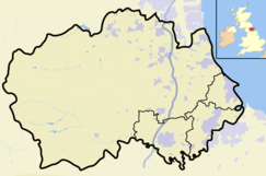
 Location of Middleton Quarry SSSI, Co Durham
Website: Map of site Middleton Quarry is a Site of Special Scientific Interest in the Teesdale district of west County Durham, England. It is a disused quarry, from which Whin Sill stone was formerly excavated. It lies just south of the River Tees, opposite the village of Middleton-in-Teesdale on the river's northern bank.
Since mineral working ceased, the quarry has been re-colonised by a variety of vegetation types. On the quarry floor, natural seepage has given rise to areas of open water, which grade into a variety of soligenous mire and fen vegetation types.
Where a skeletal soil layer has developed on the quarry floor and spoil heaps, patches of grassland occur, with species characteristic of base-rich soils, such as quaking grass, Briza media, and limestone bedstraw, Galium sterneri. On shallow slopes, this gives way to a neutral grassland characterised by false oat-grass, Arrhenatherum elatius, and Yorkshire fog, Holcus lanatus. Above the quarry, this is replaced by acid grassland, in which wavy hair-grass, Deschampsia flexuosa, is dominant.[1]
The quarry supports a moth fauna which includes at least two species, the northern rustic, Standfussiana lucernea, and the anomalous wainscot, Stilbia anomala, that are rare in north-east England.
References
- ^ "Middleton Quarry". English Nature. 1986. http://www.english-nature.org.uk/citation/citation_photo/1000391.pdf. Retrieved 27 July 2010.
Backstone Bank and Baal Hill Woods • Baldersdale Woodlands • Bishop Middleham Quarry • Bollihope, Pikestone, Eggleston and Woodland Fells • Botany Hill • Bowes Moor • Bowlees and Friar House Meadows • Brasside Pond • Brignall Banks • Burnhope Burn • Butterby Oxbow • Cassop Vale • Castle Eden Dene • Causey Bank Mires • Charity Land • Close House Mine • Cornriggs Meadows • Cotherstone Moor • Crag Gill • Crime Rigg and Sherburn Hill Quarries • Dabble Bank • Derwent Gorge and Horsleyhope Ravine • Durham Coast • Fairy Holes Cave • Far High House Meadows • Fishburn Grassland • Foster's Hush • Frog Wood Bog • God's Bridge • Grains o' th' Beck Meadows • Green Croft and Langley Moor • Greenfoot Quarry • Hannah's Meadows • Hawthorn Dene • Hawthorn Quarry • Hell Kettles • Hesledon Moor East • Hesledon Moor West • Hexhamshire Moors • Hisehope Burn Valley • Hulam Fen • Hunder Beck Juniper • Kilmond Scar • Low Redford Meadows • Lune Forest • Mere Beck Meadows • Middle Crossthwaite • Middle Side and Stonygill Meadows • Middleton Quarry • Middridge Quarry • Moorhouse and Cross Fell • Muggleswick, Stanhope and Edmundbyers Commons and Blanchland Moor • Neasham Fen • Newton Ketton Meadow • Old Moss Lead Vein • Park End Wood • Pig Hill • Pike Whin Bog • Pittington Hill • Pow Hill Bog • Quarrington Hill Grasslands • Railway Stell West • Raisby Hill Grassland • Raisby Hill Quarry • Redcar Field • Rigg Farm and Stake Hill Meadows • Rogerley Quarry • Sherburn Hill • Shipley and Great Woods • Sleightholme Beck Gorge - The Troughs • Slit Woods • Stony Cut, Cold Hesledon • Teesdale Allotments • The Bottoms • The Carrs • Thrislington Plantation • Town Kelloe Bank • Trimdon Limestone Quarry • Tuthill Quarry • Upper Teesdale • Waldridge Fell • West Newlandside Meadows • West Park Meadows • West Rigg Open Cutting • Westernhope Burn Wood • Wingate Quarry • Witton-le-Wear • Yoden Village QuarryCategories:- Sites of Special Scientific Interest in County Durham
- United Kingdom Site of Special Scientific Interest stubs
- County Durham geography stubs

Wikimedia Foundation. 2010.