- Middle Side and Stonygill Meadows
-
Middle Side and Stonygill Meadows Site of Special Scientific Interest Country England Region North East District Teesdale Location NY933262
NY927264- coordinates 54°37′56″N 2°6′31″W / 54.63222°N 2.10861°W Area 17.27 ha (42.68 acres) Notification 1991 Management Natural England Area of Search County Durham Interest Biological 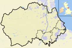
 Location of Middle Side and Stonygill Meadows SSSI, Co Durham
Website: Map of site Middle Side and Stonygill Meadows is a Site of Special Scientific Interest in the Teesdale district of County Durham, England. It consists of two separate areas, one to the north of the River Tees, the other on the south bank, about 2 km upstream from the village of Middleton-in-Teesdale. The Park End Wood and Middle Crossthwaite SSSIs lie on the same stretch of floodplain, the Teesdale Allotments SSSI is a short distance to the north, while the higher ground to the south of the river is part of the Upper Teesdale SSSI.
The site mainly consists of hay meadows, which are managed by traditional methods and support a wide variety of grasses and forbs. Common grasses include red fescue, Festuca rubra, cock's foot, Dactylis glomerata, common bent, Agrostis capillaris, and sweet vernal grass, Anthoxanthum odoratum. Common herbs include common sorrel, Rumex acetosa, wood cranesbill, Geranium sylvaticum, and great burnet, Sanguisorba officinalis. Less common are the locally rare melancholy thistle, Cirsium helenioides, globe flower, Trollius europaeus, common bistort, Polygonum bistorta, and alpine bistort, P. viviparum.[1]
References
- ^ "Middle Side and Stonygill Meadows". English Nature. 1991. http://www.english-nature.org.uk/citation/citation_photo/1006125.pdf. Retrieved 27 July 2010.
Backstone Bank and Baal Hill Woods • Baldersdale Woodlands • Bishop Middleham Quarry • Bollihope, Pikestone, Eggleston and Woodland Fells • Botany Hill • Bowes Moor • Bowlees and Friar House Meadows • Brasside Pond • Brignall Banks • Burnhope Burn • Butterby Oxbow • Cassop Vale • Castle Eden Dene • Causey Bank Mires • Charity Land • Close House Mine • Cornriggs Meadows • Cotherstone Moor • Crag Gill • Crime Rigg and Sherburn Hill Quarries • Dabble Bank • Derwent Gorge and Horsleyhope Ravine • Durham Coast • Fairy Holes Cave • Far High House Meadows • Fishburn Grassland • Foster's Hush • Frog Wood Bog • God's Bridge • Grains o' th' Beck Meadows • Green Croft and Langley Moor • Greenfoot Quarry • Hannah's Meadows • Hawthorn Dene • Hawthorn Quarry • Hell Kettles • Hesledon Moor East • Hesledon Moor West • Hexhamshire Moors • Hisehope Burn Valley • Hulam Fen • Hunder Beck Juniper • Kilmond Scar • Low Redford Meadows • Lune Forest • Mere Beck Meadows • Middle Crossthwaite • Middle Side and Stonygill Meadows • Middleton Quarry • Middridge Quarry • Moorhouse and Cross Fell • Muggleswick, Stanhope and Edmundbyers Commons and Blanchland Moor • Neasham Fen • Newton Ketton Meadow • Old Moss Lead Vein • Park End Wood • Pig Hill • Pike Whin Bog • Pittington Hill • Pow Hill Bog • Quarrington Hill Grasslands • Railway Stell West • Raisby Hill Grassland • Raisby Hill Quarry • Redcar Field • Rigg Farm and Stake Hill Meadows • Rogerley Quarry • Sherburn Hill • Shipley and Great Woods • Sleightholme Beck Gorge - The Troughs • Slit Woods • Stony Cut, Cold Hesledon • Teesdale Allotments • The Bottoms • The Carrs • Thrislington Plantation • Town Kelloe Bank • Trimdon Limestone Quarry • Tuthill Quarry • Upper Teesdale • Waldridge Fell • West Newlandside Meadows • West Park Meadows • West Rigg Open Cutting • Westernhope Burn Wood • Wingate Quarry • Witton-le-Wear • Yoden Village QuarryCategories:- Sites of Special Scientific Interest in County Durham
- United Kingdom Site of Special Scientific Interest stubs
- County Durham geography stubs

Wikimedia Foundation. 2010.