- Alt-Berlin
-
"Old Berlin" redirects here. For other meanings, see Berlin or History of Berlin.
Coat of Arms Map 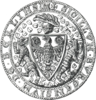
Seal of 1280

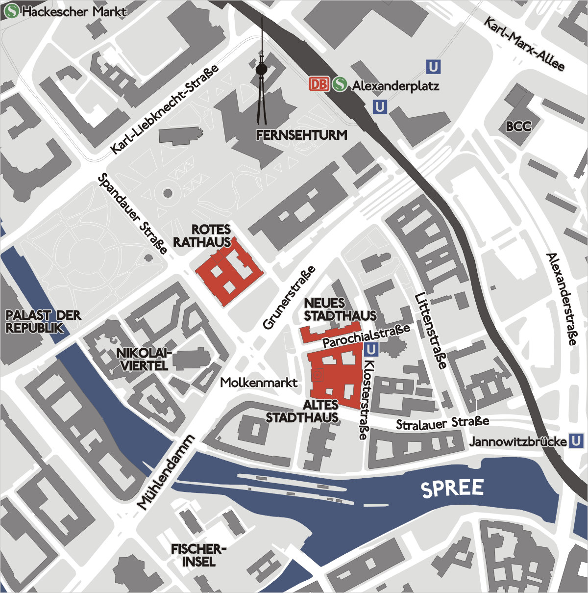
Alt-Berlin within city centre
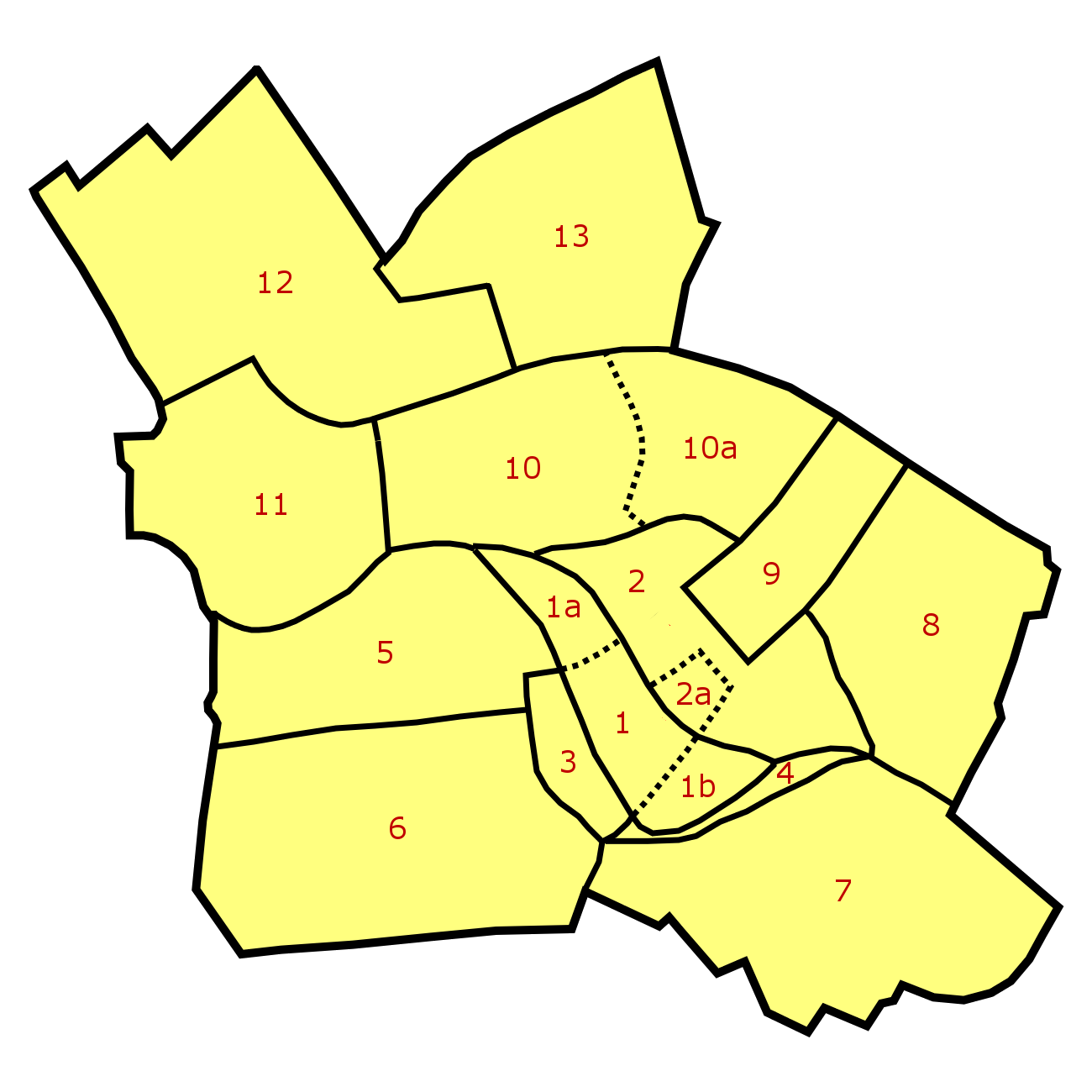
Basic Information City: Berlin Borough: Mitte Locality: Mitte Area: ? Population: ? Coordinates: 52°31′05″N 13°24′34″E / 52.51806°N 13.40944°ECoordinates: 52°31′05″N 13°24′34″E / 52.51806°N 13.40944°E Elevation: 34 m (111 ft) above sea level 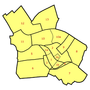 Neighborhoods in Berlin-Mitte: Old Cölln [1] (with Museum Island [1a], Fischer Island [1b]), Alt-Berlin [2] (with Nikolaiviertel [2a]), Friedrichswerder [3], Neukölln am Wasser [4], Dorotheenstadt [5], Friedrichstadt [6], Luisenstadt [7], Stralauer Vorstadt (with Königsstadt) [8], Alexanderplatz Area (Königsstadt and Altberlin) [9], Spandauer Vorstadt [10] (with Scheunenviertel [10a]), Friedrich-Wilhelm-Stadt [11], Oranienburger Vorstadt [12], Rosenthaler Vorstadt [13]
Alt-Berlin (Old Berlin), also named Altberlin, is a neighbourhood (Stadtviertel), situated in the Berliner locality (Ortsteil) of Mitte, part of the homonymous borough. In the 13th century it was the sister town of the old Cölln, located on the northern Spree Island in the Margraviate of Brandenburg. It counts in its terrytory the zone of Nikolaiviertel.
Contents
History
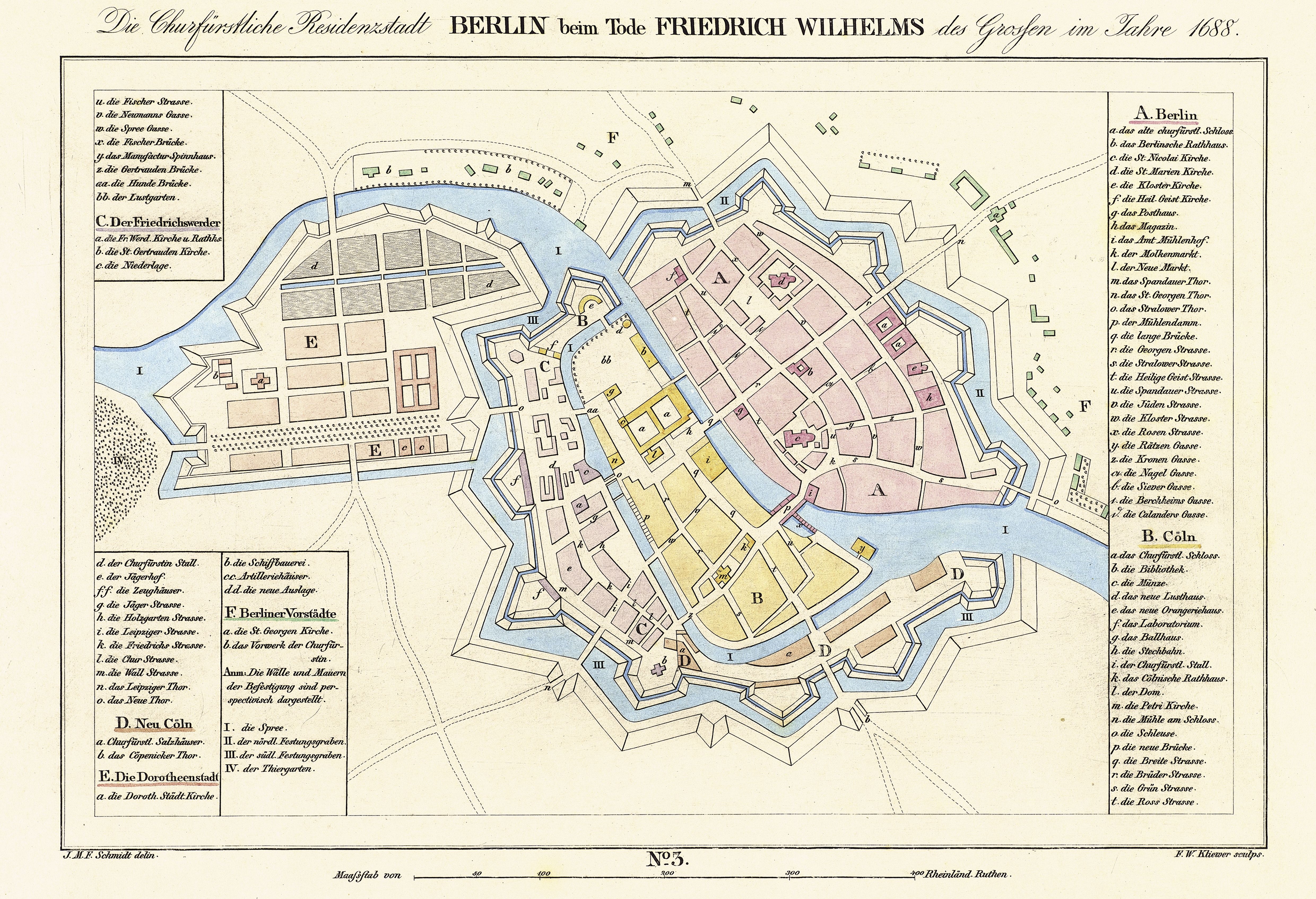
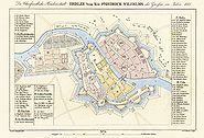 Central Berlin map of 1688 with Altberlin shown in greySee also: History of Berlin and History of Cölln
First mentioned in 1244, 7 years after Cölln, it represents the original core of the modern Berlin. The first stone fortification was built, to defend both cities, in 1250 and in 1251 it gained the city rights. In 1280 Berlin, first town on the west of the river Elbe, gained the straight to mint currency. In that period it appeared on a coat of arms for the first time, close to the symbol of the imperial eagle, two stylized bears; antecedents of the actual rampant bear, symbol of the city. On March 20, 1307 the town was united with Cölln (maintaining its name, Berlin) forming a trading union on political and security matters, and participated in the Hanseatic League.[1][2]
Geography
Alt-Berlin, crossed at its southern borders by the river Spree, is located in the middle of the city. Its northern borders are represented, except for the square area of Alexanderplatz, by the Stadtbahn railway line between the station of Jannowitzbrücke and a rail bridge after Hackescher Markt station.
Photogallery
-
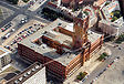
Rotes Rathaus, the city hall of Berlin
-
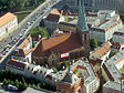
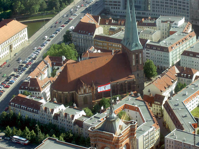
Aerial view of the Nikolaikirche in the Nikolaiviertel
References
External links
 Media related to Alt-Berlin at Wikimedia Commons
Neighbourhoods of Mitte locality (Mitte district, Berlin)  Alexanderplatz • Alt-Berlin (with Nikolaiviertel) • Cölln (with Fischerinsel and Museumsinsel) • Dorotheenstadt • Friedrichstadt • Friedrichswerder • Friedrich-Wilhelm-Stadt • Luisenstadt • Neukölln am Wasser • Oranienburger Vorstadt • Rosenthaler Vorstadt • Spandauer Vorstadt (with Scheunenviertel) • Stralauer Vorstadt
 Categories:
- Zones of Berlin
- History of Berlin
- Mitte
-


Wikimedia Foundation. 2010.