- Dorotheenstadt
-
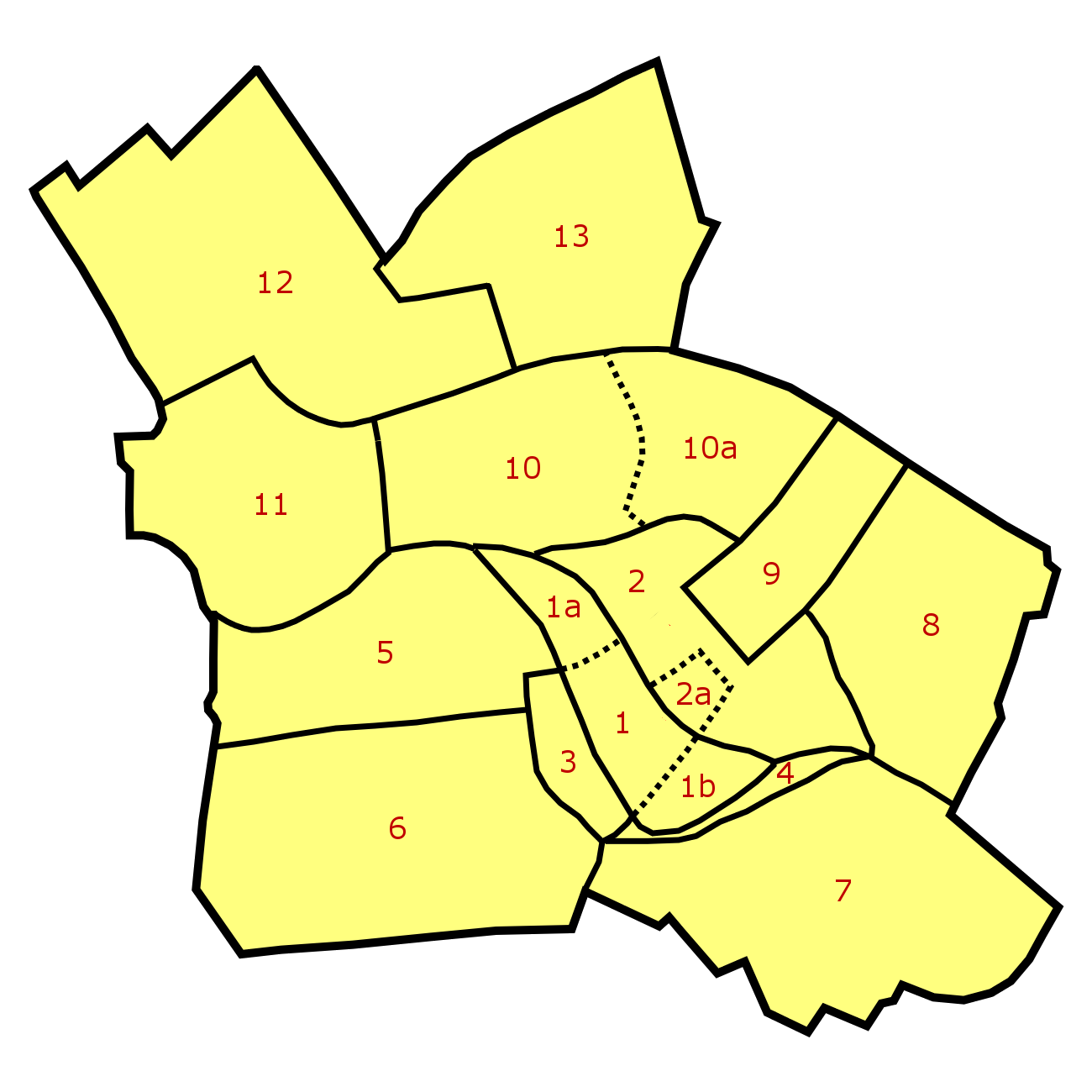
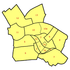 Dorotheenstadt (5) within the locality of Mitte in central Berlin
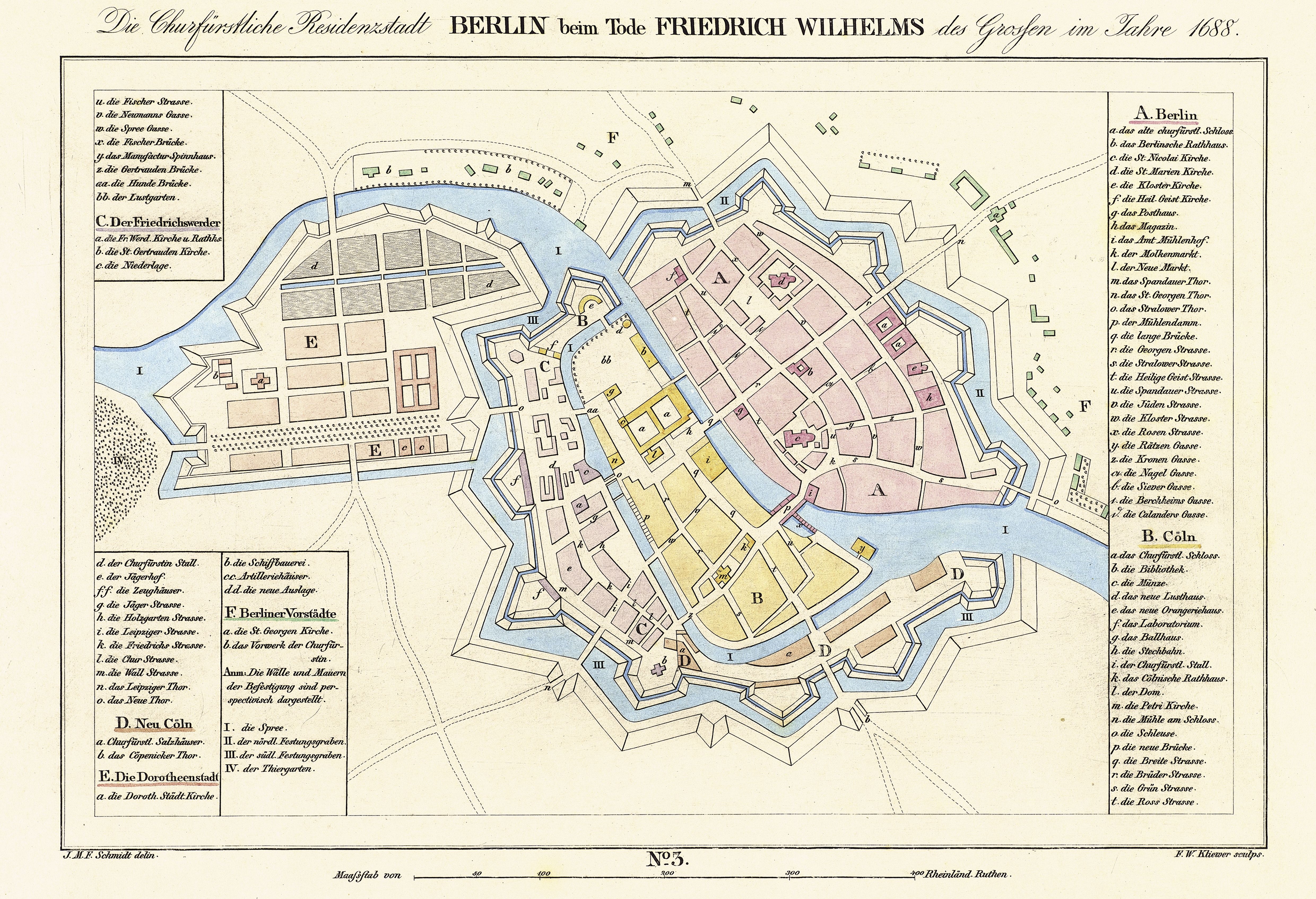
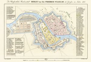 Dorotheenstadt (E) within Berlin in 1688
Dorotheenstadt is a historic zone or neighbourhood (Stadtviertel) of central Berlin, Germany, which forms part of the locality (Ortsteil) of Mitte within the borough {Bezirk) also called Mitte. It contains several famous Berlin landmarks: the Brandenburg Gate, the Pariser Platz, and Unter den Linden.
Contents
Location
Dorotheenstadt is bordered in the west by the Großer Tiergarten, in the north by the River Spree, in the northeast by the Kupfergraben (part of the Spree canal system), in the east by Hinter dem Gießhaus and Oberwallstraße and in the south by the Behrenstraße.
History
In 1670, the "Great Elector" Frederick William made a gift to his second wife, Sophie Dorothea of Schleswig-Holstein-Sonderburg-Glücksburg, of the Cölln estate of Tiergarten, located between the wall surrounding Berlin and the Großer Tiergarten.[1] A new settlement, initially called Neustadt (New Town), was laid out according to a strict rectangular street grid[2] planned by Joachim Ernst Blesendorf, the Overseer of Fortifications and Construction,[3][4] between the Georgenstraße in the north and the Schadowstraße in the south. Neustadt received town privileges in 1674[5] and was renamed Dorotheenstadt in Sophie Dorothea's honour in 1681, although the term was in use earlier.[6]
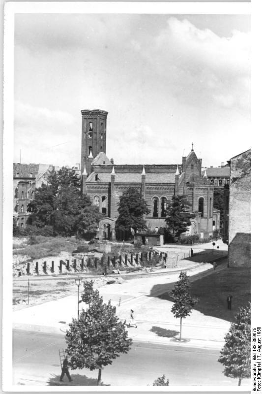
 The burnt out Dorotheenstadt Church on Neustädtische Kirchstraße in 1950 (removed in 1968).
In 1709, Dorotheenstadt was united with the two cities of Berlin and Cölln and the other two electoral 'new towns' of Friedrichswerder and Friedrichstadt to form the "royal capital and residence city" of Berlin.[7] As the 18th century continued, it was extended to the Spree in the north and the Tiergarten in the west. Originally the new towns were overwhelmingly residential, filled with stone houses 2 or 3 storeys in height, but in the second half of the 19th century, large government and business buildings replaced them. The eastern part of Dorotheenstadt, near the museums, developed into an academic area, including the Berlin University (now Humboldt University) and the Berlin State Library.[8] Following the construction of the Berlin Stadtbahn in 1880, a vibrant urban centre grew up around Friedrichstraße station alongside the desirable and elegant district of Unter den Linden. The population fell from 20,144 in 1867 to 11,492 in 1910, as the area became less residential.[9] In 1920, with the creation of Greater Berlin, Dorotheenstadt was incorporated into the newly created borough of Mitte.
After extensive destruction in World War II and the incorporation of Mitte into the Soviet Zone which became East Berlin, many historic buildings, among them the Humboldt University, the Berlin State Opera and the Alte Bibliothek were rebuilt under the German Democratic Republic. Since German reunification in 1990, the western part of Dorotheenstadt around the Pariser Platz has also been rebuilt.
Major buildings and landmarks
- Pariser Platz
- Brandenburg Gate
- U.S. Embassy
- Academy of Arts
- French Embassy
- Wilhelmstraße
- Marschall Bridge
- Jakob-Kaiser-Haus
- British Embassy
- Unter den Linden
- Russian Embassy
- Komische Oper
- Humboldt University
- Staatsbibliothek
- Alte Bibliothek
- Bebelplatz
- Berlin State Opera
- Statue of Frederick the Great
- Neue Wache
- Friedrichstraße
- Weidendammer Bridge
- Admiralspalast
- Friedrichstraße station
Cultural mentions
- Jens Gerlach, an East German poet, wrote a collection of poems called Dorotheenstädtische Monologe (Berlin: Aufbau, 1972)
References
- ^ Erica Schachinger, Die Dorotheenstadt 1673-1708: eine Berliner Vorstadt, Veröffentlichungen aus den Archiven Preussischer Kulturbesitz Beiheft 9, Cologne: Böhlau, 2001, ISBN 3412106011, p. 1 (German)
- ^ Doug Clelland, Berlin: An Architectural History, London: Architectural Design, 1983, ISBN 0856708372, p. 29.
- ^ Schachinger, p. 2.
- ^ T.H. Elkins with B. Hofmeister, Berlin: The Spatial Structure of a Divided City, London: Methuen, 1988, ISBN 0-416-92220-1, e-edition Taylor & Francis 2005, ISBN 0-203-94802-1, p. 150 points out that since the Electors owned the land in the new cities, they dictated not only their planning but the characteristics of the buildings.
- ^ Schachinger, p. 3.
- ^ Volker Wagner, Die Dorotheenstadt im 19. Jahrhundert: vom vorstädtischen Wohnviertel barocker Prägung zu einem Teil der modernen Berliner City, Berlin/New York: De Gruyter, 1998, ISBN 3110157098, p. 54 (German), Schachinger, p. 3, note 7.
- ^ Elkins, p. 9.
- ^ Elkins, p. 150.
- ^ Wagner, pp. 244, 422
Sources
- Hermann Zech. Die Dorotheenstadt in Berlin-Mitte. Berlin: H. Zech, 2000. ISBN 3980491420
- This article incorporates information from this version of the equivalent article on the German Wikipedia.
Neighbourhoods of Mitte locality (Mitte district, Berlin)  Alexanderplatz • Alt-Berlin (with Nikolaiviertel) • Cölln (with Fischerinsel and Museumsinsel) • Dorotheenstadt • Friedrichstadt • Friedrichswerder • Friedrich-Wilhelm-Stadt • Luisenstadt • Neukölln am Wasser • Oranienburger Vorstadt • Rosenthaler Vorstadt • Spandauer Vorstadt (with Scheunenviertel) • Stralauer Vorstadt
Coordinates: 52°31′13″N 13°23′0″E / 52.52028°N 13.383333°E
Categories:- Zones of Berlin
- Mitte
- History of Berlin
- Pariser Platz
Wikimedia Foundation. 2010.