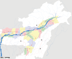
- Odalguri
-
Udalguri — city — Coordinates 26°44′43″N 92°05′46″E / 26.7452°N 92.0962°ECoordinates: 26°44′43″N 92°05′46″E / 26.7452°N 92.0962°E Country India State Assam District(s) Udalguri-BTAD-Bodo Land Territorial Autonomous District Population 14,893 (2001[update]) Official languages Assamese, Bodo Time zone IST (UTC+05:30) Area
• 180 metres (590 ft)
Website udalguri.gov.in Odalguri (Also spelled as Udalguri), (Assamese: ওদালগুৰি), (Hindi: ओदालगुरि) is a town and a town area committee and the headquarters of Udalguri district in the north-eastern Indian state of Assam. Earlier, Udalgiri was a sub-divisional headquarters in Darrang District. But after signing of Bodo Accord to end the demand for a Separate Bodoland State, An Autonomous District called Bodoland Territorial Autonomous District (BTAD) was created and Odalguri district became one of the four Districts under BTAD. Odalguri became the district headquarters when the new district was formally inaugurated on June 14, 2004.
Contents
Geography
Odalguri(Udalguri) is located at 26°44′43″N 92°05′46″E / 26.7452°N 92.0962°E.[1] It has an average elevation of 180 metres (590 feet).
Demographics
According to the 2011 census Odalguri has a population of 832,769 ,[2] roughly equal to the nation of Qatar[3] or the US state of South Dakota.[4] This gives it a ranking of 476th in India (out of a total of 640).[2] The district has a population density of 497 inhabitants per square kilometre (1,290 /sq mi) .[2] Its population growth rate over the decade 2001-2011 was 9.76 %.[2] Udalguri has a sex ratio of 966 females for every 1000 males,[2] and a literacy rate of 66.6 %.[2]
The major communities include Bodo Kachari, Assamese, Tea tribe, Nepali and Bengali. There are also a small population of Muslim, Bihari, Nishi, Garo and RabhaWeather
Like the North-Eastern Part of India,the weather is pleasant with Winters not being that harsh and the rainy season in full swing from the month of March to August.
Festivals
Bihu or Bwisagu is the most celebrated festival and it falls in the month of April.Populated with people of different religions,Christmas is also celebrated with full fervour.Many Churches are present in Udalguri and during Christmas,they are all beautifully decorated and late night hymns can be heard.
Educational Institute
- Udalguri College, Purani Goraibari
- Udalguri Higher Secondary School
- Udalguri Girls Higher Secondary School
- Golmagaon High school
- Asboford Academy(Arts/commerce junior college)
- Bihuram Boro Memorial College
- Sankardev Mission High School
- Sacred Heart Catholic High School
- Diamond English School
- Ramswaroop Agarwal Memorial English School
- Kendriya Vidyalaya
- Jawahar Navodaya Vidyalaya
- Maharishi Vidyalaya
- U N Academy
- Rabi Kachari memorial School
- Dream Flower School
- Neds computer education
- Third eye computer infotech
- IT centre udalguri
- Epitome computer institute
-
- Besides,the foundation stone of UDALGURI ENGINEERING COLLEGE has been laid recently on 10th February, 2011.
- Besides,the foundation Stone of Central Tribal University has been laid recently on 2010
Place of interest near Udalguri
Transport
Rail
Udalguri is well connected with Tezpur and Guwahati through meter gauge railway line. Ths approximate distance from Guwahati is 150 km from Guwahati. Currently, this line is being upgraded to Broad Gauge.
Road
Udalguri is also well connected with Guwahati, Tezpur and Mangaldai. Udalguri is situated at 14 km away from Rowta which is connected with NH52. Udalguri is 60 km away from Mangaldai, 90 km Tezpur and 120 km away from Guwahati. Buses are available at regular intervals from Udalguri to any of these places. Connectivity is good and one can travel from Guwahati to Rowta in Guwahati-Tezpur Bus and take a cab/auto from Rowta to Udalguri. Also direct buses are avilable from ASTC Bus stand, Machkhowa, Guwahati.
Politics
Udalgiri is part of Mangaldoi (Lok Sabha constituency).[5]
References
- ^ Falling Rain Genomics, Inc - Odalguri
- ^ a b c d e f "District Census 2011". Census2011.co.in. 2011. http://www.census2011.co.in/district.php. Retrieved 2011-09-30.
- ^ US Directorate of Intelligence. "Country Comparison:Population". https://www.cia.gov/library/publications/the-world-factbook/rankorder/2119rank.html. Retrieved 2011-10-01. "Qatar 848,016 July 2011 est."
- ^ "2010 Resident Population Data". U. S. Census Bureau. http://2010.census.gov/2010census/data/apportionment-pop-text.php. Retrieved 2011-09-30. "South Dakota 814,180"
- ^ "List of Parliamentary & Assembly Constituencies". Assam. Election Commission of India. http://archive.eci.gov.in/se2001/background/S03/AS_ACPC.pdf. Retrieved 2008-10-06.
External links
Categories:- Udalguri
- Assam geography stubs
Wikimedia Foundation. 2010.


