- Herat Airport
-
Herat Airport 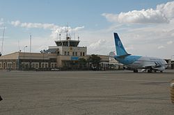
A Pamir Airways parked at Herat Aiport IATA: HEA – ICAO: OAHR Location of airport in Afghanistan
 HEA
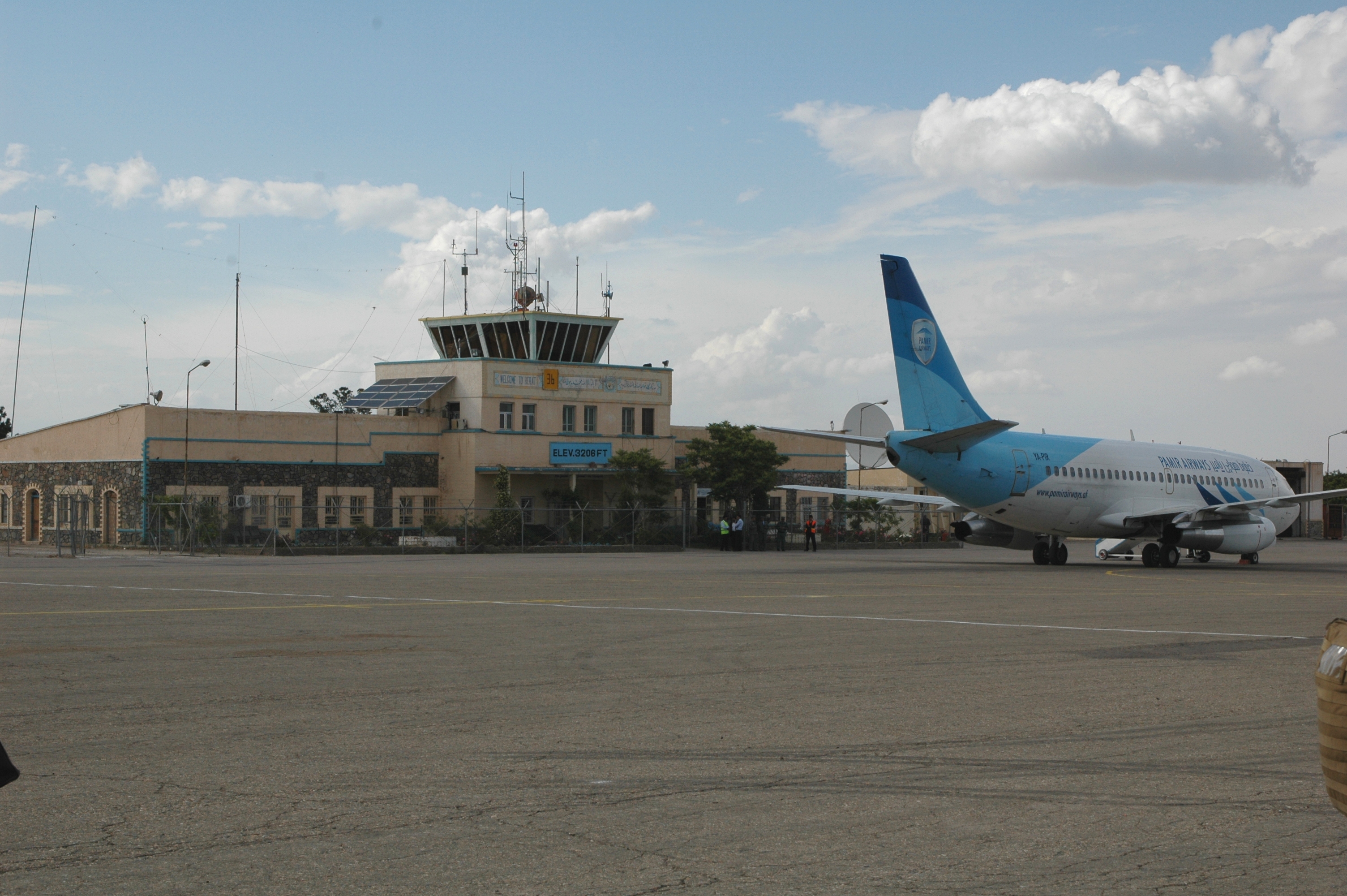
HEASummary Airport type Public/Military Owner Afghanistan Operator Ministry of Transport and Civil Aviation / ISAF Location Herat Elevation AMSL 3,205 ft / 977 m Coordinates 34°12′38″N 62°13′42″E / 34.21056°N 62.22833°ECoordinates: 34°12′38″N 62°13′42″E / 34.21056°N 62.22833°E Runways Direction Length Surface ft m 18/36 8,435 2,571 Paved Herat Airport (soon to be Herat International Airport) (IATA: HEA, ICAO: OAHR) is 6.5 miles (10.5 km) southeast of the city Herat, just east of the Herat-Farah road, close to Guzara in the Guzara District of the Herat Province.
The airport was originally built by engineers from the United States in the late 1950s. During the 1980s Soviet war, it was heavily used by the Soviets to launch bombardment missions on Mujahideen rebel forces. During the late 2001 Operation Enduring Freedom, it was bombed by US-British planes. Prior to the arrival of NATO's forces, the airport was a military base for fighters and transport aircraft (likely Antonov An-26, Antonov An-32 and Mikoyan-Gurevich MiG-21).
It has been used by the International Security Assistance Force (ISAF) in the last decade as well as by the military of Afghanistan and the Afghan Border Police. In recent years the runway was extended and newly paved. The airport will soon become international, Herat International Airport, in which direct flights will go between Herat and Iran, Pakistan, Dubai, Tajikistan and other destinations.
Contents
Airlines and destinations
Airlines Destinations Ariana Afghan Airlines Kabul, Mazar-i-Sharif, Kandahar Kam Air Kabul Safi Airways Mazar-i-Sharif See also
References
External links
Categories:- Airports in Afghanistan
- Afghan building and structure stubs
- Asian airport stubs

Wikimedia Foundation. 2010.