- Norfolk Coast Path
-
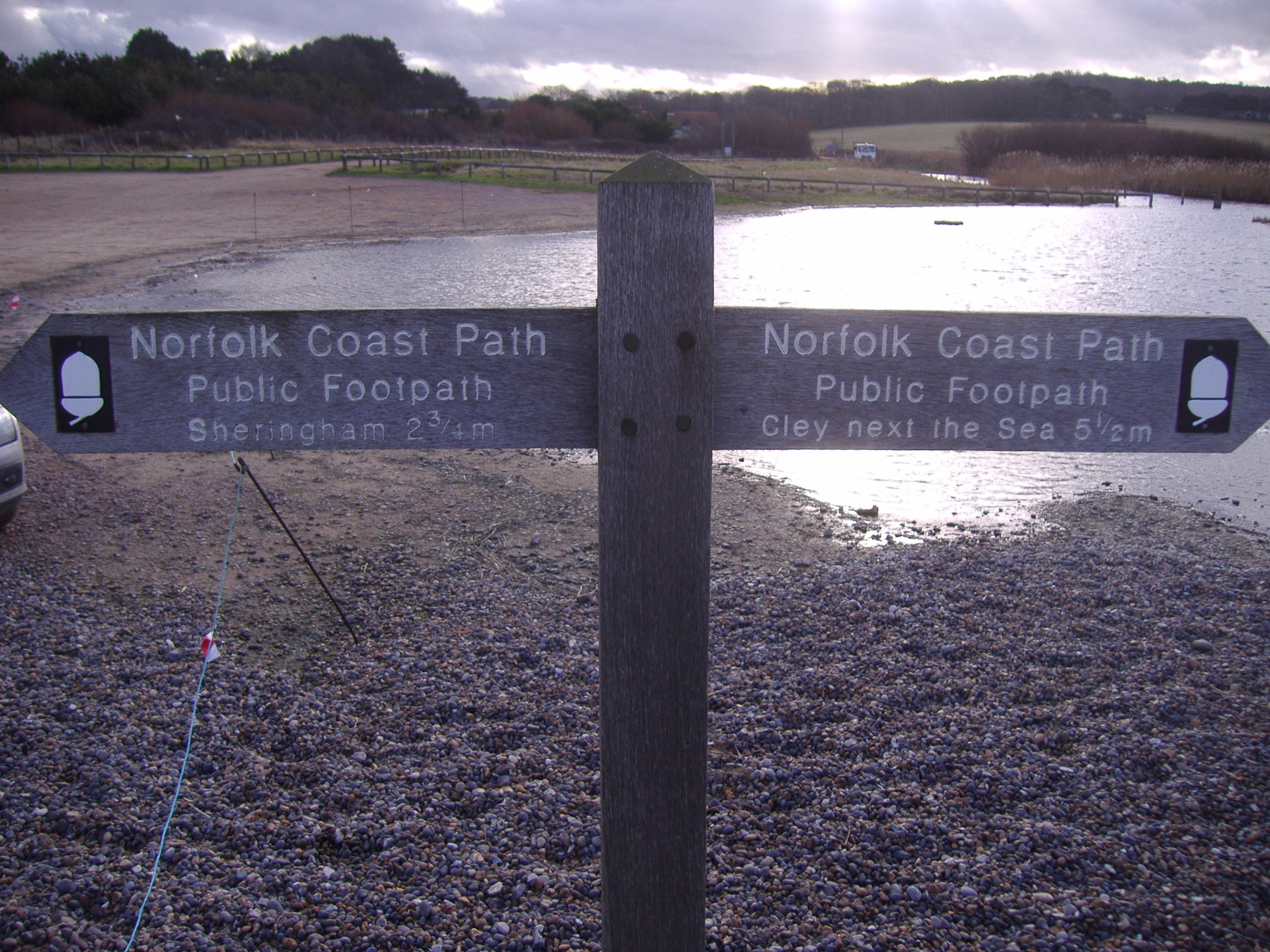
Norfolk Coast Path 
Signpost at Weybourne Length 72 kilometres (45 mi) Location North Norfolk, England Designation UK National Trail Trailheads Hunstanton
52°56′23″N 0°29′14″E / 52.9396°N 0.4873°E
Cromer
52°55′48″N 1°17′34″E / 52.9300°N 1.2929°EUse Walking Highest point Beeston Bump at 63 metres (207 ft) Lowest point Holme-next-the-Sea Season All year Round Hazards Cliff Erosion The Norfolk Coast Path[1] is a long distance footpath in Norfolk, running 45 miles (72 km) from Hunstanton to Cromer. It was opened in 1986 and covers the North Norfolk Coast AONB (Area of Outstanding Natural Beauty).
It links with the Peddars Way at Holme-next-the-Sea, and the two in combination form the Peddars Way & Norfolk Coast Path National Trail, one of 15 National Trails[2] in England and Wales. At Cromer it links to the Weavers Way.
The Norfolk Coast Path passes through or near:-
- Hunstanton
- Holme-next-the-Sea
- Thornham
- Titchwell
- Brancaster
- Burnham Deepdale
- Burnham Overy Staithe
- Wells-next-the-Sea
- Morston
- Blakeney
- Cley next the Sea
- Salthouse
- Kelling
- Weybourne
- Sheringham
- Beeston Regis
- East Runton
- Cromer
References
Long-distance footpaths in the United Kingdom National Trails (England and Wales) Cleveland Way · Cotswold Way · Glyndŵr's Way · Hadrian's Wall Path · North Downs Way · Norfolk Coast Path · Offa's Dyke Path · Peddars Way · Pembrokeshire Coast Path · Pennine Bridleway · Pennine Way · The Ridgeway · South Downs Way · South West Coast Path · Thames Path · Yorkshire Wolds Way
Long Distance Routes (Scotland) Scotland: Arran Coastal Way · Ayrshire Coastal Path · Fife Coastal Path · John Muir Way · Moray Coast trail · Scottish Coastal WayCategories:- Footpaths in Norfolk
- Long-distance footpaths in England
- Geography of Norfolk
- Visitor attractions in Norfolk
- Transport in Norfolk
- Coastal feature of Norfolk
- Protected areas of Norfolk
- Coastal paths in England
Wikimedia Foundation. 2010.