- North Kivu
-
Nord-Kivu
Province du Nord-Kivu— Province — Masisi area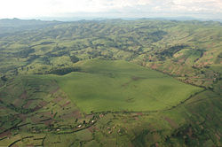 Nord-Kivu on map of proposed provinces
 Nord-Kivu on map of current provinces
Country  Democratic Republic of the Congo
Capital Goma Largest city Goma Government - Governor Julien Paluku Kahongya Area - Total 59,483 km2 (22,966.5 sq mi) Population (1998 est.) - Total 3,564,434 - Density 59.9/km2 (155.2/sq mi) Demonym North Kivutian National language Swahili Districts 5 Cities 3 Website provincenordkivu.org Nord-Kivu (also Kivu-Nord, or North Kivu in English) is a province bordering Lake Kivu in the eastern Democratic Republic of Congo. Its capital is Goma. The estimated population was 3,564,434 in 1998 but a more recent (2010) estimate is 5,768,000.
Following the 2005 Constitution (effective 18 February 2006), 25 new provinces were to be created from the 10 current provinces within 36 months (18 February 2009). As of October 2010, this had not taken place.[1] Nord-Kivu would be one of three provinces to retain its present name and boundaries (the others being Sud-Kivu and Maniema), along with the city-province of Kinshasa.
Contents
Geography
Nord-Kivu borders the provinces of the Orientale to the north (proposed Ituri Province) and northwest (proposed Tshopo Province), Maniema to the southwest, and Sud-Kivu to the south. To the east it borders the countries of Uganda and Rwanda.
The province consists of three cities—Goma, Butembo and Beni—and six territories—Beni, Lubero, Masisi, Rutshuru, Nyiragongo and Walikale. The province is home to the Virunga National Park, a World Heritage Site containing the endangered Mountain Gorillas.
Cities and towns
Name Pop. 2010[2] Coordinates[2] Beni 95,407 0°29′N 29°27′E / 0.49°N 29.45°E Butembo 204,452 0°08′N 29°17′E / 0.13°N 29.28°E Goma 377,112 1°41′S 29°13′E / 1.69°S 29.22°E Kanyabayonga 29,936 0°43′S 29°10′E / 0.71°S 29.17°E Katwa 60,591 0°06′N 29°19′E / 0.10°N 29.32°E Kayna 34,653 0°37′S 29°10′E / 0.62°S 29.17°E Kirumba 35,290 1°05′S 29°17′E / 1.09°S 29.29°E Lubero 28,293 0°10′S 29°13′E / 0.16°S 29.22°E Mangina 37,594 0°34′N 29°19′E / 0.57°N 29.32°E Masisi 6,502 1°24′S 28°49′E / 1.40°S 28.81°E Oicha 50,559 0°42′N 29°31′E / 0.70°N 29.52°E Rutshuru 56,066 1°11′S 29°27′E / 1.18°S 29.45°E Walikale 9,903 1°25′S 28°04′E / 1.42°S 28.06°E History
North Kivu was formerly a "sub-region" in the region of Kivu.
The region was the scene of much fighting during the Second Congo War (1998–2003), and the Kivu conflict (2004–present).
In 2003 the Eighth Military Region of the new Congo Government's FARDC was established covering the province. Brigadier General Vainqueur Mayala is the current military region commander.[3] During late 2008, the FARDC maintained its dismal record in combat against Laurent Nkunda's CNDP faction, losing the Rumangabo military camp to the rebels.
The dissident Mai-Mai 85th Brigade, commanded by Colonel Samy Matumo, controls the cassiterite mine at Bisie, just north of Manoire in Walikale, in the south-east of North Kivu.[4] The former RCD-K/ML also has fighters in the province; 'at the beginning of the transition [2002-3] the RCD-Mouvement de Libération president declared he had 8-10,000 Armée Patriotic Congolaise (APC) troops in the Beni-Lubero area of North Kivu.’ This exaggerated figure now seems to have been reduced to ‘several thousand’ (2-4,000?) as of early 2006 following demobilizations and men joining the integrated brigades.[5]
Human rights issues
In October 2007, the United Nations High Commissioner for Refugees (UNHCR) warned of an increasing number of internally displaced people (IDP) in North Kivu related to the fighting there between the government army, the Democratic Forces for the Liberation of Rwanda (FDLR) rebels and renegade troops, including Laurent Nkunda's forces, and a build-up of military supplies and forces, including the reported recruitment of child soldiers by armed groups across North Kivu. The UNHCR thought that there were over 370,000 people in North Kivu displaced since December 2006, and is expanding its camps in the Mugunga area where over 80,000 IDPs were estimated.[6]
References
- ^ "The AMP conclave: Another step towards 2011 elections". Congo Siasa. http://congosiasa.blogspot.com/2010/10/amp-conclave-another-step-towards-2011.html.
- ^ a b "Nord-Kivu: largest cities and towns and statistics of their population". World Gazetteer. http://world-gazetteer.com/wg.php?x=1263071407&men=gcis&lng=en&des=gamelan&geo=-46&srt=npan&col=abcdefghinoq&msz=1500&pt=c&va=&geo=-859.
- ^ Rwanda: War Rages in DRC as Government Forces Seek FDLR Support, The New Times, 21 September 2008
- ^ Polgreen, Lydia (16 November 2008). "Congo's Riches, Looted by Renegade Troops". The New York Times. http://www.nytimes.com/2008/11/16/world/africa/16congo.html?_r=2&ref=todayspaper&pagewanted=all&oref=slogin&oref=slogin. Retrieved 9 April 2010.
- ^ International Crisis Group, Security Sector Reform in the Congo, Africa Report N°104, 13 February 2006, p.14
- ^ "DR Congo: UN agency concerned at military buildup in North Kivu". UN News Service. 2007-10-05. http://www.un.org/apps/news/story.asp?NewsID=24198&Cr=DRC&Cr1=. Retrieved 2007-10-06.
Further reading
- Denis Tull, The reconfiguration of political order in Africa: a case study of North Kivu (DR Congo), Volume 13 of Hamburg African studies, Institut für Afrika-Kunde (Hamburg, Germany), GIGA-Hamburg, 2005, ISBN 3928049909, 9783928049900, 342 pages
External links
Nord-Kivu province (DR Congo) Cities 
Communes Goma: Goma · Karisimbi • Beni: Beni · Bungulu · Ruwenzori · Muhekera • Butembo: Bulengera · Kimemi · Mususa · VutambaTerritories Provinces of the Democratic Republic of the Congo Current provinces Bandundu · Bas-Congo · Équateur · Kasai-Occidental · Kasai-Oriental · Katanga · Kinshasa · Maniema · Nord-Kivu · Orientale · Sud-Kivu · Ituri Interim Administration
Proposed provinces
(2005 Constitution)Bas-Uele · Équateur · Haut-Lomami · Haut-Katanga · Haut-Uele · Ituri · Kasaï · Kasaï oriental · Kongo central · Kwango · Kwilu · Lomami · Lualaba · Lulua · Mai-Ndombe · Maniema · Mongala · Nord-Kivu · Nord-Ubangi · Sankuru · Sud-Kivu · Sud-Ubangi · Tanganyika · Tshopo · Tshuapa · Kinshasa
1966 Sud-Katanga1962-1966 Cuvette-Centrale · Ubangi Province · Moyen-Congo · Lomami · Luluabourg · Sankuru · Sud-Kasaï · Unité Kasaïenne · Lualaba · Katanga Oriental · Nord-Katanga · Congo Central · Kwango · Kwilu · Mai-Ndombe · Maniema · Kivu Central · Nord-Kivu · Kibali-Ituri · Uele · Haut-Congo
Categories:- Provinces of the Democratic Republic of the Congo
- Nord-Kivu Province
- Democratic Republic of the Congo geography stubs

Wikimedia Foundation. 2010.