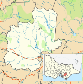
- Noojee
-
Noojee
VictoriaPopulation: 261[1] Postcode: 3833 Elevation: 275 m (902 ft) Location: - 128 km (80 mi) E of Melbourne
- 38 km (24 mi) N of Warragul
- 20 km (12 mi) N of Neerim South
LGA: Shire of Baw Baw County: Buln Buln State District: Narracan Federal Division: McMillan Mean max temp Mean min temp Annual rainfall 18.4 °C
65 °F7.1 °C
45 °F1,116.3 mm
43.9 inLocalities around Noojee: Warburton McMahons Creek Erica Hoddles Creek Noojee Tanjil Bren Labertouche Neerim Junction Hill End Noojee is a town in the Gippsland region of Victoria, Australia, located north of Warragul and east of Melbourne, in the Baw Baw local government area. At the 2006 census, Noojee and the surrounding area had a population of 261.[1]
It was first settled after gold was found in the area in the 1860s. Noojee became a major timber town when the railway connected the town to Warragul in 1919. Noojee Post Office opened on 3 May 1920, though an earlier office had been open between 1902 and 1904.[2]
The town was destroyed by bushfires in 1926 and again in the Black Friday fires of 1939.
"Noojee" is an Aboriginal word meaning "valley of or place of rest".
Noojee is widely well known for its great trout fishing. A trout farm is located on the outskirts of the town.
References
- ^ a b Australian Bureau of Statistics (25 October 2007). "Noojee (State Suburb)". 2006 Census QuickStats. http://www.censusdata.abs.gov.au/ABSNavigation/prenav/LocationSearch?collection=Census&period=2006&areacode=SSC26355&producttype=QuickStats&breadcrumb=PL&action=401. Retrieved 8 June 2010.
- ^ Premier Postal History, Post Office List, https://www.premierpostal.com/cgi-bin/wsProd.sh/Viewpocdwrapper.p?SortBy=VIC&country=, retrieved 2008-04-11
See Also
External links
Places in Shire of Baw Baw Aberfeldy • Athlone • Buln Buln • Darnum • Drouin • Erica • Fumina South • Hill End • Icy Creek • Jindivick • Longwarry • Neerim • Neerim North • Neerim South • Nilma • Noojee • Parkers Corner • Rawson • Rokeby • Tanjil Bren • Thorpdale • Trafalgar • Walhalla • Warragul • Willow Grove • Yarragon •
Coordinates: 37°53′S 146°00′E / 37.883°S 146°E

This article about a location in Gippsland is a stub. You can help Wikipedia by expanding it.

