- Neerim South
-
Neerim South
Victoria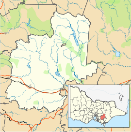
 Neerim South
Population: 1,602[1] Postcode: 3831 Location: LGA: Shire of Baw Baw State District: Narracan Federal Division: McMillan Neerim South is a town in West Gippsland, Victoria, Australia, located in the Shire of Baw Baw, 109 kilometres (68 mi) east of Melbourne and 19 kilometres (12 mi) north of Warragul. At the 2006 census, Neerim South and the surrounding area had a population of 1,602.[1]
The Post Office opened on 1 February 1883.[2]
The town was connected to the Victorian Railways network with the opening of a branch line from the main Gippsland line at Warragul on 18 March 1892,[3] later connecting to Noojee in 1919. The line closed in 1958.[4]
The town's main industry is tourism. It contains art galleries, a working Alpaca farm with an Alpaca product shop, cafés, restaurants, a pub and bed and breakfasts. Until 2008, the bakery still cooked bread in the wood-fired oven built in 1880. The town hosts a Celtic Festival each November. The area has numerous wineries, and is known for its blue cheese.
The town in conjunction with neighbouring township Neerim has an Australian Rules football team competing in the Ellinbank & District Football League.[5]
References
- ^ a b Australian Bureau of Statistics (25 October 2007). "Neerim South (State Suburb)". 2006 Census QuickStats. http://www.censusdata.abs.gov.au/ABSNavigation/prenav/LocationSearch?collection=Census&period=2006&areacode=SSC26319&producttype=QuickStats&breadcrumb=PL&action=401. Retrieved 2007-08-05.
- ^ Premier Postal History, Post Office List, https://www.premierpostal.com/cgi-bin/wsProd.sh/Viewpocdwrapper.p?SortBy=VIC&country=, retrieved 2008-04-11
- ^ Fiddian, Marc, Trains, Tracks, Travellers: a history of the Victorian Railways, South Eastern Independent Newspapers, p. 163, ISBN 1875475125
- ^ Fiddian (1997), p. 171.
- ^ Full Points Footy, Neerim-Neerim South, http://www.fullpointsfooty.net/Neerim-Neerim_South.htm, retrieved 2008-07-25[dead link]
Places in Shire of Baw Baw Aberfeldy • Athlone • Buln Buln • Darnum • Drouin • Erica • Fumina South • Hill End • Icy Creek • Jindivick • Longwarry • Neerim • Neerim North • Neerim South • Nilma • Noojee • Parkers Corner • Rawson • Rokeby • Tanjil Bren • Thorpdale • Trafalgar • Walhalla • Warragul • Willow Grove • Yarragon •
Coordinates: 38°01′S 145°58′E / 38.017°S 145.967°E

This article about a location in Gippsland is a stub. You can help Wikipedia by expanding it.
