- Nong Saeng District, Saraburi
-
Nong Saeng
หนองแซง— Amphoe — Amphoe location in Saraburi Province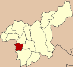
Coordinates: 14°29′32″N 100°47′4″E / 14.49222°N 100.78444°ECoordinates: 14°29′32″N 100°47′4″E / 14.49222°N 100.78444°E Country  Thailand
Province Saraburi Seat Tambon Muban Amphoe established Area – Total 87.081 km2 (33.6 sq mi) Population (2000) – Total 14,781 – Density 169.7/km2 (439.5/sq mi) Time zone THA (UTC+7) Postal code 18170 Geocode 1905 Nong Saeng (Thai: หนองแซง) is a district (Amphoe) of Saraburi Province, central Thailand.
Contents
History
Originally, the district was a minor district (King Amphoe) under the district Sao Hai. It was upgraded to a full district in 1953.
The most people of Nong Saeng migrated from Vientiane. They established their new town nearby a pond that has many Saeng trees around. So they named their new town Ban Nong Saeng.
Geography
Neighboring district are (from the north clockwise) Sao Hai, Mueang Saraburi, Nong Khae of Saraburi Province, and Phachi and Tha Ruea of Ayutthaya Province.
Administration
The district is subdivided into 9 subdistricts (tambon), which are further subdivided into 69 villages (muban). The township (thesaban tambon) Nong Saeng covers parts of the tambon Nong Saeng, Nong Khwai So and Kai So. There are further 9 Tambon administrative organizations (TAO).
1. Nong Saeng หนองแซง 2. Nong Khwai So หนองควายโซ 3. Nong Hua Pho หนองหัวโพ 4. Nong Sida หนองสีดา 5. Nong Kop หนองกบ 6. Kai Sao ไก่เส่า 7. Khok Sa-at โคกสะอาด 8. Muang Wan ม่วงหวาน 9. Khao Din เขาดิน External links
Mueang Saraburi · Kaeng Khoi · Nong Khae · Wihan Daeng · Nong Saeng · Ban Mo · Don Phut · Nong Don · Phra Phutthabat · Sao Hai · Muak Lek · Wang Muang · Chaloem Phra Kiat
Categories:- Amphoe of Saraburi
- Central Thailand geography stubs

Wikimedia Foundation. 2010.