- Mueang Saraburi District
-
Mueang Saraburi
เมืองสระบุรี— Amphoe — Amphoe location in Saraburi Province
Coordinates: 14°31′38″N 100°54′35″E / 14.52722°N 100.90972°ECoordinates: 14°31′38″N 100°54′35″E / 14.52722°N 100.90972°E Country  Thailand
Province Saraburi Seat Tambon Muban Amphoe established Area – Total 301.6 km2 (116.4 sq mi) Population (2000) – Total 106,107 – Density 351.8/km2 (911.2/sq mi) Time zone THA (UTC+7) Postal code 18000 Geocode 1901 Mueang Saraburi (Thai: เมืองสระบุรี) is the capital district (Amphoe Mueang) of Saraburi Province, central Thailand.
History
In 1896 when the Northeastern railway was built and passed by Tambon Pak Phriao. The governor of Saraburi, Phraya Phichai Ronnarong Songkhram moved the capital district from Sao Hai district to the area.
Geography
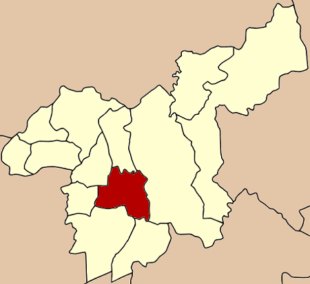
Neighboring districts are (from the north clockwise) Chaloem Phra Kiat, Kaeng Khoi, Wihan Daeng, Nong Khae, Nong Saeng and Sao Hai.
Mueang Saraburi is an important land transportation hub. Mittraphap Road begins at the downtown, as well as the northeastern railway line passing through it.
Administration
The district is subdivided into 11 subdistricts (tambon), which are further subdivided into 77 villages (muban). The town (thesaban mueang) Saraburi covers the whole tambon Pak Phriao. The township (thesaban tambon) Phok Phaek covers part of the tambon Nong No. Kut Nok Plao and Takut are two further recently created townships.
1. Pak Phriao ปากเพรียว 5. Dao Rueang ดาวเรือง 6. Na Chong นาโฉง 7. Khok Sawang โคกสว่าง 8. Nong No หนองโน 9. Nong Yao หนองยาว 10. Pak Khao San ปากข้าวสาร 11. Nong Pla Lai หนองปลาไหล 12. Kut Nok Plao กุดนกเปล้า 13. Taling Chan ตลิ่งชัน 14. Takut ตะกุด Missing numbers are tambon which now from the district Chaloem Phra Kiat.
Mueang Saraburi · Kaeng Khoi · Nong Khae · Wihan Daeng · Nong Saeng · Ban Mo · Don Phut · Nong Don · Phra Phutthabat · Sao Hai · Muak Lek · Wang Muang · Chaloem Phra Kiat
Categories:- Amphoe of Saraburi
- Central Thailand geography stubs
Wikimedia Foundation. 2010.