- Ngwathe Local Municipality
-
Ngwathe Local Municipality — Local municipality — Location in the Free State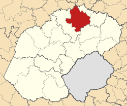
Country South Africa Province Free State District Fezile Dabi District Seat Parys Area - Total 7,055 km2 (2,724 sq mi) Population (2007)[1] - Total 95,187 - Density 13.5/km2 (34.9/sq mi) - Households 32,872 Racial makeup[2] (2007) - Black African 83.82% - White 10.30% - Coloured 5.87% - Indian or Asian 0.00% Time zone SAST (UTC+2) Municipal code FS203 Ngwathe Local Municipality is an administrative area in the Fezile Dabi District of the Free State in South Africa. "Ngwathe" is the Sesotho name for the Renoster River.[3]
References
- ^ "Community Survey, 2007: Basic Results Municipalities" (PDF). Statistics South Africa. http://www.statssa.gov.za/Publications/P03011/P030112007.pdf. Retrieved 2009-10-20.
- ^ "Community Survey 2007 interactive data". Statistics South Africa. http://www.statssa.gov.za/community_new/content.asp?link=interactivedata.asp. Retrieved 19 October 2009.
- ^ South African Languages - Place names
Province of Free State, South Africa Provincial Capital: Bloemfontein Metropolitan
MunicipalityDistrict
and Local
MunicipalitiesThabo MofutsanyanaCategories:- Local Municipalities of Fezile Dabi

Wikimedia Foundation. 2010.