- Dihlabeng Local Municipality
-
Dihlabeng Local Municipality — Local municipality — Location in the Free State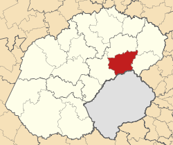
Country South Africa Province Free State District Thabo Mofutsanyane District Seat Bethlehem Government - Mayor Honorable Mayor Tjhetane Mofokeng - Municipal Manager Mr Thabiso Tsoaeli Area - Total 4,739 km2 (1,829.7 sq mi) Population (2007)[1] (2001) - Total 108,449 - Density 22.9/km2 (59.3/sq mi) - Households 31,836 Racial makeup[2] (2007) - Black African 84.23% - White 10.11% - Coloured 5.58% - Indian or Asian 0.08% Time zone SAST (UTC+2) Municipal code FS192 Dihlabeng Local Municipality is an administrative area in the Thabo Mofutsanyane District of the Free State in South Africa. It was established in terms of Section 12 of the Local Government Structures Act, 117 of 1998, after the first general local government elections of 5 December 2000 which heralded the final phase of local government reform as envisaged in 1994 at the onset of the process of democratisation. Category & type
The Municipality is a category B as defined in the Local Government Structures Act and shares executive and legislative authority with the category C municipality within whose area it falls i.e. Thabo Mofutsanyana District Municipality. The type is that of a Collective Executive System combined with a Ward Participatory System. Geographics
The Dihlabeng Local Municipality is situated within the boundaries of the Thabo Mofutsanyana District Municipality in the Eastern Free State. The geographical area is 7550.4910 km2. The Municipality consists of the towns Bethlehem (incl. Bohlokong & Bakenpark), Clarens (incl. Kgubetswana), Fouriesburg (incl. Mashaeng), Paul Roux (incl. Fateng-Tse-Ntsho) and Rosendal (incl. Mautse).
Bethlehem is situated approximately 240km north-east of Bloemfontein, 140km east of Kroonstad and 90km west of Harrismith. The town is strategically situated in the heart of the picturesque north-eastern Free State and originally developed as a service centre. Growth is stimulated by the strategic location of the area that serves as a central regional centre, situated adjacent to the N5 between Bloemfontein and Durban.
The scenic town of Clarens, often referred to the “Switzerland” of South Africa is situated ± 34 km south-east of Bethlehem. Clarens is a mere 20km from the Golden Gate Highlands National Park.
Fouriesburg is situated on the R26 route an in close proximity of Lesotho. The town has the predominant function of a small service centre and is increasingly being supported by the tourism industry. 67% of the population resides in urban areas and 33% in surrounding rural areas.
Paul Roux is situated 35km west of Bethlehem, on the N%. The area is mainly focused on agricultural significance.
Rosendal is located at the foot of the Witteberg mountain range on the R70. The town offers excellent property investment opportunities.
Economy & industry
The economic activities within the Municipality are dominated by farming (29,4%) and private business (17,2%). At ± 15% and 11% respectively, social services and trade operations are also relatively high economic activities.
Of a total farmland area of ± 3 000 ha in the Eastern Free State, 34% thereof is located within the Dihlabeng area – a factor that confirms the Agricultural comparative advantage that the sub region has in the Free State Province. The normal industrial incentives, with specific reference to affordable purchase prices, endorsed by Dihlabeng Local Council, ensure growth in the epithelium industrial area. The significance of the Lesotho Highlands Water and the Bethlehem Hydro Electricity projects are also relevant in this regard. Upmarket Residential, Business and Tourism development of a large scale is currently taking place in the region.
The agricultural sector of the Dihlabeng region is extremely prominent.
Considering small scale processing industries and intensive farming activities will result in future economic growth in the Agriculture sector. Effective productive grazing and small scale farming programmes on the existing and identified land for commonage have future growth potential. As part of Government’s Land Reform Programme, emerging farmers are trained and supported to ensure productive farming practices, which ensures economic growth in Dihlabeng..
References
- ^ "Community Survey, 2007: Basic Results Municipalities" (PDF). Statistics South Africa. http://www.statssa.gov.za/Publications/P03011/P030112007.pdf. Retrieved 2009-10-20. "Census 2001 interactive data". Statistics South Africa. http://www.statssa.gov.za/census01/html/C2001Interactive.asp. Retrieved 19 October 2009.
- ^ "Community Survey 2007 interactive data". Statistics South Africa. http://www.statssa.gov.za/community_new/content.asp?link=interactivedata.asp. Retrieved 19 October 2009.
Province of Free State, South Africa Provincial Capital: Bloemfontein Metropolitan
MunicipalityDistrict
and Local
MunicipalitiesThabo MofutsanyanaCategories:- Local Municipalities of Thabo Mofutsanyane

Wikimedia Foundation. 2010.