- Mantsopa Local Municipality
-
Mantsopa Local Municipality — Local municipality — Location in the Free State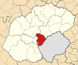
Country South Africa Province Free State District Thabo Mofutsanyana District Seat Ladybrand Area - Total 4,291 km2 (1,656.8 sq mi) Population (2007)[1] - Total 59,028 - Density 13.8/km2 (35.6/sq mi) - Households 15,985 Racial makeup[2] (2007) - Black African 81.67% - White 7.21% - Coloured 10.83% - Indian or Asian 0.29% Time zone SAST (UTC+2) Municipal code FS173 Mantsopa Local Municipality is a local municipality in the Thabo Mofutsanyana District of the Free State in South Africa.
Origin of the name
Mantsopa was a sister to King Moshoeshoe who banished her from the Kingdom when he suspected that her powers were greater than his. When she arrived at Modderpoort there were no houses and she stayed in a cave. In 1886 a group of men called The Brotherhood of St Augustine arrived at Modderpoort, and Mantsopa accommodated them in her cave. The missionaries decided to stay and they turned the cave into a chapel. Mantsopa later joined the church and was baptised and given the name Anna. Mantsopa's grave continues to be visited and offerings are still placed on or near it.[3]
References
- ^ "Community Survey, 2007: Basic Results Municipalities" (PDF). Statistics South Africa. http://www.statssa.gov.za/Publications/P03011/P030112007.pdf. Retrieved 2009-10-20.
- ^ "Community Survey 2007 interactive data". Statistics South Africa. http://www.statssa.gov.za/community_new/content.asp?link=interactivedata.asp. Retrieved 19 October 2009.
- ^ South African Languages - Place names
Province of Free State, South Africa Provincial Capital: Bloemfontein Metropolitan
MunicipalityDistrict
and Local
MunicipalitiesThabo MofutsanyanaCategories:- Local Municipalities of Thabo Mofutsanyane

Wikimedia Foundation. 2010.