- Newington, Victoria
-
Newington
Ballarat, Victoria
Pleasant Street commercial area looking south. The Bunch of Grapes Hotel is on the left.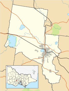
 Newington
Population: 1,747[1] Postcode: 3350 Location: 2 km (1 mi) from Ballarat Central LGA: City of Ballarat State District: Ballarat West Federal Division: Ballarat Suburbs around Newington: Lake Gardens Lake Wendouree Lake Wendouree Alfredton Newington Ballarat Central Delacombe Delacombe, Redan Redan Newington is a suburb south west of Ballarat, Victoria, Australia. The population at the 2006 census was 1,747.[1]
Newington is bordered by Gillies Street to the West, Sturt Street to the North, Pleasant Street to the East and Winter Street to the South
Newington is notable for Victoria Park, Ballarat's largest open parkland which features numerous sporting grounds connected by grand avenues of conifers and oaks planted in the 1920s as well as some ornamental wetlands and lakes.
 Entrance to Victoria Park at Sturt Street
With the exception of the park and schools, the suburb consists almost solely of Single-family detached homes in grid plan street layout. Many of the homes are either Victorian or interwar styles.
References
- ^ a b Australian Bureau of Statistics (25 October 2007). "Newington (L) (State Suburb)". 2006 Census QuickStats. http://www.censusdata.abs.gov.au/ABSNavigation/prenav/LocationSearch?collection=Census&period=2006&areacode=SSC23006&producttype=QuickStats&breadcrumb=PL&action=401. Retrieved 2009-01-06.
 Localities of Greater Ballarat
Addington · Alfredton · Ascot · Bakery Hill · Ballarat Central · Ballarat East · Ballarat North · Black Hill · Bo Peep · Bonshaw · Brown Hill · Buninyong · Bunkers Hill · Burrumbeet · Canadian · Cardigan · Cardigan Village · Chapel Flat · Coghills Creek · Delacombe · Durham Lead · Ercildoune · Eureka · Glen Park · Glendaruel · Glendonnell · Golden Point · Gong Gong · Invermay · Invermay Park · Lake Gardens · Lake Wendouree · Learmonth · Magpie · Miners Rest · Mitchell Park · Mount Clear · Mount Helen · Mount Pleasant · Mount Rowan · Nerrina · Newington · Redan · Scotchmans Lead · Scotsburn · Sebastopol · Soldiers Hill · Tourello · Warrenheip · Weatherboard · Wendouree · Windermere
Categories:- Suburbs of Ballarat
- Victoria (Australia) geography stubs


Wikimedia Foundation. 2010.