- Delacombe, Victoria
-
Delacombe
Ballarat, Victoria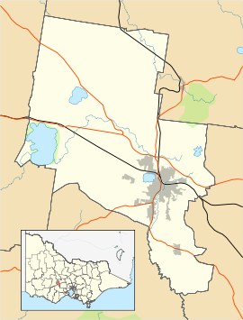
 Delacombe
Population: 3,811[1] Postcode: 3356 Location: 6 km (4 mi) from Ballarat Central LGA: City of Ballarat State District: Ballarat West Federal Division: Ballarat Suburbs around Delacombe: Alfredton Newington Newington Bunkers Hill Delacombe Redan Smythes Creek Bonshaw Sebastopol Delacombe is a large and rapidly growing industrial/residential suburb on the south west rural-urban fringe of Ballarat, Victoria, Australia. The population at the 2006 census was 3,811[1] making it the sixth most populated in the Ballarat urban area.
Delacombe forms a large part of the Ballarat West Growth Area where suburban development is encouraged by the City of Ballarat and State Government of Victoria. Much of the city's planned subdivision for new housing estates is happening in Greenfield land in and around the suburb and it is predicted to be home to over 12,000 residents in 2030.
The suburb is built upon the floodplain of the Winter Creek. Its tributaries are stormwater drains, including the Banyule.[2]
It is one of the few Ballarat suburbs with its own shopping centres and a future activity centre for the suburb is planned by the City of Ballarat.
Contents
History
Delacombe was planned in the 1970s and developed in the 1980s. The primary school opened in 1981[3].
During the 2011 Victorian floods, flash flooding caused the Banyule drain overflowed on more than one occasion, causing flooding to homes.[4] The floods spurred implement stormwater upgrades[5] and a flood strategy from the City of Ballarat[6] including the creation of artificial wetlands.[7]
Urban form and housing
The majority of Delacombe's residential areas have been developed under the concepts of street hierarchy with light industry and commercial areas centred on the main streets with single-family detached homes along branching cul-de-sacs.
Education
- Lumen Christi Catholic school
- Delacombe Primary School
Transport
The main form of transport in Delacombe is the private motor car and it can be classed as a car dependent suburb and over 50% of all households with more than two vehicles. The suburb is serviced by Ballarat taxis and a bus service runs regularly to the city.
A branch of the disused Cattleyards freight railway line terminated in Delacombe and was proposed by the Victorian Greens transport policy as the site of a potential railway station, however the line was demolished in 2010. The nearest railway station is Wendouree 5 km to the north.
Parks and open space
While there is still much greenfield land in Delacombe, currently the Delacombe Sports Centre is set aside as a public recreation space.
References
- ^ a b Australian Bureau of Statistics (25 October 2007). "Delacombe (L) (State Suburb)". 2006 Census QuickStats. http://www.censusdata.abs.gov.au/ABSNavigation/prenav/LocationSearch?collection=Census&period=2006&areacode=SSC23046&producttype=QuickStats&breadcrumb=PL&action=401. Retrieved 2009-01-06.
- ^ http://www.ballarat.vic.gov.au/media/69273/attachment%20b7%20-%20strategies%20for%20winter%20creek%20sub-catchment.pdf
- ^ http://www.delacombeps.vic.edu.au/aboutus.php
- ^ http://www.thecourier.com.au/news/local/news/general/delacombe-homes-flooded-for-second-time/2068265.aspx
- ^ http://www.abc.net.au/local/stories/2011/02/06/3131171.htm
- ^ http://www.thecourier.com.au/news/local/news/general/ballarat-council-plan-to-prevent-delacombe-flooding/2121960.aspx
- ^ http://www.thecourier.com.au/news/local/news/general/new-wetland-will-help-curb-suburbs-propensity-to-flood/407747.aspx
 Localities of Greater Ballarat
Addington · Alfredton · Ascot · Bakery Hill · Ballarat Central · Ballarat East · Ballarat North · Black Hill · Bo Peep · Bonshaw · Brown Hill · Buninyong · Bunkers Hill · Burrumbeet · Canadian · Cardigan · Cardigan Village · Chapel Flat · Coghills Creek · Delacombe · Durham Lead · Ercildoune · Eureka · Glen Park · Glendaruel · Glendonnell · Golden Point · Gong Gong · Invermay · Invermay Park · Lake Gardens · Lake Wendouree · Learmonth · Magpie · Miners Rest · Mitchell Park · Mount Clear · Mount Helen · Mount Pleasant · Mount Rowan · Nerrina · Newington · Redan · Scotchmans Lead · Scotsburn · Sebastopol · Soldiers Hill · Tourello · Warrenheip · Weatherboard · Wendouree · Windermere
Coordinates: 37°34′S 143°49′E / 37.567°S 143.817°E
Categories:- Suburbs of Ballarat
- Victoria (Australia) geography stubs

Wikimedia Foundation. 2010.