- New Sea Passenger port
-
New Sea Passenger port Location Country Russia Location St. Petersburg, Vasilievsky Island Coordinates 59°56′48″N 30°11′32″E / 59.94667°N 30.19222°ECoordinates: 59°56′48″N 30°11′32″E / 59.94667°N 30.19222°E Details Opened July, 28th 2007 Operated by Big port Saint Petersburg Owned by Marine Facade Management Company (builder) Type of harbor Passenger Sea Terminus Available berths 3 Wharfs 7 Piers 0 Statistics Passenger traffic 12,000 per day[1] Website "Port Russian: Порт" (in ru). Marine Facade Management Company Official Cite. http://www.mfspb.ru/port.html. Retrieved 2011-08-29. New Sea Passenger port is an under-construction port in Gulf of Finland on the Baltic Sea in St. Petersburg, Russia. It is located on new alluvial territories of Sea Facade. Officially the port has no name yet, a section on the official site has the name "port".[1] The last document of the Saint Petersburg City Administration names the area "the sea passenger terminal on Vasilevsky island".[2]
Construction chronology
- In 2006
- Marine facade Company has built:
- 35 hectares of reclaimed land;
- The technological channel on water area of seaport for building of moorings;
- Access technological road;
- The dividing dam.
- In 2007
- By July, 28th the educational sailing vessel named "Young Baltiets" was moored at berth number seven.[3]
- In 2008
- Two moorings, building the cruise terminal and coastal constructions necessary for work are constructed and transferred in the summer.[1]
- On September, 10th, 2008 the port accepted the first passenger cruise liner a 16-deck Italian vessel named "Costa Mediterranea".[1]
- In 2009
- On August a hydrofoil line to Peterhof and Winter Palace was started.[4]
The schedule of building of port[1] Stage Year Harbor walls Note 1 2008 Two walls With a complex necessary port structures 2 2009 Three walls 3 2010 Two walls References
- ^ a b c d e "Port Russian: Порт" (in ru). Marine Facade Management Company Official Cite. http://www.mfspb.ru/port.html. Retrieved 2011-08-29.
- ^ Matvienko, Valentina (2007-11-13). "The order of the government of St.-Petersburg Number 1431 from November, 13th 2007 Russian: Постановление правительства Санкт-Петербурга № 1431 от 13 ноября 2007" (in ru). Saint Petersburg City Administration. http://www.mfspb.ru/docum/13.html. Retrieved 2009-09-13.[dead link]
- ^ "News. 28.07.2007" (in en). Marine Facade Management Company Official Cite. 2007-07-28. http://www.mfspb.ru/news_archive_eng.html. Retrieved 2009-09-13.
- ^ ""Sea facade" have connected with fountains of Petrodvorets Russian: "Морской фасад" связали с фонтанами Петродворца" (in ru). City (fontanka.ru). 2009-08-21. http://www.fontanka.ru/2009/08/21/074/. Retrieved 2009-09-13.
Marine Facade of St. Petersburg "Marine Facade Management Company Official Cite" (in en). Marine Facade Management Company. http://www.mfspb.ru/index_eng.html. Retrieved 2009-09-13. Hydrofoil boats lines of St. Petersburg Winter palace-Petergof 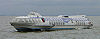
Winter palace-Sea Facade Sea Facade-Petergof Type of ships: Meteor Categories:- Gulf of Finland
- Ports and harbours of Russia
Wikimedia Foundation. 2010.