- National Register of Historic Places listings in Downtown Louisville, Kentucky
-
This is a list of the 88 sites on the National Register of Historic Places in downtown Louisville, Kentucky, United States.
Landmark name Image Date listed Location Summary 1 Adath Israel Temple December 31, 1974 834 S. 3rd St.
38°14′35″N 85°45′27″W / 38.24306°N 85.7575°W2 Adath Jeshurun Temple and School January 28, 1982 749-757 S. Brook St.
38°14′35″N 85°45′7″W / 38.24306°N 85.75194°W3 Almsted Brothers Building 
March 1, 1982 425 W. Market St.
38°15′19″N 85°45′28″W / 38.25528°N 85.75778°W4 Ancient and Accepted Scottish Rite Temple 
April 29, 1982 200 E. Gray St.
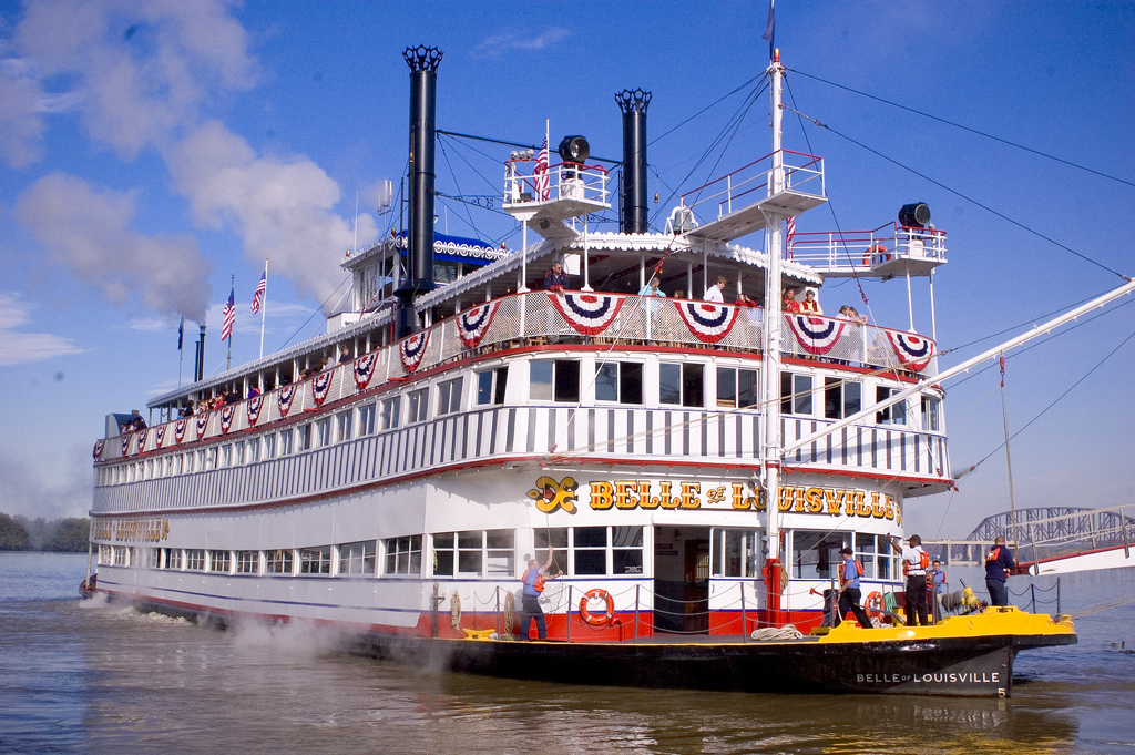
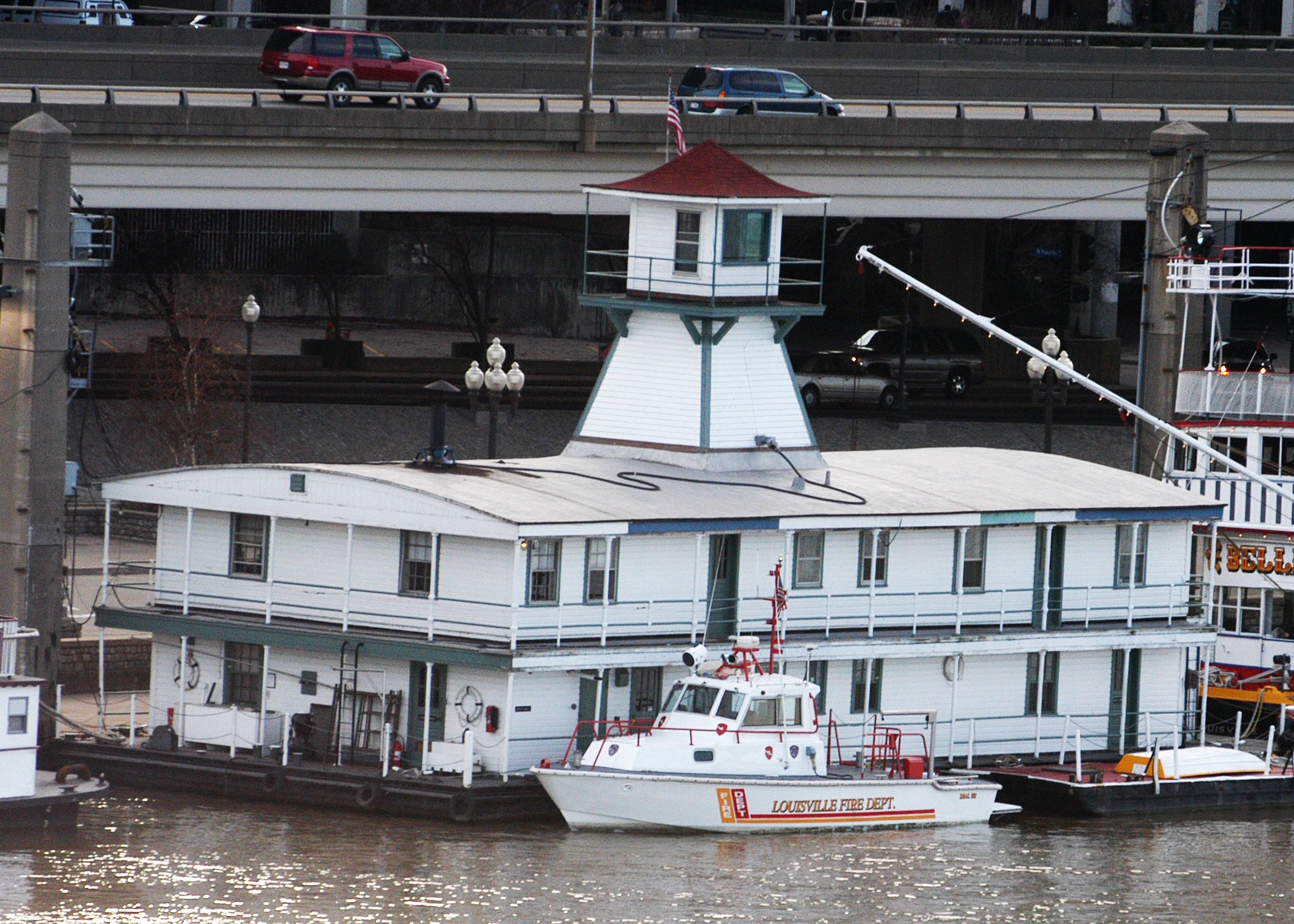
38°14′48″N 85°45′46″W / 38.24667°N 85.76278°W5 BELLE OF LOUISVILLE (steamer) 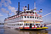
April 10, 1972 4th St. and River Rd.
38°15′40″N 85°45′22″W / 38.26111°N 85.75611°W6 Bosler Fireproof Garage 
August 18, 1983 423 S. 3rd St.
38°15′7″N 85°45′17″W / 38.25194°N 85.75472°W7 Brandeis House March 1, 1984 310 E. Broadway
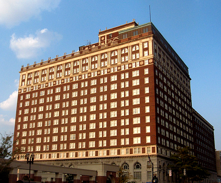
38°14′42″N 85°44′57″W / 38.245°N 85.74917°W8 Brown Hotel Building and Theater 
February 17, 1978 675 River City Mall
38°14′48″N 85°45′28″W / 38.24667°N 85.75778°W9 J.T.S. Brown and Son's Complex December 10, 1998 105, 107-109 W. Main St.
38°15′24″N 85°45′7″W / 38.25667°N 85.75194°W10 The Business Women's Club 
February 7, 2008 425 Muhammad Ali Boulevard
38°15′5″N 85°45′31″W / 38.25139°N 85.75861°W11 Caperton Block 
July 12, 1984 564-574 4th Ave.
38°14′57″N 85°45′29″W / 38.24917°N 85.75806°W12 Cathedral of the Assumption 
September 21, 1977 443 S. 5th St.
38°15′7″N 85°45′31″W / 38.25194°N 85.75861°W13 Chestnut Street Methodist Church July 16, 1979 809 W. Chestnut St.
38°15′1″N 85°45′55″W / 38.25028°N 85.76528°W14 Christ Church Cathedral 
August 14, 1973 421 S. 2nd St.
38°15′7″N 85°45′13″W / 38.25194°N 85.75361°W15 Church of the Messiah April 21, 1976 805 S. 4th St.
38°14′38″N 85°45′30″W / 38.24389°N 85.75833°W16 J. Dolfinger and Company Building 
December 21, 1990 642 S. 4th St.
38°14′50″N 85°45′31″W / 38.24722°N 85.75861°W17 Electric Building 
March 14, 1985 619 S. 4th Ave.
38°14′54″N 85°45′27″W / 38.24833°N 85.7575°W18 Elks Athletic Club July 16, 1979 604 S. 3rd St.
38°14′55″N 85°45′23″W / 38.24861°N 85.75639°W19 Fifth Ward School March 31, 1978 743 S. 5th St.
38°14′40″N 85°45′36″W / 38.24444°N 85.76°W20 First Lutheran Church October 29, 1982 417 E. Broadway
38°14′44″N 85°44′47″W / 38.24556°N 85.74639°W21 First National Bank-Kentucky Title Company Building May 19, 1983 214 S. 5th St.
38°15′17″N 85°45′33″W / 38.25472°N 85.75917°W22 German Bank Building October 11, 1984 150 S. 5th St.
38°15′20″N 85°45′31″W / 38.25556°N 85.75861°W23 German Insurance Bank 
March 14, 1985 207 W. Market St.
38°15′18″N 85°45′13″W / 38.255°N 85.75361°W24 Hamilton Brothers Warehouse 
February 7, 2008 125-127 W. Main St.
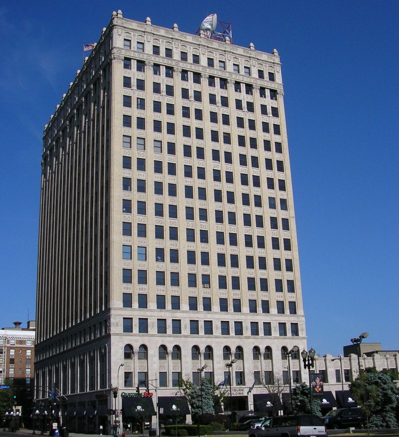
38°15′23″N 85°45′10″W / 38.25639°N 85.75278°W25 Heyburn Building 
July 16, 1979 332 W. Broadway
38°14′44″N 85°45′30″W / 38.24556°N 85.75833°W26 House of Weller September 26, 1979 121 W. Main St.
38°15′23″N 85°45′4″W / 38.25639°N 85.75111°W27 Howard-Hardy House 
November 9, 2004 429 S. 2nd St.
38°15′5″N 85°45′14″W / 38.25139°N 85.75389°W28 Inter-Southern Insurance Building March 19, 1980 239-247 S. 5th St.
38°15′15″N 85°45′30″W / 38.25417°N 85.75833°W29 Jefferson County Armory 
March 24, 1980 525 W. Muhammad Ali Boulevard
38°15′5″N 85°45′37″W / 38.25139°N 85.76028°W30 Jefferson County Courthouse 
April 10, 1972 527 W. Jefferson St.
38°15′16″N 85°45′34″W / 38.25444°N 85.75944°WNow the Louisville Metro Hall, seat of government for all of Louisville and Jefferson County, Kentucky. 31 Jefferson County Courthouse Annex April 21, 1980 517 Court Pl.
38°15′18″N 85°45′34″W / 38.255°N 85.75944°W32 Jefferson County Jail July 16, 1973 514 W. Liberty St.
38°15′11″N 85°45′36″W / 38.25306°N 85.76°W33 Jewish Hospital Complex July 22, 1994 236 E. Kennedy St.
38°14′15″N 85°45′6″W / 38.2375°N 85.75167°W34 Kaufman-Straus Building 
February 14, 1978 427-437 S. 4th St.
38°15′7″N 85°45′26″W / 38.25194°N 85.75722°W35 Keneseth Israel Synagogue October 29, 1982 232-236 W. Jacob St.
38°15′9″N 85°45′1″W / 38.2525°N 85.75028°W36 Kentucky National Bank 
July 16, 1979 300 W. Main St.
38°15′22″N 85°45′19″W / 38.25611°N 85.75528°W37 Knights of Pythias Temple November 29, 1978 928-932 W. Chestnut St.
38°14′58″N 85°46′3″W / 38.24944°N 85.7675°W38 Levy Brothers Building 
March 24, 1978 235 W. Market St.
38°15′19″N 85°45′17″W / 38.25528°N 85.75472°W39 Loew's and United Artists State Theatre 
March 28, 1978 625 S. 4th St.
38°14′52″N 85°45′28″W / 38.24778°N 85.75778°W40 Louisville and Nashville Railroad Office Building 
September 8, 1983 908 W. Broadway
38°14′40″N 85°46′4″W / 38.24444°N 85.76778°W41 Louisville City Hall Complex 
September 1, 1976 601, 603, 617 W. Jefferson St.
38°15′16″N 85°45′39″W / 38.25444°N 85.76083°W42 Louisville Grocery Company Building 
April 18, 2003 231 E. Main St.
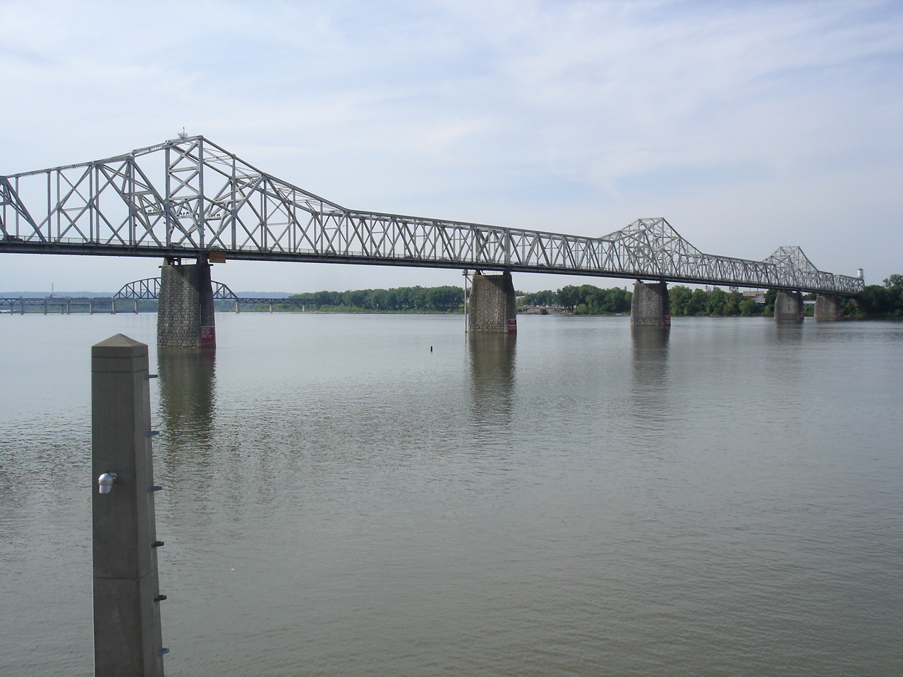
38°15′21″N 85°44′54″W / 38.25583°N 85.74833°W43 Louisville Municipal Bridge, Pylons and Administration Building 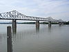
March 8, 1984 Spans the Ohio River between Louisville and Jeffersonville, IN
38°15′52″N 85°45′6″W / 38.26444°N 85.75167°WExtends into Clark County, Indiana 44 Louisville Trust Building 
April 18, 1977 208 S. 5th St.
38°15′19″N 85°45′32″W / 38.25528°N 85.75889°W45 Madrid Building 
July 11, 1985 545 S. 3rd St.
38°14′58″N 85°45′20″W / 38.24944°N 85.75556°W46 Main Street District, Expanded April 1, 1980 316, 320, 324 and 328 W. Main St.
38°15′22″N 85°45′21″W / 38.25611°N 85.75583°W47 Marmaduke Building 
July 26, 1991 520 S. 4th Ave.
38°15′0″N 85°45′29″W / 38.25°N 85.75806°W48 MAYOR ANDREW BROADDUS 
June 30, 1989 4th St. and River Rd.
38°15′34″N 85°45′15″W / 38.25944°N 85.75417°W49 Miller Paper Company Buildings February 11, 2011 118-122 E. Main St.
38°15′21″N 85°45′2″W / 38.25583°N 85.75056°W50 New Enterprise Tobacco Warehouse 
December 4, 1980 925 W. Main St.
38°15′28″N 85°45′56″W / 38.25778°N 85.76556°W51 Old Presbyterian Theological Seminary 
March 24, 1978 109 E. Broadway
38°14′47″N 85°45′10″W / 38.24639°N 85.75278°W52 Old U.S. Customshouse and Post Office 
November 23, 1977 300-314 W. Liberty St.
38°15′9″N 85°45′21″W / 38.2525°N 85.75583°W53 The Olympic July 9, 2007 223 W. Breckinridge St.
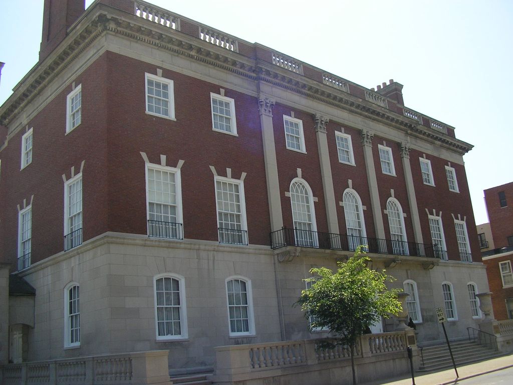
38°14′37″N 85°45′27″W / 38.24361°N 85.7575°W54 Pendennis Club 
December 4, 2003 218 W. Walnut St.
38°15′3″N 85°45′17″W / 38.25083°N 85.75472°W55 Republic Building 
August 12, 1982 429 W. Muhammad Ali Boulevard
38°15′2″N 85°45′28″W / 38.25056°N 85.75778°W56 Ronald–Brennan House 
August 11, 1975 631 S. 5th St.
38°14′52″N 85°45′34″W / 38.24778°N 85.75944°W57 Rossmore Apartment House 
November 14, 1978 664 River City Mall
38°14′50″N 85°45′31″W / 38.24722°N 85.75861°W58 St. Bonifacius Kirche Complex October 29, 1982 501-531 E. Liberty St.
38°14′41″N 85°45′5″W / 38.24472°N 85.75139°W59 St. Paul's German Evangelical Church and Parish House 
February 25, 1982 213 E. Broadway
38°14′45″N 85°45′3″W / 38.24583°N 85.75083°W60 Savoy Historic District June 1, 1988 209-221 W. Jefferson St.
38°15′13″N 85°45′16″W / 38.25361°N 85.75444°W61 Sears, Roebuck and Company Store 
February 18, 1983 800 W. Broadway
38°14′47″N 85°45′54″W / 38.24639°N 85.765°W62 Second and Market Streets Historic District March 17, 1988 Address Restricted
38°15′16″N 85°45′15″W / 38.25444°N 85.75417°W63 Seelbach Hotel 
August 12, 1975 500 S. 4th St.
38°15′3″N 85°45′29″W / 38.25083°N 85.75806°W64 Snead Manufacturing Building August 1, 1978 817 W. Market St.
38°15′22″N 85°45′52″W / 38.25611°N 85.76444°W65 South Central Bell Company Office Building December 3, 1980 521 W. Chestnut St.
38°14′58″N 85°45′35″W / 38.24944°N 85.75972°W66 Southern National Bank 
August 12, 1971 320 W. Main St.
38°15′20″N 85°45′20″W / 38.25556°N 85.75556°W67 Speed Building 
May 18, 1983 319 Guthrie Green
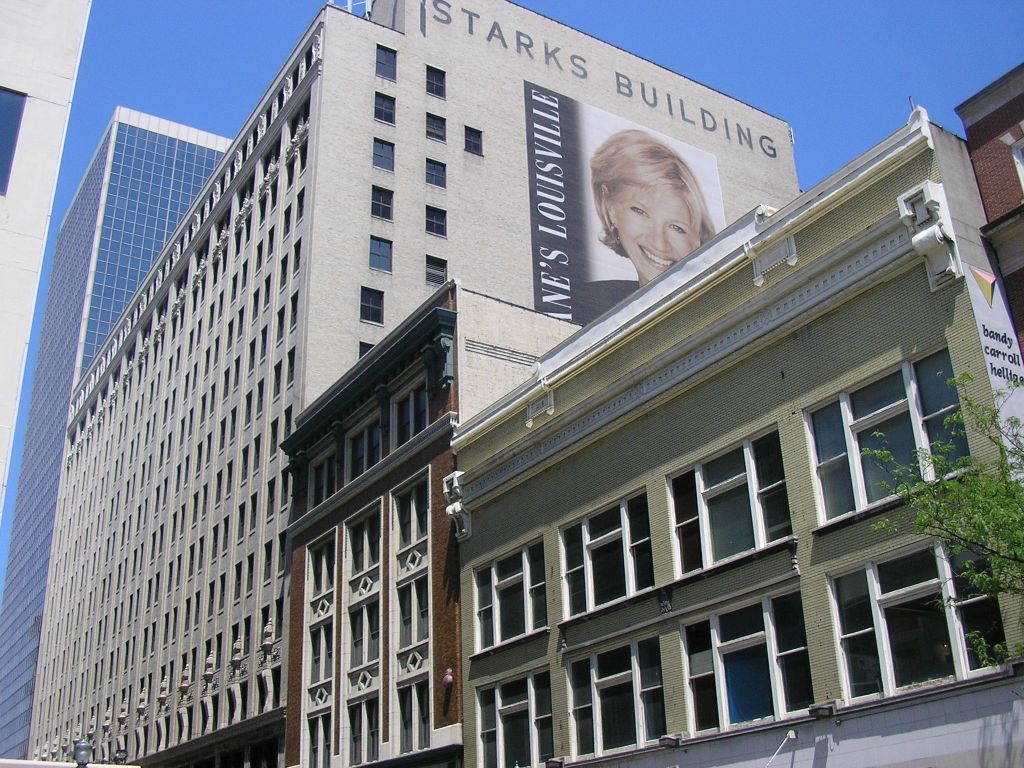
38°14′58″N 85°45′25″W / 38.24944°N 85.75694°W68 Starks Building 
July 11, 1985 455 S. 4th Ave.
38°15′22″N 85°45′46″W / 38.25611°N 85.76278°W69 Steam Engine Company No. 2 November 7, 1980 617-621 W. Jefferson St.
38°15′16″N 85°45′41″W / 38.25444°N 85.76139°W70 Stewart's Dry Goods Company Building 
August 12, 1982 501 S. 4th St.
38°15′3″N 85°45′26″W / 38.25083°N 85.75722°W71 W.K. Stewart Bookstore March 24, 2003 550 S. 4th St.
38°15′6″N 85°45′29″W / 38.25167°N 85.75806°W72 Theater Building August 12, 1982 625-33 S. 4th Ave.
38°14′52″N 85°45′28″W / 38.24778°N 85.75778°W73 Thierman Apartments June 3, 1983 416-420 W. Breckinridge St.
38°14′30″N 85°45′35″W / 38.24167°N 85.75972°W74 Third and Jefferson Streets Historic District March 17, 1988 301-317 S. 3rd St. and 232-244 Jefferson St.
38°15′12″N 85°45′19″W / 38.25333°N 85.75528°W75 Third and Market Streets Historic District March 17, 1988 201-219 S. 3rd St. and 224-240 W. Market St.
38°15′17″N 85°45′19″W / 38.25472°N 85.75528°W76 Trade Mart Building May 25, 1973 131 W. Main St.
38°15′23″N 85°45′10″W / 38.25639°N 85.75278°W77 Tyler Block 
October 15, 1973 319 W. Jefferson
38°15′14″N 85°45′22″W / 38.25389°N 85.75611°W78 Tyler Hotel March 17, 1988 229-245 W. Jefferson St.
38°15′14″N 85°45′19″W / 38.25389°N 85.75528°W79 Tyler-Muldoon House 
July 20, 1977 132 E. Gray St.
38°14′48″N 85°45′6″W / 38.24667°N 85.75167°W80 Union Station 
August 11, 1975 1000 W. Broadway
38°14′46″N 85°46′8″W / 38.24611°N 85.76889°W81 United States Post Office, Court House and Custom House 
March 18, 1999 601 W. Broadway
38°14′51″N 85°45′45″W / 38.2475°N 85.7625°W82 University of Louisville School of Medicine 
July 30, 1975 101 W. Chestnut St.
38°14′55″N 85°45′11″W / 38.24861°N 85.75306°W83 Walnut Street Theater 
September 1, 1978 416 W. Walnut St.
38°15′4″N 85°45′32″W / 38.25111°N 85.75889°W84 Weissinger-Gaulbert Apartments 
December 12, 1977 709 S. 3rd St.
38°14′44″N 85°45′24″W / 38.24556°N 85.75667°W85 West Main Street Historic District 
March 22, 1974 W. Main St.; also the 600-800 blocks of W. Main St., and the southern side of the 500 block
38°15′26″N 85°45′44″W / 38.25722°N 85.76222°WSecond set of addresses represents a boundary increase of March 27, 1980, the "West Main Street Historic District, Expanded" 86 Whiskey Row Historic District June 4, 2010 101-133 W. Main St.
38°15′22.25″N 85°45′8.7″W / 38.2561806°N 85.752417°W87 Wright and Taylor Building 
November 15, 1984 611-617 S. 4th St.
38°14′54″N 85°45′28″W / 38.24833°N 85.75778°W88 Y.M.C.A. Building 
December 16, 1977 227-229 W. Broadway
38°14′47″N 85°45′23″W / 38.24639°N 85.75639°WCategories:- National Register of Historic Places in Louisville, Kentucky


Wikimedia Foundation. 2010.