- Narrows, Oregon
-
Narrows, Oregon — Unincorporated community — 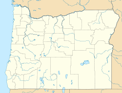
 Narrows, Oregon
Coordinates: 43°16′44″N 118°57′43″W / 43.279°N 118.962°WCoordinates: 43°16′44″N 118°57′43″W / 43.279°N 118.962°W Country United States State Oregon County Harney Elevation 4,111 ft (1,253 m) Time zone Pacific (PST) (UTC-8) – Summer (DST) PDT (UTC-7) ZIP code 97721 Area code(s) 458 and 541 Narrows, or The Narrows, is an unincorporated community in Harney County, Oregon, United States.[1][2] It was started as a community in 1889 by Lewis B. Springer and Albert Hembree. A post office was established in August 1889 and Springer, the postmaster, named it after himself. In April 1892 the name was changed to Narrows and Hembree became postmaster. The post office operated until 1936,[2] and is now served by the Princeton, Oregon 97721 post office.
References
- ^ Oregon Hometown Locator
- ^ a b McArthur, Lewis A.; McArthur, Lewis L (2003 [1928]). Oregon geographic names. Portland, Oregon: Oregon Historical Society Press. pp. 689–690. ISBN 0-87595-277-1.
Municipalities and communities of Harney County, Oregon Cities 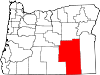
Unincorporated
communitiesIndian reservation Burns Paiute Indian Reservation
Categories:- Unincorporated communities in Harney County, Oregon
- Oregon geography stubs


Wikimedia Foundation. 2010.