- Narborough Watermill
-
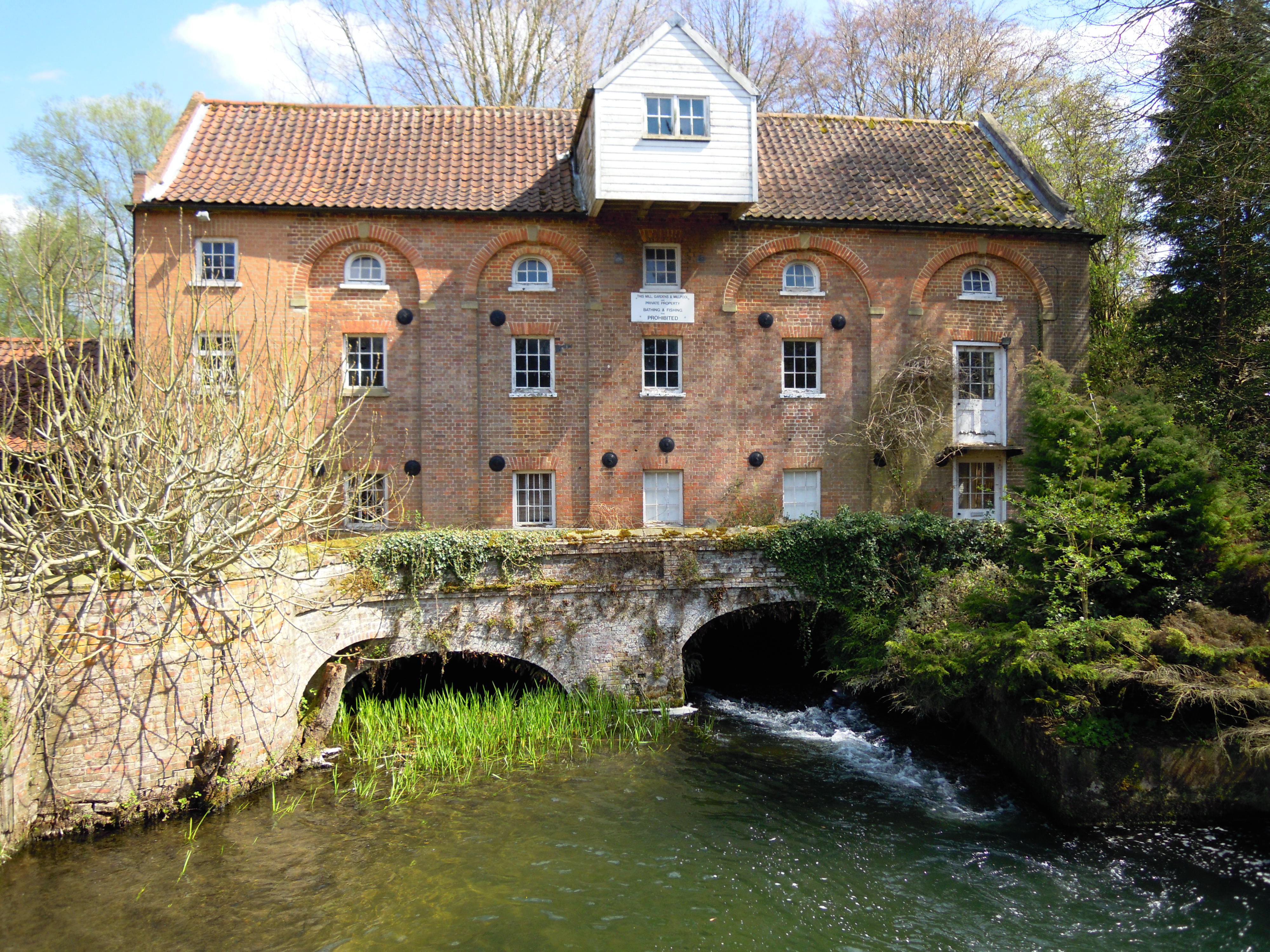
Narborough Watermill Watermill  Narborough Watermill west elevation.
Country England State Norfolk Region East of England District Breckland Municipality Narborough Location River Nar - coordinates 52°41′15.56″N 0°35′0.96″E / 52.6876556°N 0.5836°E Material Norfolk red Brick built with red Pantile roof Founded cica 1780 Owner Private 
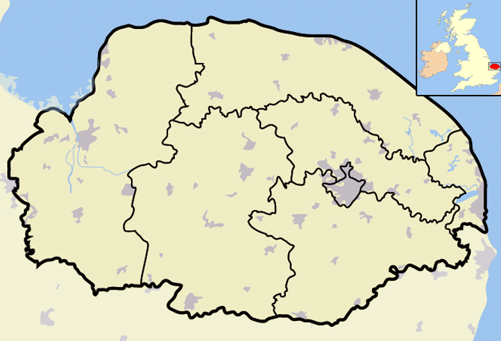
 Narborough Watermill within North Norfolk
Narborough Watermill is located on the river Nar, within the village of Narborough in the English county of Norfolk [1]. The watermill is thought to have been built around 1780[2] and is a Grade II listed building
Contents
Description
The Watermill is built from red Norfolk brick over three storeys in six bays to the west elevation. Four of the six bays are recessed within giant enclosing arches. The arches are semicircular headed with raised ashlars and a Keystone. In the center of the west elevation of the mill there is a timber lucam (covered sack hoist) of shiplap construction. In front of the west elevation there is a bridge with a three centered arch through which the mill race flows. The bridge has a parapet wall. The rear east elevation is constructed with weatherboard cladding with a continuous first floor outshoot which houses machinery of the mill. Below this there are sluice gates beneath a three centered archway. The ground and first floor of the mill still contains the Mill wheel and the machinery all which are now listed. The surviving machinery includes a 13 feet 7 inches (4.14 m) wheel driving pit-wheel and wallower. There is a horizontal mainshaft that once drove 6 pairs of stones, although there are only five that now survive.The mill race still flows through under the building.
History
Narborough watermill is thought to have been built around 1780[2] and over the years has been extended, altered and had parts demolished over the long period of its existence. In 1845[2] the watermill had an extension built on to the North West corner of the mill by the miller Charles Tyssen[2]. However this addition proved to be un-successful as the building had been erected on poor foundations and it began to slowly sink over a period of years. The section, including a miller’s house which stood to the front, had to be demolished in 1980[2] for safety reasons. At the same time piling work was done to underpin the remaining building.
See also
References
- ^ OS Explorer Map 236:King’s Lynn, Downham Market & Swaffham. ISBN 0 319 23808 3
- ^ a b c d e "Norfolk Mills-Narborough Watermill". Norfolk Mills. http://www.norfolkmills.co.uk/Watermills/narborough.html. Retrieved 23 April 2010.
Aldborough Watermill • Bolwick Hall Watermill • Bintry Watermill • Buxton Watermill • Congham Oil Mill • Eade’s Watermill • Gimingham Watermill • Glandford Watermill • Gresham Watermill • Gunton Park Sawmill • Heacham Watermill • Hempstead Watermill • Kettle Watermill • Lenwade Watermill • Letheringsett Watermill • Letheringsett Brewery watermill • Mundesley Watermill • Narborough Bone Mill • Narborough Watermill • Sheringham Watermill • Snettisham Watermill • Weybourne WatermillCategories:- Watermills in England
- Watermills in Norfolk
Wikimedia Foundation. 2010.