- Nam Kliang District
-
Nam Kliang
น้ำเกลี้ยง— Amphoe — Amphoe location in Sisaket Province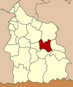
Coordinates: 14°55′38″N 104°30′47″E / 14.92722°N 104.51306°ECoordinates: 14°55′38″N 104°30′47″E / 14.92722°N 104.51306°E Country  Thailand
Province Sisaket Seat Nam Kliang Tambon Muban Amphoe established Area – Total 257.8 km2 (99.5 sq mi) Population (2008) – Total 43,339 – Density 168.1/km2 (435.4/sq mi) Time zone THA (UTC+7) Postal code 33130 Geocode 3315 Nam Kliang (Thai: น้ำเกลี้ยง) is a district (Amphoe) in the central part of Sisaket Province, northeastern Thailand.
Contents
Geography
Neighboring districts are (from the north clockwise) Kanthararom, Non Khun, Benchalak, Si Rattana, Phayu and Mueang Sisaket.
History
The minor district (King Amphoe) was created on January 7 1986, when the four tambon Nam Kliang, La-o, Tong Pit and Khoen were split off from Kanthararom district.[1] It was upgraded to a full district on July 4 1994.[2]
Administration
The district is subdivided into 6 subdistricts (tambon), which are further subdivided into 75 villages (muban). There are no municipal (thesaban) areas, and 6 Tambon administrative organizations (TAO).
No. Name Thai Villages Inh. 1. Nam Kliang น้ำเกลี้ยง 10 5,869 2. La-o ละเอาะ 13 7,703 3. Tong Pit ตองปิด 14 7,254 4. Khoen เขิน 13 7,904 5. Rung Rawi รุ่งระวี 15 7,895 6. Khup คูบ 10 6,714 References
- ^ "ประกาศกระทรวงมหาดไทย เรื่อง แบ่งเขตท้องที่อำเภอกันทรารมย์ จังหวัดศรีสะเกษ ตั้งเป็นกิ่งอำเภอน้ำเกลี้ยง" (in Thai). Royal Gazette 103 (9 ง): 157. January 21 1986. http://www.ratchakitcha.soc.go.th/DATA/PDF/2529/D/009/157.PDF.
- ^ "พระราชกฤษฎีกาตั้งอำเภอเปือยน้อย ... และอำเภอศรีวิไล พ.ศ. ๒๕๓๗" (in Thai). Royal Gazette 111 (21 ก): 32–35. June 3 1994. http://www.ratchakitcha.soc.go.th/DATA/PDF/2537/A/021/32.PDF.
External links
- amphoe.com (Thai)
Sisaket Main article Capital Districts (amphoe) Mueang Sisaket · Benchalak · Bueng Bun · Huai Thap Than · Kantharalak · Kanthararom · Khukhan · Khun Han · Mueang Chan · Nam Kliang · Non Khun · Phayu · Pho Si Suwan · Phrai Bueng · Phu Sing · Prang Ku · Rasi Salai · Si Rattana · Sila Lat · Uthumphon Phisai · Wang Hin · Yang Chum Noi
Related topics Si Saket FC · Mun River · Chi River · Northern Khmer people · Preah Vihear Temple · 2008 Cambodian-Thai stand-off
Neighboring areas Thailand: Surin · Roi Et · Yasothon · Ubon Ratchathani ·
Cambodia: Oddar Meancheay · Preah VihearCategories:- Amphoe of Sisaket
- Isan geography stubs

Wikimedia Foundation. 2010.