- El Reno Regional Airport
-
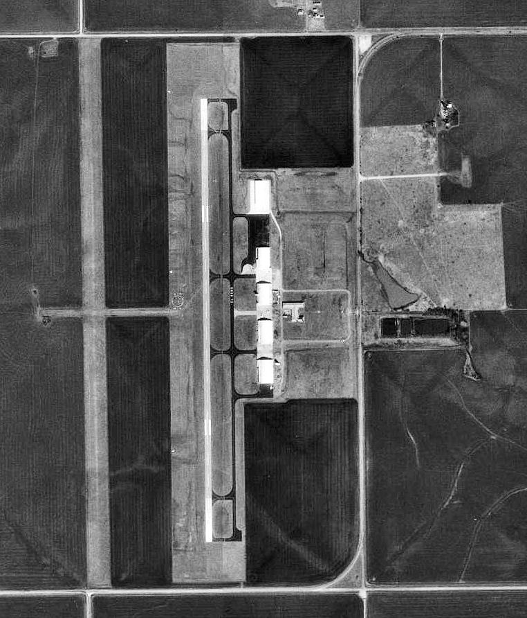
El Reno Regional Airport 
USGS aerial image, 1995 IATA: none – ICAO: KRQO – FAA LID: RQO Summary Airport type Public Owner City of El Reno Serves El Reno, Oklahoma Elevation AMSL 1,420 ft / 433 m Coordinates 35°28′22″N 098°00′21″W / 35.47278°N 98.00583°W Runways Direction Length Surface ft m 17/35 5,600 1,707 Concrete 18/36 4,630 1,411 Turf Statistics (2008) Aircraft operations 24,825 Based aircraft 24 Source: Federal Aviation Administration[1] El Reno Regional Airport (ICAO: KRQO, FAA LID: RQO) is a city-owned public-use airport located four nautical miles (7 km) southwest of the central business district of El Reno, a city in Canadian County, Oklahoma, United States.[1] According to the FAA's National Plan of Integrated Airport Systems for 2009–2013, it is categorized as a general aviation facility.[2]
Although many U.S. airports use the same three-letter location identifier for the FAA and IATA, this facility is assigned RQO by the FAA but has no designation from the IATA.[3]
Contents
History
The airport was opened in 1943 as a United States Army Air Forces World War II primary (stage 1) pilot training airfield by the Army Air Forces Training Command Gulf Coast Training Center (later Central Flying Training Command). It was known as El Reno Field or Mustang Field.
It was operated by the 320th Flying Training detachment, with the Midwest Air School as a contract flying training provider. The Oklahoma Air College, Inc. also was a contractor to the USAAF at El Reno. Flying training was performed with Fairchild PT-19s as the primary trainer. Also had several PT-17 Stearmans and a few P-40 Warhawks assigned.
During its wartime use, the airfield had three turf runways, their alignment now being undetermined. It also had several (between 3 to 6) local axillary landing fields emergency or overflow landings. Known auxiliaries were located at Calumet and Union City with several others in the El Reno area.
Pilot training at the airfield apparently ended during the summer of 1944, with the reduced demand for new pilots. The airfield was then turned over to the local government at the end of the war. [4][5]
Facilities and aircraft
El Reno Regional Airport covers an area of 698 acres (282 ha) an elevation of 1,420 feet (433 m) above mean sea level. It has two runways: 17/35 is 5,600 by 75 feet (1,707 x 23 m) with a concrete surface and 18/36 is 4,630 by 190 feet (1,411 x 58 m) with a turf surface.[1]
For the 12-month period ending February 12, 2008, the airport had 24,825 aircraft operations, an average of 68 per day: 99.9% general aviation and 0.1% military. At that time there were 24 aircraft based at this airport: 79% single-engine and 21% multi-engine.[1]
See also
References
- ^ a b c d FAA Airport Master Record for RQO (Form 5010 PDF). Federal Aviation Administration. Effective 3 June 2010.
- ^ National Plan of Integrated Airport Systems for 2009–2013: Appendix A: Part 4 (PDF, 1.61 MB). Federal Aviation Administration. Updated 15 October 2008.
- ^ "El Reno, Oklahoma (ICAO: KRQO, FAA: RQO)". Great Circle Mapper. http://www.gcmap.com/airport/KRQO. Retrieved 18 June 2010.
- ^
 This article incorporates public domain material from websites or documents of the Air Force Historical Research Agency.
 - ^ Shaw, Frederick J. (2004), Locating Air Force Base Sites History’s Legacy, Air Force History and Museums Program, United States Air Force, Washington DC, 2004.
External links
- FAA Terminal Procedures for RQO, effective 20 October 2011
- Resources for this airport:
- AirNav airport information for KRQO
- FlightAware airport information and live flight tracker
- NOAA/NWS latest weather observations
- SkyVector aeronautical chart, Terminal Procedures for KRQO
 Army Air Forces Training Command
Flying Training Flying Schools Eastern Flying Training Command · Central Flying Training Command · Western Flying Training CommandSpecialized Schools Bombardier · Contract Flying · Glider Training · Gunnery · Navigator
Technical Training Eastern Technical Training Command · Central Technical Training Command · Western Technical Training CommandCategories:- Airports in Oklahoma
- 1943 establishments
- Airfields of the United States Army Air Forces in Oklahoma
- Buildings and structures in Canadian County, Oklahoma
- USAAF Contract Flying School Airfields

Wikimedia Foundation. 2010.