- Muskeg River, Alberta
-
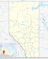
 Muskeg RiverLocation of Muskeg River in Alberta
Muskeg River is a settlement in northern Alberta, Canada within the Municipal District of Greenview No. 16.
It is located at the junction of the Bighorn Highway (Highway 40) and Forestry Trunk Road (former Highway 734), approximately 35 kilometers (22 mi) east of Grande Cache. It has an elevation of 1,250 meters (4,100 ft).
Muskeg River flows through the community and north into the Smoky River.
See also
- List of communities in Alberta
- List of settlements in Alberta

Wanyandie Flats Debolt Grande Cache 
 Muskeg River

Jasper National Park Hinton  Subdivisions of Alberta
Subdivisions Regions · Census divisions · Municipal districts (counties) · Specialized municipalities · School districts · Regional health authoritiesCommunities Cities · Towns · Villages · Summer villages · Hamlets · Indian reserves · Métis settlements · Ghost towns · Designated placesCities and Urban
Service AreasAirdrie · Brooks · Calgary · Camrose · Cold Lake · Edmonton (capital) · Fort McMurray · Fort Saskatchewan · Grande Prairie · Lacombe · Leduc · Lethbridge · Lloydminster · Medicine Hat · Red Deer · Sherwood Park · Spruce Grove · St. Albert · WetaskiwinCoordinates: 53°55′00″N 118°39′00″W / 53.91661°N 118.64994°W
Categories:- Greenview No. 16, Alberta
- Northern Alberta geography stubs

Wikimedia Foundation. 2010.