- Muskeget Island
-
Muskeget Island National Natural Landmarks 
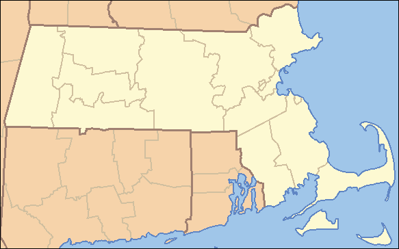
 Location of Muskeget Island in Massachusetts
Country United States State Massachusetts County Nantucket Location west of Tuckernuck and Nantucket Island, Massachusetts USA - coordinates 41°20′7″N 70°18′15″W / 41.33528°N 70.30417°WCoordinates: 41°20′7″N 70°18′15″W / 41.33528°N 70.30417°W - elevation 14 ft (4.3 m) 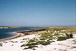 Muskeget Island
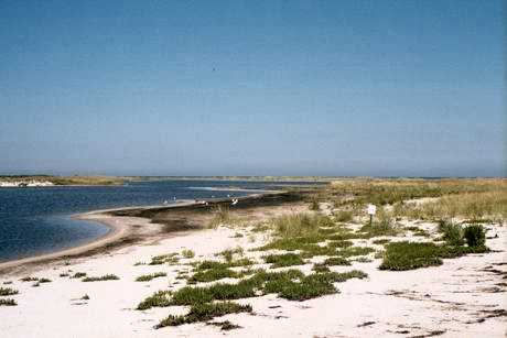
Muskeget Island is a low sandy island to the west of Tuckernuck Island and Nantucket, in the town of Nantucket, Massachusetts.
Contents
Geography
Muskeget Island is part of the terminal moraine marking the maximum extent of the last glacial ice sheet to reach the northeastern coast. It has an area of 292 acres (1.18 km2).[1] The Muskeget Island group contains Dry Shoal, Skiff Island, Tombolo Point, and Adams Island. Much of Muskeget is owned by the town of Nantucket. There are currently two unoccupied shacks on the island, both of which are remnants of old structures.
Muskeget has a high elevation of fourteen feet. Its northern shore is mostly sand dunes, while its southern shore is mainly marshes. A sandy point protects the lagoon.
History
It was part of Dukes County until the 1870s. The island was designated a National Natural Landmark by the National Park Service in April 1980.
Fauna
Muskeget is the southernmost breeding place of Grey Seals. Muskeget Island and Monomoy Island are the primary seal colonies off the New England coast. in 2008, more than 2,000 pups were born on Muskeget. With this large seal population, the waters surrounding Muskeget are an important feeding area for Great white sharks.[2]
The island is also home to an indigenous species of rodent known as the Muskeget Vole.
Access
Muskeget is inaccessible to most boats because of shoals and sandbars. Kayaking there can be very dangerous because of rip currents, swells, whirlpools, and lobster pots. Specialized boats designed to navigate the difficult waters around the Island depart from Nantucket Harbor.
References
- ^ [1]
- ^ MYERS, K.C. (2010-04-04). "Scientist shares great white shark insight". Cape Cod Times (Hyannis, MA: Cape Cod Media Group). http://www.capecodonline.com/apps/pbcs.dll/article?AID=/20100404/NEWS/4040324. Retrieved 4 April 2010.
Categories:- Islands of Massachusetts
- Landforms of Nantucket County, Massachusetts
- National Natural Landmarks in Massachusetts
- Nantucket, Massachusetts
- Massachusetts geography stubs
Wikimedia Foundation. 2010.