- List of longest placenames in Ireland
-
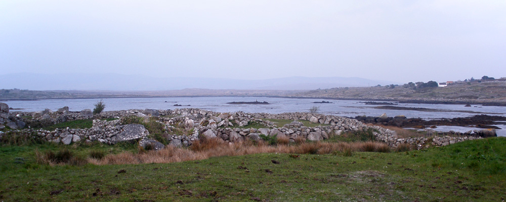
 Muiceanach idir Dhá Sháile (Muckanaghederdauhaulia)
in Co. Galway, IrelandThis is a list of the longest place names in Ireland. It includes names written in English as a single word of at least 20 letters. The vast majority of English-language place names in Ireland are anglicisations of Irish language names. The spelling which has legal force is usually that used by the Ordnance Survey of Ireland in the mid-nineteenth century. Many of Ireland's longest place names are found in the far west of the island, where the Irish language survived the longest, including Gaeltacht areas, where it is still the vernacular. These names are generally written as multiple words in Irish.
At 22 letters long, Muckanaghederdauhaulia (from Muiceanach idir Dhá Sháile meaning "pig-marsh between two saltwaters") is often believed to be Ireland's longest one-word place name.[1][2] In Life: A User's Manual by Georges Perec, it is one of the ports visited and painted by the character Bartlebooth, who believes it to be the longest port name in the world. An 1830s boundary survey uses the spelling Mwickanaghedderauhaulia, which is 23 letters long.
However, the Placenames Database of Ireland (logainm.ie) records several other place names of at least 22 letters. Furthermore, the anglicised form Muckanaghederdauhaulia ceased to have official status in 2005, after a Placenames Order was made under the Official Languages Act 2003; the sole official name is now the Irish form Muiceanach idir Dhá Sháile.[3]
Multiple-word place names may be longer still; for example, "Plughoge and Leabrannagh Mountain North", the name of a townland in County Donegal, has 35 letters, and its Irish equivalent "Sliabh Phlochóige agus Leadhb Reannach Thuaidh" has 41.[3]
In Northern Ireland, the townland of Brackagh Slieve Gallion[4] in County Londonderry has sometimes been written as one 21-letter word, Brackaghslievegallion,[5] or similar.[4]
List
Four of the places in this list are archeological sites on Inishmore. The spellings and locations given in the table are those on the Ordnance Survey's current and historic maps.[6][7]
English Letters Irish Type Location:
county, barony, civil parish, townlandBullaunancheathrairaluinn[6] 25 Ballán an Cheathrair Álainn[8] Bullaun Galway, Aran, Inishmore, Oghil[6] Sruffaunoughterluggatoora[9] 25 Sruthán Uachtar Log an tSamhraidh Stream Galway, Ballynahinch, Moyrus, Glencoaghan Sruffaungolinluggatavhin[10] 24 Sruthán Góilín Log an Tafainn Stream Galway, Ballynahinch, Moyrus, Glencoaghan Templeancheathrairaluinn[6] 24 Teampall an Cheathrair Álainn[11] Ruined church Galway, Aran, Inishmore, Oghil[6] Leabaancheathrairaluinn[6] 23 Leaba an Cheathrair Álainn[12] Ruined grave Galway, Aran, Inishmore, Oghil[6] Carrickwilliamodonnell[13] 22 Carraig Liam Uí Dhónaill Rock Galway, Moycullen, Moycullen, Derryloughaun East Clougherbowbartleymede[14] 22 Loch Chlochar Bó Bhairtliméid Lake Galway, Ballynahinch, Moyrus, Lettershinna Cooneenskerragohiffern[15] 22 Cuainín Sciorradh-go-hIfreann Harbour Mayo, Murrisk, Kilgeever, Lettereeragh Glassillaunvealnacurra[16] 22 (uncertain) Townland Galway, Ballynahinch, Ballindoon & Islands, Glassillaunvealnacurra Illaungraffanavrankagh[17] 22 (uncertain) Townland Clare, Burren, Gleninagh, Illaungraffanavrankagh Loughaunfiddaunbuntack[18] 22 Lochán Fheadán Bhun tSaic Lake Mayo, Burrishoole, Achill, Srahmore Muckanaghederdauhaulia[19] 22 Muiceanach idir Dhá Sháile Townland Galway, Moycullen, Kilcummin, Muckanaghederdauhaulia Ballywinterrourkewood[20] 21 Coill Bhaile Mhuintir Ruairc Townland Limerick, Connello Lower, Rathkeale, Ballywinterrourkewood Carrickemonmacdonagha[21] 21 Carraig Éamainn Mhic Dhonncha Rock Galway, Aran, Inishmore, Brannock Island Carrickmoylenacurhoga[22] 21 Carraig Bhéal na gCaróg Rock Mayo, Erris, Kilmore, Carrickawilt Island Carricknagalliaghduff[23] 21 Carraig na gCailleach Dubh Rock Mayo, Erris, Kilmore, Duvillaun More (Island)[24] Corragunnagalliaghdoo Island[25] 21 (uncertain) Townland Mayo, Burrishoole, Burrishoole, Corragunnagalliaghdoo Island Fiddauntawnynagalloge[26] 21 Feadán na nGealóg Stream[27] Mayo, Tirawley, Doonfeeny, Belderg More Ooghinneendonnellduff[28] 21 Uaich Iníon Dhónaill Dhuibh Inlet Mayo, Erris, Kilmore, Inishkea South Sruffaunnambrackdeony[29] 21 Sruthán na mBreac Deamhnaí Stream Galway, Moycullen, Moycullen, Oghery Sruffaunscalpnagollum[30] 21 Sruthán Scailp na gColm Stream Galway, Ballynahinch, Moyrus, Gleninagh Sruffaunnavonseebegga[31] 21 Sruthán na bhFonsaí Beaga Stream Galway, Ballynahinch, Moyrus, Glencoaghan Sruffaunrulardheemore[32] 21 Sruthán Rolardaí Mór Stream Galway, Ballynahinch, Moyrus, Glencoaghan Ardloughnabrackbaddy[33] 20 Ard Loch na mBreac Beadaí Peak Donegal, Kilmacrenan, Tullaghobegly, Tullaghobegly Irish Carrickacushcamemore[34] 20 (uncertain) Rock Mayo, Murrisk, Kilgeever, Garranty[n 1] Carrickbriendurragha[35] 20 Carraig Bhriain Dorcha Rock Donegal, Boylagh, Templecrone, Braade Carrickillaunnascalp[36] 20 Carraig Oileán na Scailpe Rock Galway, Moycullen, Kilcummin, Derravonniff Carrigeenmoylenanagh[37] 20 Carraig Mheall na nEach Rock Mayo, Erris, Kilmore, Inishkea South Carrigillaunyrahilly[38] 20 Carraig Léin Ní Rathaille Rock Kerry, Dunkerron South, Kilcrohane, Coomatloukane Carrowkeelanahaglass[39] 20 Ceathrú Chaol an Atha Ghlais Townland Galway, Ballymoe, Dunmore, Carrowkeelanahaglass Cartroncarrowntogher[40] 20 (uncertain) Townland Roscommon, Frenchpark, Kilmacumsy, Cartroncarrowntogher Coosfohermarenabinia[41] 20 Cuas Foithir Mhór na Binne Cove Kerry, Corkaguiny, Garfinny, Beenbane Foildermotycronacane[42] 20 Faill Diarmada Cliff Cork, Carbery West (East Division), Clear Island, Ballyieragh South Gubpaudeenshaneneese[43] 20 Gob Pháidín Sheáin Aonghais Headland Mayo, Burrishoole, Achill, Derreen Knockavanniamountain[44] 20 Sliabh Chnoc an Bhainne Townland Waterford, Glenahiry, Seskinan, Knockavanniamountain Lackshivaunnageelagh[45] 20 Leac Shiobhán na nGeimhleach Minor feature Kerry, Corkaguiny, Dingle, Emlagh East Monasterconnaughtagh[46] 20 Teampall Chiaráin Ruined church Galway, Aran, Inishmore, Oghil[7] Newtownmoneenluggagh[47] 20 (uncertain) Townland Kildare, Ikeathy and Oughterany, Scullogestown Poulillaundonaghbane[48] 20 Oileán Dhonncha Bháin Island Kerry, Iveragh, Dromod, Kealafreaghane West Scartnadrinymountain[49] 20 Barr na Scairte Townland Waterford, Decies-without-Drum, Kilgobnet, Scartnadrinymountain Sruffaunmaumnavonsee[50] 20 Sruthán Mhám na bhFonsaí Stream Galway, Ballynahinch, Moyrus, Glencoaghan Tobernashaghtninneen[51] 20 Tobar na Seacht nIníon Holy well Galway, Ross, Ross, Munterowen East Notes:
See also
- Place names in Ireland
- List of long place names
- Two Irish towns with 19-letter names:
- Newtownmountkennedy
- Castletownbere, sometimes called Castletownberehaven
References
- ^ Gerry Coughlan & Martin Hughes. Irish Language and Culture. Lonely Planet, 2007. Page 213.
- ^ "Well, I'm glad you asked ... it's all here in Erindipity". Irish Independent. 24 November 2006.
- ^ a b "Place names (Ceantair Ghaeltachta) Order 2004" (in Irish and English). Irish Statute Book. 21 December 2004. pp. Schedule, Part 1, Section A, Chapter 1, No. 439. http://www.irishstatutebook.ie/2004/ga/si/0872.html. Retrieved 22 April 2010.
- ^ a b "Townland of Brackagh Slieve Gallion". Placenames NI. http://www.placenamesni.org/resultsdetail.phtml?entry=4061. Retrieved 28 September 2010.
- ^ Portlock, Joseph Ellison; Ordnance Survey of Ireland (1843). Report on the geology of the county of Londonderry, and of parts of Tyrone and Fermanagh. Dublin: Andrew Milliken. p. 736. http://books.google.com/books?id=qw68AAAAIAAJ&pg=PA736. Retrieved 28 September 2010.
- ^ a b c d e f g "Small-scale map of Ceathrar Álainn site". Mapviewer. Ordnance Survey of Ireland. http://ims0.osiemaps.ie/website/publicviewer/main.aspx#V1,485174,710176,7. Retrieved 23 April 2010.
- ^ a b "Small-scale map of Monasterconnaughtagh site". Mapviewer. Ordnance Survey of Ireland. http://ims0.osiemaps.ie/website/publicviewer/main.aspx#V1,487325,710351,8. Retrieved 3 June 2010.
- ^ "Bullaunancheathrairaluinn". Placenames Database of Ireland. http://www.logainm.ie/1397563.aspx.
- ^ "Sruffaunoughterluggatoora". Placenames Database of Ireland. http://www.logainm.ie/1398922.aspx.
- ^ "Sruffaungolinluggatavhin". Placenames Database of Ireland. http://www.logainm.ie/1398910.aspx.
- ^ "Templeancheathrairaluinn". Placenames Database of Ireland. http://www.logainm.ie/1398974.aspx.
- ^ "Leabaancheathrairaluinn". Placenames Database of Ireland. http://www.logainm.ie/1398262.aspx.
- ^ "Carrickwilliamodonnell". Placenames Database of Ireland. http://www.logainm.ie/1397675.aspx.
- ^ "Clougherbowbartleymede". Placenames Database of Ireland. http://www.logainm.ie/1167543.aspx.
- ^ Not listed in logainm.ie, but named on the Ordnance Survey map: "Small-scale map of Killary Harbour". Mapviewer. Ordnance Survey of Ireland. http://ims0.osiemaps.ie/website/publicviewer/main.aspx#V1,486425,762858,5. Retrieved 23 April 2010.
- ^ "Glassillaunvealnacurra". Placenames Database of Ireland. http://www.logainm.ie/18086.aspx.
- ^ "Illaungraffanavrankagh". Placenames Database of Ireland. http://www.logainm.ie/5774.aspx.
- ^ "Loughaunfiddaunbuntack". Placenames Database of Ireland. http://www.logainm.ie/1399657.aspx.
- ^ "Muckanaghederdauhaulia". Placenames Database of Ireland. http://www.logainm.ie/20703.aspx.
- ^ "Ballywinterrourkewood". Placenames Database of Ireland. http://www.logainm.ie/31973.aspx.
- ^ "Carrickemonmacdonagha". Placenames Database of Ireland. http://www.logainm.ie/1397635.aspx.
- ^ "Carrickmoylenacurhoga". Placenames Database of Ireland. http://www.logainm.ie/1399256.aspx.
- ^ "Carricknagalliaghduff". Placenames Database of Ireland. http://www.logainm.ie/1399262.aspx.
- ^ "Small-scale map of Duvillaun More". Mapviewer. Ordnance Survey of Ireland. http://ims0.osiemaps.ie/website/publicviewer/main.aspx#V1,457479,816323,8. Retrieved 5 June 2010.
- ^ "Corragunnagalliaghdoo". Placenames Database of Ireland. http://www.logainm.ie/37391.aspx.
- ^ "Fiddauntawnynagalloge". Placenames Database of Ireland. http://www.logainm.ie/1399429.aspx.
- ^ "Small-scale map of Belderg More". Mapviewer. Ordnance Survey of Ireland. http://ims0.osiemaps.ie/website/publicviewer/main.aspx#V1,499290,838291,8. Retrieved 3 June 2010.
- ^ "Ooghinneendonnellduff". Placenames Database of Ireland. http://www.logainm.ie/1399718.aspx.
- ^ "Sruffaunnambrackdeony". Placenames Database of Ireland. http://www.logainm.ie/1398917.aspx.
- ^ "Sruffaunscalpnagollum". Placenames Database of Ireland. http://www.logainm.ie/1398927.aspx.
- ^ "Sruffaunnavonseebegga". Placenames Database of Ireland. http://www.logainm.ie/1398920.aspx.
- ^ "Sruffaunrulardheemore". Placenames Database of Ireland. http://www.logainm.ie/1398926.aspx.
- ^ "Ardloughnabrackbaddy". Placenames Database of Ireland. http://www.logainm.ie/1395273.aspx.
- ^ "Small-scale map of Garranty". Mapviewer. Ordnance Survey of Ireland. http://ims0.osiemaps.ie/website/publicviewer/main.aspx#V1,462297,775775,8. Retrieved 23 April 2010.
- ^ "Carrickbriendurragha". Placenames Database of Ireland. http://www.logainm.ie/1395521.aspx.
- ^ "Carrickillaunnascalp". Placenames Database of Ireland. http://www.logainm.ie/1397638.aspx.
- ^ "Carrigeenmoylenanagh". Placenames Database of Ireland. http://www.logainm.ie/1399294.aspx.
- ^ "Carrigillaunyrahilly". Placenames Database of Ireland. http://www.logainm.ie/1394054.aspx.
- ^ "Carrowkeelanahaglass". Placenames Database of Ireland. http://www.logainm.ie/21418.aspx.
- ^ "Cartroncarrowntogher". Placenames Database of Ireland. http://www.logainm.ie/43049.aspx.
- ^ "Coosfohermarenabinia". Placenames Database of Ireland. http://www.logainm.ie/1394215.aspx.
- ^ "Foildermotycronacane". Placenames Database of Ireland. http://www.logainm.ie/1395120.aspx.
- ^ "Gubpaudeenshaneneese". Placenames Database of Ireland. http://www.logainm.ie/1399549.aspx.
- ^ "Knockavanniamountain". Placenames Database of Ireland. http://www.logainm.ie/49533.aspx.
- ^ "Lackshivaunnageelagh". Placenames Database of Ireland. http://www.logainm.ie/1394609.aspx.
- ^ "Monasterconnaughtagh". Placenames Database of Ireland. http://www.logainm.ie/1398642.aspx.
- ^ "Newtownmoneenluggagh". Placenames Database of Ireland. http://www.logainm.ie/25343.aspx.
- ^ "Poulillaundonaghbane". Placenames Database of Ireland. http://www.logainm.ie/1394828.aspx.
- ^ "Scartnadrinymountain". Placenames Database of Ireland. http://www.logainm.ie/49435.aspx.
- ^ "Sruffaunmaumnavonsee". Placenames Database of Ireland. http://www.logainm.ie/1398914.aspx.
- ^ "Tobernashaghtninneen". Placenames Database of Ireland. http://www.logainm.ie/1399015.aspx.
Categories:- Lists of place names
- Irish toponymy
- Superlatives
Wikimedia Foundation. 2010.