- Mueang Uttaradit District
-
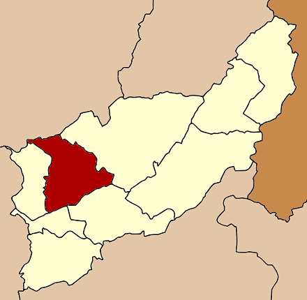
Mueang Uttaradit
เมืองอุตรดิตถ์— Amphoe — Amphoe location in Uttaradit Province
Coordinates: 17°37′33″N 100°5′48″E / 17.62583°N 100.09667°ECoordinates: 17°37′33″N 100°5′48″E / 17.62583°N 100.09667°E Country  Thailand
Province Uttaradit Seat Tha It Area - Total 765.476 km2 (295.6 sq mi) Population (2009) - Total 151,108 - Density 200.6/km2 (519.6/sq mi) Time zone THA (UTC+7) Postal code 53000 Geocode 5301 Mueang Uttaradit (Thai: เมืองอุตรดิตถ์; IPA: [mɯ̄aŋ ʔùt.tā.rā.dìt]) is the capital district (Amphoe Mueang) of Uttaradit Province, northern Thailand.
Contents
Geography
Neighboring districts are (from the east clockwise) Tha Pla, Thong Saen Khan, Tron, Laplae of Uttaradit Province and Den Chai of Phrae Province.
History
In 1917 the district was renamed from Mueang to Bang Po (บางโพ).[1] In 1938 it was renamed back to Mueang Uttaradit.[2]
Administration
The district is subdivided into 17 subdistricts (tambon), which are further subdivided into 154 villages (muban). The town (thesaban mueang) Uttaradit covers the whole tambon Tha It. There are three more subdistrict municipalities (thesaban tambon) - Wang Kaphi and Ban Ko each cover the whole of their eponymous tambons, and Ban Dan Na Kham covers parts of tambon Ban Dan Na Kham. There are further 15 Tambon Administrative Organizations (TAO).
No. Name Thai Villages Inh.[3] 1. Tha It ท่าอิฐ - 34,500 2. Tha Sao ท่าเสา 10 13,436 3. Ban Ko บ้านเกาะ 8 8,863 4. Pa Sao ป่าเซ่า 8 7,478 5. Khung Taphao คุ้งตะเภา 8 8,765 6. Wang Kaphi วังกะพี้ 9 10,364 7. Hat Kruat หาดกรวด 9 7,771 8. Nam Rit น้ำริด 10 7,127 9. Ngio Ngam งิ้วงาม 15 9,040 10. Ban Dan Na Kham บ้านด่านนาขาม 11 10,329 11. Ban Dan บ้านด่าน 12 5,118 12. Pha Chuk ผาจุก 14 8,499 13. Wang Din วังดิน 11 4,664 14. Saen To แสนตอ 8 3,374 15. Hat Ngio หาดงิ้ว 10 4,979 16. Khun Fang ขุนฝาง 7 3,926 17. Tham Chalong ถ้ำฉลอง 4 2,875 References
- ^ "ประกาศกระทรวงมหาดไทย เรื่อง เปลี่ยนชื่ออำเภอ" (in Thai). Royal Gazette 34 (0 ก): 40–68. 1917-04-29. http://www.ratchakitcha.soc.go.th/DATA/PDF/2460/A/40.PDF.
- ^ "พระราชกฤษฎีกาเปลี่ยนนามจังหวัด และอำเภอบางแห่ง พุทธศักราช ๒๔๘๑" (in Thai). Royal Gazette 55 (0 ก): 658–666. 1938-11-14. http://www.ratchakitcha.soc.go.th/DATA/PDF/2481/A/658.PDF.
- ^ "Population statistics 2009". Department of Provincial Administration. http://www.dopa.go.th/xstat/p5253_01.html.
Mueang Uttaradit · Tron · Tha Pla · Nam Pat · Fak Tha · Ban Khok · Phichai · Laplae · Thong Saen Khan
Categories:- Amphoe of Uttaradit
- Uttaradit Province geography stubs
Wikimedia Foundation. 2010.