- Mueang Uthai Thani District
-
Mueang Uthai Thani
เมืองอุทัยธานี— Amphoe — Amphoe location in Uthai Thani Province
Coordinates: 15°22′46″N 100°1′29″E / 15.37944°N 100.02472°ECoordinates: 15°22′46″N 100°1′29″E / 15.37944°N 100.02472°E Country  Thailand
Province Uthai Thani Seat Tambon Muban Amphoe established Area – Total 250.1 km2 (96.6 sq mi) Population (2005) – Total 52,591 – Density 210.3/km2 (544.7/sq mi) Time zone THA (UTC+7) Postal code 61000 Geocode 6101 Mueang Uthai Thani (Thai: เมืองอุทัยธานี) is the capital district (Amphoe Mueang) of Uthai Thani Province, northern Thailand.
Geography
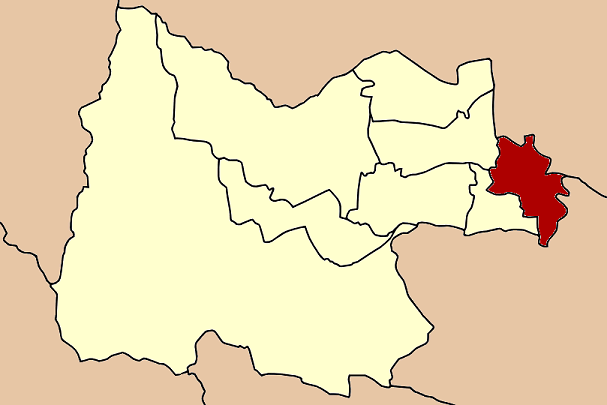
Neighboring districts are (from the west clockwise) Nong Khayang, Thap Than, of Uthai Thani Province, Krok Phra, Phayuha Khiri of Nakhon Sawan Province, Manorom and Wat Sing of Chainat Province.
Administration
The district is subdivided into 14 subdistricts (tambon), which are further subdivided into 86 villages (muban). The town (thesaban mueang) Uthai Thani covers the whole tambon Uthai Mai. There are further 8 Tambon administrative organizations (TAO).
No. Name Thai name Villages Inh. 1. Uthai Mai อุทัยใหม่ - 17,510 2. Nam Suem น้ำซึม 7 6,148 3. Sakae Krang สะแกกรัง 8 4,773 4. Don Khwang ดอนขวาง 7 3,197 5. Hat Thanong หาดทนง 6 2,036 6. Ko Thepho เกาะเทโพ 6 2,480 7. Tha Sung ท่าซุง 8 3,951 8. Nong Kae หนองแก 6 2,059 9. Non Lek โนนเหล็ก 6 1,406 10. Nong Tao หนองเต่า 6 1,768 11. Nong Phai Baen หนองไผ่แบน 6 2,356 12. Nong Phang Kha หนองพังค่า 6 1,654 13. Thung Yai ทุ่งใหญ่ 5 909 14. Noen Chaeng เนินแจง 9 2,344 Mueang Uthai Thani · Thap Than · Sawang Arom · Nong Chang · Nong Khayang · Ban Rai · Lan Sak · Huai Khot
Categories:- Amphoe of Uthai Thani
- Northern Thailand geography stubs
Wikimedia Foundation. 2010.