- Chum Ta Bong District
-
Chum Ta Bong
ชุมตาบง— Amphoe — Amphoe location in Nakhon Sawan Province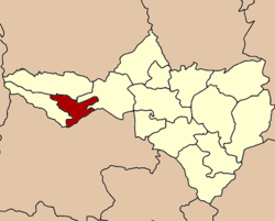
Coordinates: 15°37′54″N 99°33′10″E / 15.63167°N 99.55278°ECoordinates: 15°37′54″N 99°33′10″E / 15.63167°N 99.55278°E Country  Thailand
Province Nakhon Sawan Seat Chum Ta Bong Tambon Muban Amphoe established Area - Total 379.04 km2 (146.3 sq mi) Population (2005) - Total 18,369 - Density 48.5/km2 (125.6/sq mi) Time zone THA (UTC+7) Postal code 60150 Geocode 6015 Chum Ta Bong (Thai: ชุมตาบง) is a district (amphoe) in the western part of Nakhon Sawan Province, northern Thailand.
Contents
History
The Chum Ta Bong community was established by the people from Tambon Wang Mueang, Lat Yao district in 1967. They had Mr. Bong Charawan (นายบง ชาระวัน) as their leader. The community was in Tambon Huai Nam Hom.
When the government established the minor district Mae Wong in 1992, Huai Nam Hom was included in the district. Later Huai Nam Hom was divided to be three tambon, Huai Nam Hom, Chum Ta Bong and Pang Sawan.
Becoming effective on July 1, 1997 Tambon Chum Ta Bong and Pang Sawan were separated from Mae Wong to become the minor district (King Amphoe) Chum Ta Bong[1].
Following a decision of the Thai government on May 15, 2007, all of the 81 minor districts were to be upgraded to full districts[2]. With the publishing in the Royal Gazette on August 24 the upgrade became official [3].
Geography
Neighboring districts are (from the north clockwise) Mae Wong and Lat Yao of Nakhon Sawan Province, Sawang Arom and Lan Sak of Uthai Thani Province, and Mae Poen of Nakhon Sawan again.
Administration
The minor district is subdivided into 2 subdistricts (tambon), which are further subdivided into 22 villages (muban). There are no municipal (thesaban) areas, and 2 Tambon administrative organizations (TAO).
No. Name Thai name Villages Inh. 1. Chum Ta Bong ชุมตาบง 12 11,623 2. Pang Sawan ปางสวรรค์ 10 6,746 References
- ^ "ประกาศกระทรวงมหาดไทย เรื่อง แบ่งเขตท้องที่อำเภอลาดยาว จังหวัดนครสวรรค์ ตั้งเป็นกิ่งอำเภอชุมตาบง" (in Thai). Royal Gazette 114 (Special 51 ง): 12. June 25, 1997. http://www.ratchakitcha.soc.go.th/DATA/PDF/2540/E/051/12.PDF.
- ^ "แถลงผลการประชุม ครม. ประจำวันที่ 15 พ.ค. 2550" (in Thai). Manager Online. http://www.manager.co.th/Politics/ViewNews.aspx?NewsID=9500000055625.
- ^ "พระราชกฤษฎีกาตั้งอำเภอฆ้องชัย...และอำเภอเหล่าเสือโก้ก พ.ศ. ๒๕๕๐" (in Thai). Royal Gazette 124 (46 ก): 14–21. August 24, 2007. http://www.ratchakitcha.soc.go.th/DATA/PDF/2550/A/046/14.PDF.
External links
Mueang Nakhon Sawan · Krok Phra · Chum Saeng · Nong Bua · Banphot Phisai · Kao Liao · Takhli · Tha Tako · Phaisali · Phayuha Khiri · Lat Yao · Tak Fa · Mae Wong · Mae Poen · Chum Ta Bong
Categories:- Amphoe of Nakhon Sawan
- Northern Thailand geography stubs

Wikimedia Foundation. 2010.