- Mueang Phayao District
-
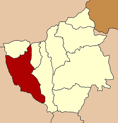
Mueang Phayao
เมืองพะเยา— Amphoe — Amphoe location in Phayao Province
Coordinates: 19°11′31″N 99°52′43″E / 19.19194°N 99.87861°ECoordinates: 19°11′31″N 99°52′43″E / 19.19194°N 99.87861°E Country  Thailand
Province Phayao Seat Ban Tom Area – Total 842.1 km2 (325.1 sq mi) Population (2008) – Total 125,818 – Density 143.8/km2 (372.4/sq mi) Time zone THA (UTC+7) Postal code 56000 Geocode 5601 Mueang Phayao (Thai: เมืองพะเยา; IPA: [mɯ̄aŋ pʰā.jāw]) is the capital district (Amphoe Mueang) of Phayao Province, northern Thailand.
Contents
Geography
Neighboring districts are (from the north clockwise) Mai Chai of Phayao Province, Pa Daet of Chiang Rai Province, Phu Kamyao, Dok Khamtai of Phayao Province again, Ngao and Wang Nuea of Lampang Province.
History
1917 the district Phayao was renamed to Mueang Phayao.[1] In 1938 the word Mueang was removed again, as only the capital districts of the provinces were supposed to have that name.[2] With the creation of Phayao province in 1977, the district was named Mueang Phayao again.[3]
Administration
The district is subdivided into 15 subdistricts (tambon), which are further subdivided into 171 villages (muban). The town (thesaban mueang) Phayao covers the whole tambon Wiang and Mae Tam. There are further 13 Tambon administrative organizations (TAO).
No. Name Thai Inh.[4] 1. Wiang เวียง 10,701 2. Mae Tam แม่ต๋ำ 7,929 4. Mae Na Ruea แม่นาเรือ 9,072 5. Ban Tun บ้านตุ่น 5,098 6. Ban Tam บ้านต๊ำ 7,310 7. Ban Tom บ้านต๋อม 13,308 8. Mae Puem แม่ปืม 9,269 10. Mae Ka แม่กา 17,629 11. Ban Mai บ้านใหม่ 4,869 12. Cham Pa Wai จำป่าหวาย - 8,482 13. Tha Wang Thong ท่าวังทอง 14,111 14. Mae Sai แม่ใส 6,451 15. Ban Sang บ้านสาง 4,433 16. Tha Champi ท่าจำปี 4,100 18. San Pa Muang สันป่าม่วง 3,056 Missing numbers belong to tambon which now form Phu Kamyao.
References
- ^ "ประกาศกระทรวงมหาดไทย เรื่อง เปลี่ยนชื่ออำเภอ" (in Thai). Royal Gazette 34 (0 ก): 40–68. 1917-04-29. http://www.ratchakitcha.soc.go.th/DATA/PDF/2460/A/40.PDF.
- ^ "พระราชกฤษฎีกาเปลี่ยนนามจังหวัด และอำเภอบางแห่ง พุทธศักราช ๒๔๘๑" (in Thai). Royal Gazette 55 (0 ก): 658–666. 1938-11-14. http://www.ratchakitcha.soc.go.th/DATA/PDF/2481/A/658.PDF.
- ^ "พระราชบัญญัติตั้งจังหวัดพะเยา พ.ศ. ๒๕๒๐" (in Thai). Royal Gazette 94 (69 ก ฉบับพิเศษ): 1–3. 1977-07-28. http://www.ratchakitcha.soc.go.th/DATA/PDF/2520/A/069/1.PDF.
- ^ "Population statistics 2008". Department of Provincial Administration. http://www.dopa.go.th/xstat/p5156_01.html.
External links
- amphoe.com (Thai)
Mueang Phayao · Chun · Chiang Kham · Chiang Muan · Dok Khamtai · Pong · Mae Chai · Phu Sang · Phu KamyaoCategories:- Amphoe of Phayao
- Northern Thailand geography stubs
Wikimedia Foundation. 2010.