- Mueang Phatthalung District
-
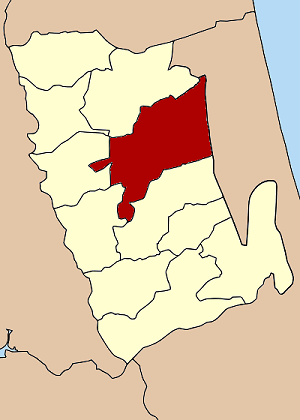
Mueang Phatthalung
เมืองพัทลุง— Amphoe — Amphoe location in Phatthalung Province
Coordinates: 7°37′6″N 100°4′24″E / 7.61833°N 100.07333°ECoordinates: 7°37′6″N 100°4′24″E / 7.61833°N 100.07333°E Country  Thailand
Province Phatthalung Seat Tambon Muban Amphoe established Area - Total 427.4 km2 (165 sq mi) Population (2005) - Total 119,680 - Density 280.0/km2 (725.2/sq mi) Time zone THA (UTC+7) Postal code 93000 Geocode 9301 Mueang Phatthalung (Thai: เมืองพัทลุง) is the capital district (Amphoe Mueang) of Phatthalung Province, southern Thailand.
Contents
Geography
Neighboring districts are (from the south clockwise) Khao Chaison, Kong Ra, Srinagarindra, and Khuan Khanun of Phatthalung Province, and Ranot and Krasae Sin of Songkhla Province.
The eastern part of the district is at the shore of the Thale Luang, the northern part of the Songkhla Lake.
History
The district Klang Mueang (กลางเมือง) was one of the three original districts established in 1896. In 1917 it was renamed to Lampam (ลำปำ), following the name of the tambon containing the district administration.[1] The administration was moved to tambon Khuha Sawan in 1924. 1938 the district was finally renamed to Mueang Phatthalung.
Administration
The district is subdivided into 14 subdistricts (tambon), which are further subdivided into 144 villages (muban). The town (thesaban mueang) Phatthalung covers the whole tambon Khuhu Sawan, and small parts of the tambon Khao Chiak, Tha Miram, Prang Mu, Lampam, Tamnan and Khuan Maphrao. There are further 13 Tambon administrative organizations (TAO).
No. Name Thai name Villages Inh. 1. Khuha Sawan คูหาสวรรค์ - 38,340 3. Khao Chiak เขาเจียก 11 3,656 4. Tha Miram ท่ามิหรำ 10 4,980 5. Khok Cha-ngai โคกชะงาย 9 5,062 6. Na Thom นาท่อม 8 4,386 7. Prang Mu ปรางหมู่ 9 4,909 8. Tha Khae ท่าแค 12 7,512 9. Lampam ลำปำ 11 6,049 10. Tamnan ตำนาน 14 7,371 11. Khuan Maphrao ควนมะพร้าว 16 10,626 12. Rom Mueang ร่มเมือง 9 5,129 13. Chai Buri ชัยบุรี 13 8,285 14. Na Not นาโหนด 12 8,056 15. Phaya Khan พญาขัน 10 5,319 Missing numbers are tambon which now form Srinagarindra district.
References
- ^ "ประกาศกระทรวงมหาดไทย เรื่อง เปลี่ยนชื่ออำเภอ" (in Thai). Royal Gazette 34 (0 ก): 40–68. April 29 1917. http://www.ratchakitcha.soc.go.th/DATA/PDF/2460/A/40.PDF.
Mueang Phatthalung · Kong Ra · Khao Chaison · Tamot · Khuan Khanun · Pak Phayun · Si Banphot · Pa Bon · Bang Kaeo · Pa Phayom · Srinagarindra
Categories:- Amphoe of Phatthalung
- Southern Thailand geography stubs
Wikimedia Foundation. 2010.