- In Buri District
-
In Buri
อินทร์บุรี— Amphoe — Amphoe location in Singburi Province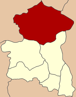
Coordinates: 15°0′28″N 100°19′37″E / 15.00778°N 100.32694°ECoordinates: 15°0′28″N 100°19′37″E / 15.00778°N 100.32694°E Country  Thailand
Province Singburi Seat In Buri Tambon Muban Amphoe established Area – Total 314.3 km2 (121.4 sq mi) Population (2007) – Total 57,771 – Density 183.8/km2 (476/sq mi) Time zone THA (UTC+7) Postal code 16110 Geocode 1706 In Buri (Thai: อินทร์บุรี; IPA: [īn būrīː]) is the northernmost district (amphoe) of Singburi Province in central Thailand.
Contents
History
In Buri is an ancient city, one of the major Mueang or city states. It was built in the reign of King Ramesuan in 1369. In the Ayutthaya era, the governor of In Buri always was a royal family member because In Buri was as a north frontier city of Ayutthaya. During the thesaphiban administrative reforms King Rama V downgraded In Buri to be a subordinate of Singburi in 1895. It was converted into a district of Singburi province later.
Geography
Neighboring districts are (from the north clockwise) Takhli of Nakhon Sawan Province, Ban Mi of Lopburi Province, Mueang Sing Buri and Bang Rachan of Singburi Province, and Sapphaya and Sankhaburi of Chainat Province.
Administration
The district is subdivided into 10 subdistricts (tambon), which are further subdivided into 101 villages (muban). In Buri tiself is a subdistrict municipality which covers parts of the tambon In Buri. There are further 10 Tambon administrative organizations (TAO).
No. Name Thai Inh. 1. In Buri อินทร์บุรี 11,150 2. Prasuk ประศุก 6,221 3. Thap Ya ทับยา 6,161 4. Ngio Rai งิ้วราย 5,604 5. Chi Nam Rai ชีน้ำร้าย 4,386 6. Tha Ngam ท่างาม 5,340 7. Nam Tan น้ำตาล 3,584 8. Thong En ทองเอน 7,977 9. Huai Chan ห้วยชัน 4,909 10. Pho Chai โพธิ์ชัย 2,439 External links
- amphoe.com (Thai)
Categories:- Amphoe of Singburi
- Former provinces of Thailand
- Central Thailand geography stubs

Wikimedia Foundation. 2010.