- Phrom Buri District
-
Phrom Buri
พรหมบุรี— Amphoe — Amphoe location in Singburi Province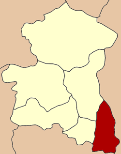
Coordinates: 14°47′28″N 100°27′13″E / 14.79111°N 100.45361°ECoordinates: 14°47′28″N 100°27′13″E / 14.79111°N 100.45361°E Country  Thailand
Province Singburi Seat Tambon Muban Amphoe established Area – Total 82.5 km2 (31.9 sq mi) Population (2007) – Total 24,306 – Density 294.6/km2 (763/sq mi) Time zone THA (UTC+7) Postal code 16120 Geocode 1704 Phrom Buri (Thai: พรหมบุรี; IPA: [pʰrōm būrīː]) is a district (amphoe) the in eastern part of Singburi Province, central Thailand.
Contents
History
The town (Mueang) of Phrom Buri dates back to before the reign of King U Thong, the first king of Ayutthaya kingdom. The old city was located at Wat Amphawan, Tambon Phrom Buri. Later the center of the city was moved to Pak Bang Mhuen Han (ปากบางหมื่นหาญ) and to the north side of Wat Phromma Thephawat.
During the thesaphiban reforms, Phrom Buri was one of the provinces included into Monthon Krungkao (later renamed to Monthon Ayutthaya) in 1895. It was later downgraded to a district within the province Singburi.
In 1943 the district office was moved to its present location north side of Wat Kudi Thong.
Geography
Neighboring districts are (from the east clockwise) Tha Wung of Lopburi Province, Chaiyo and Pho Thong of Ang Thong Province, Tha Chang and Mueang Sing Buri of Sing Buri Province.
Administration
The district is subdivided into 7 subdistricts (tambon), which are further subdivided into 42 villages (muban). There are two townships (thesaban tambon) in the district - Pak Bang covers the complete tambon Phrom Buri, and Bang Nam Chiao covers nearly the complete tambon Bang Nam Chiao. There are further 4 Tambon administrative organizations (TAO).
No. Name Thai Inh. 1. Phra Ngam พระงาม 3,902 2. Phrom Buri พรหมบุรี 3,170 3. Bang Nam Chiao บางน้ำเชี่ยว 3,647 4. Ban Mo บ้านหม้อ 6,250 5. Ban Paeng บ้านแป้ง 2,369 6. Hua Pa หัวป่า 1,477 7. Rong Chang โรงช้าง 3,491 External links
- amphoe.com (Thai)
Categories:- Amphoe of Singburi
- Former provinces of Thailand
- Central Thailand geography stubs
Wikimedia Foundation. 2010.