- Mueang Phuket District
-
Mueang Phuket
เมืองภูเก็ต— Amphoe — Amphoe location in Phuket Province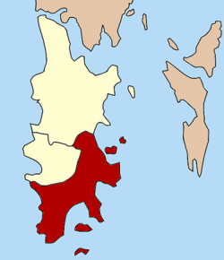
Coordinates: 7°53′24″N 98°23′6″E / 7.89°N 98.385°ECoordinates: 7°53′24″N 98°23′6″E / 7.89°N 98.385°E Country  Thailand
Province Phuket Seat Talat Yai Tambon Muban Amphoe established Area - Total 224.0 km2 (86.5 sq mi) Population (2007) - Total 196,733 - Density 878.3/km2 (2,274.8/sq mi) Time zone THA (UTC+7) Postal code 83000 and 83100 Geocode 8301 Amphoe Mueang Phuket (Thai: เมืองภูเก็ต) is the capital district (amphoe mueang) of Phuket Province. The town Phuket itself is in the northwest of the district.
Contents
Geography
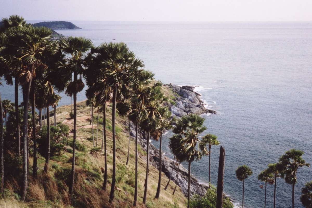
 Promthep Cape
The district covers the southern part of the island Phuket. The western and southern coast consists of several more or less touristical beaches, from the northwest: Karon, Kata, Kata Noi, Nai Harn, Rawai and the Friendship Beach along the Chalong Bay. The beaches are separated from each other by rocky capes, most notably the Promthep Cape with the southernmost tip of the island. The cape is popular for Thai people to see the sunset there.
History
Originally named Thung Kha (ทุ่งคา), it was renamed to Mueang Phuket according to the province name on November 14 1938.[1]
Temples
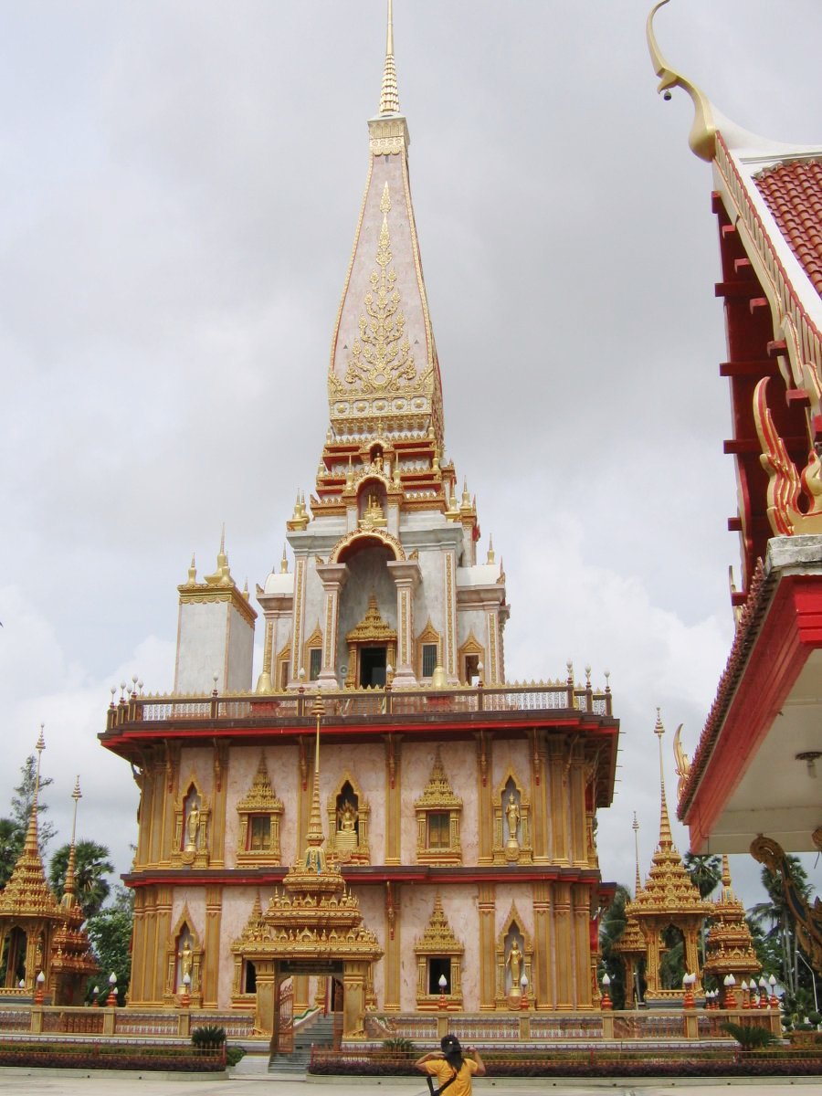
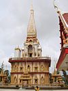 Pagoda of Wat Chalong
The most important of the 29 buddhist temples of Phuket is Wat Chalong (วัดฉลอง, วัดไชยธาราราม). It is dedicated to two highly venerable monks, Luang Pho Chaem (หลวงพ่อแช่ม) and Luang Pho Chuang (หลวงพ่อช่วง), who with their knowledge of herbal medicine helped the injured of a tin miners rebellion in 1876.
Administration
The district is subdivided into 8 subdistricts (tambon), which are further subdivided into 44 villages (muban). The town of Phuket has city status (thesaban nakhon) and covers the tambon Talad Yai and Talad Nuea; Karon, Ratsada, Rawai and Wichit have subdistrict municipality status (thesaban tambon) and each cover the complete same-named tambon. Chalong and Ko Kaeo have a Tambon administrative organizations (TAO).
Nr. Name Thai name Villages Inh. 1. Talat Yai ตลาดใหญ่ - 52,192 2. Talat Nuea ตลาดเหนือ - 23,381 3. Ko Kaeo เกาะแก้ว 7 10,136 4. Ratsada รัษฎา 7 33,534 5. Wichit วิชิต 9 38,701 6. Chalong ฉลอง 10 18,072 7. Rawai ราไวย์ 7 13,623 8. Karon กะรน 4 7,094 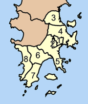
References
- ^ "พระราชกฤษฎีกาเปลี่ยนนามจังหวัด และอำเภอบางแห่ง พุทธศักราช ๒๔๘๑" (in Thai) (PDF). Royal Gazette 55 (0 ก): 658. November 14 1938. http://www.ratchakitcha.soc.go.th/DATA/PDF/2481/A/658.PDF.
External links
Categories:- Amphoe of Phuket


Wikimedia Foundation. 2010.