- Mowden, County Durham
-
Coordinates: 54°32′02″N 1°35′36″W / 54.534°N 1.5934°W
Mowden 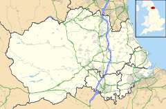
 Mowden
Mowden shown within County DurhamOS grid reference NZ264154 Unitary authority Darlington Ceremonial county County Durham Region North East Country England Sovereign state United Kingdom Post town DARLINGTON Postcode district DL1 Dialling code 01325 Police Durham Fire County Durham and Darlington Ambulance North East EU Parliament North East England UK Parliament Darlington List of places: UK • England • County Durham For the place in Essex see Mowden, Essex.
Mowden is a large housing estate situated on the northern edge of the West End of Darlington.
Contents
History
Houses here date back to 1960s and they are among some of the most sought after in the town.
Amenities
The Mowden estate itself contains an infant and junior school, a small shopping precinct (Mowden shops), Mowden Park rugby club and Mowden Hall, now used as a government office. Mowden Hall on Staindrop Road was a private school from 1935-45 and is now used by the Department for Children, Schools and Families [1] and the Teachers' Pensions HQ. Local pubs include the Mowden.
Geography
Nearby areas include Hummersknott to the south, Branksome to the north and Cockerton to the north-east.
External links
Categories:- County Durham geography stubs
- Villages in County Durham
- Darlington (borough)

Wikimedia Foundation. 2010.