- Mittagong railway station
-
 Mittagong
Southern Highlands Line CountryLink Southern Station code MIT Town Mittagong Street(s) Regent Street Distance from Central Station 131.57 km Altitude (above sea level) 635.57 m Types of stopping trains Intercity
CountryLinkNumber of platforms 2 Number of tracks 2 Platform arrangement 2 Side Type of station Ground Ticket barriers No Transfers available Bus Disabled access 
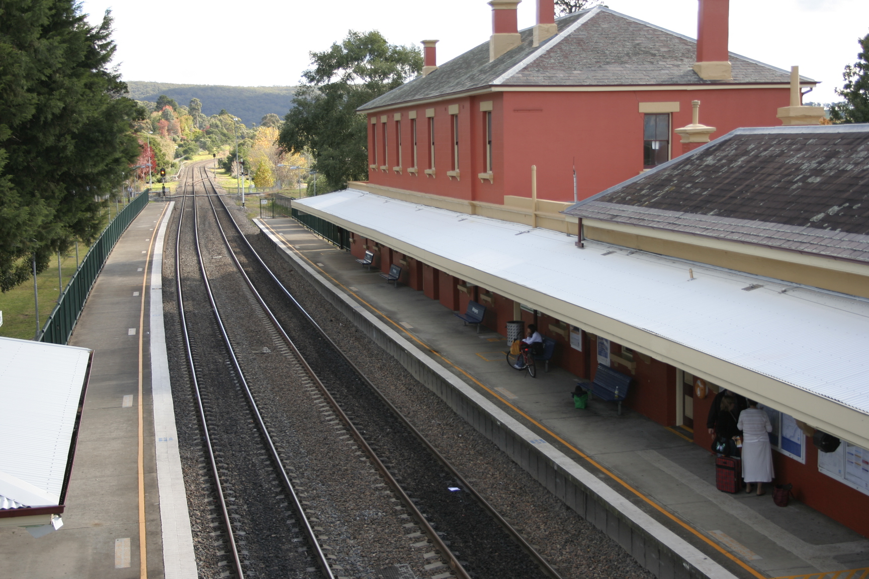
No Station facilities Link Mittagong Railway Station is a station on the Southern Highlands line of the CityRail intercity network, serving the large town of Mittagong, New South Wales, Australia. The station opened on 1 March 1867. The station has two platforms that serve the diesel railcars that use the line as well as CountryLink services between Sydney, Canberra and Griffith.
The platforms are connected by a pedestrian overbridge. There is no Easy Access for wheelchairs.
The station is the junction for the old alignment of the Main South Railway Line between here and Picton, and for the now lifted line to the ghost town of Joadja.
Contents
Platforms and services
The station has a reasonably infrequent service, with trains between Moss Vale and Sydney approximately every 1.5 to 2 hours, and only three trains on weekdays and two on weekends proceeding further to Goulburn. The trains to Goulburn only come in the early morning and in the evenings. CountryLink services between Canberra and Sydney also use the station twice a day. On Saturdays, the morning Canberra service divides at Goulburn, where half the train proceeds to Griffith. This train returns with the Sunday afternoon service to Sydney.
Platform Line Stopping Pattern Notes 
Southern Highlands Line Intercity services to Campbelltown and Sydney Terminal CountryLink Southern Country services to Sydney (2 per day) 
Southern Highlands Line Intercity services to Moss Vale and Goulburn via Bowral CountryLink Southern Country services to Canberra (2 per day) and Griffith (1 per week) Transport links
Berrima Coaches runs five routes to and from Mittagong railway station:
- 800L - to Picton
- 806 - between Bowral and Bargo
- 807 - between Bowral and High Range
- 811 - to Moss Vale
- 816 - to Moss Vale
Neighbouring stations
Preceding station NSW Main lines Following station towards AlburyMain Southern Line Aylmertontowards SydneyPreceding station Closed lines Following station Terminus Picton Loop Line (closed)Braemartowards PictonPreceding station CityRail Following station towards GoulburnSouthern Highlands Line towards CentralPreceding station CountryLink Following station CountryLink Southern Griffith Xplorer
Canberra Xplorertowards SydneyConnecting services
 Mittagong railway station
The station has an adjoining bus stop which is served by the Bowral to Picton (Loop Line - via Thirlmere) bus line that runs to the towns served by the old Main South railway alignment between Mittagong and Picton. Five services a day run in each direction on weekdays, three of the services proceeding to and from Bowral.
Coordinates: 34°27′10″S 150°26′51″E / 34.4528°S 150.4474°E
Categories:- Regional railway stations in New South Wales
- Railway stations opened in 1867


Wikimedia Foundation. 2010.