- Picton, New South Wales
-
Picton
New South Wales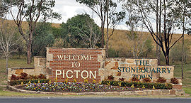

 Picton
Population: 3,027 (2006 Census)[1] Established: 1841 Postcode: 2571 Elevation: 165 m (541 ft) Location: - 80 km (50 mi) from Sydney CBD
- 20 km (12 mi) from Camden
- 30 km (19 mi) from Campbelltown
LGA: Wollondilly Shire Region: Macarthur State District: Wollondilly Federal Division: Hume Mean max temp Mean min temp Annual rainfall 23.5 °C
74 °F8.8 °C
48 °F803.6 mm
31.6 inPicton is a small town in the Macarthur Region of New South Wales, Australia, in the Wollondilly Shire. The town is located 80 kilometres South-west of Sydney, close to Camden and Campbelltown. It is also the administrative centre of Wollondilly Shire.
Contents
History
Picton was first explored by Europeans in 1798 and remained beyond the limits of legal settlement until 1821. Following the discovery of good land in the interior and the settlement of Bong Bong and the Goulburn areas, Governor Macquarie authorised the building of the new Great South Road between Sydney and the Southern Highlands in 1819.[2] This opened up the Picton area to settlers, including Henry Colden Antill,[3] who established a 2,000-acre (8.1 km2) property in 1822.[2]
Picton developed when a new line of the Great South Road was cut over the Razorback Range from Camden, and especially after the railway arrived in 1863. Picton is the only town in the Southern Hemisphere where you can pass through it twice when travelling by train.[4] It was established as Stonequarry in 1841 and was renamed Picton in 1845. It remained a stopping point on the Great South Road, later renamed the Hume Highway, until it was bypassed in the 1970s.
Bushfires destroyed several homes in the Nangarin Estate located on the western outskirts of Picton, from a fire front originating from Lakesland in September 2006.[5]
Landmarks
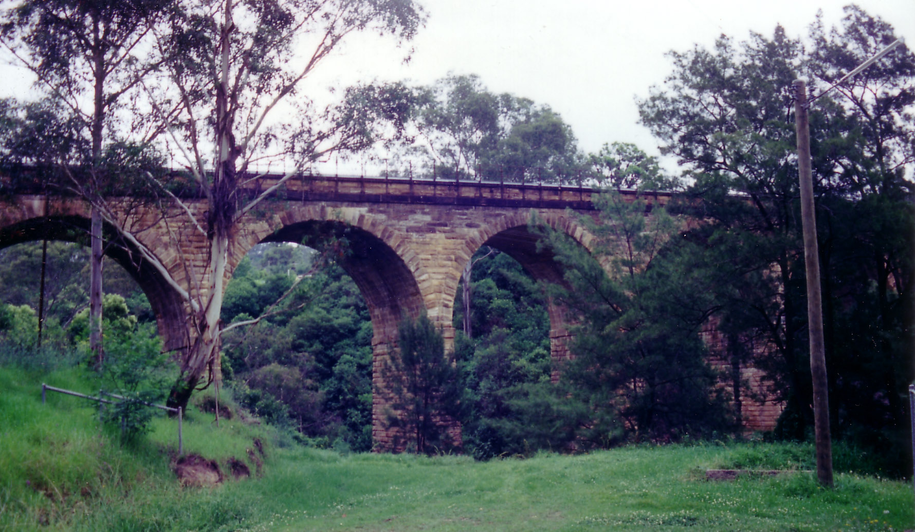
Picton is home to many historic buildings, including two types of bridges not found easily anymore elsewhere in the state - Victoria Bridge a timber trestle bridge that crosses Stonequarry Creek, opened in 1897, and the 'Picton Railway Viaduct' a stone viaduct opened in 1863 to also cross Stonequarry Creek.
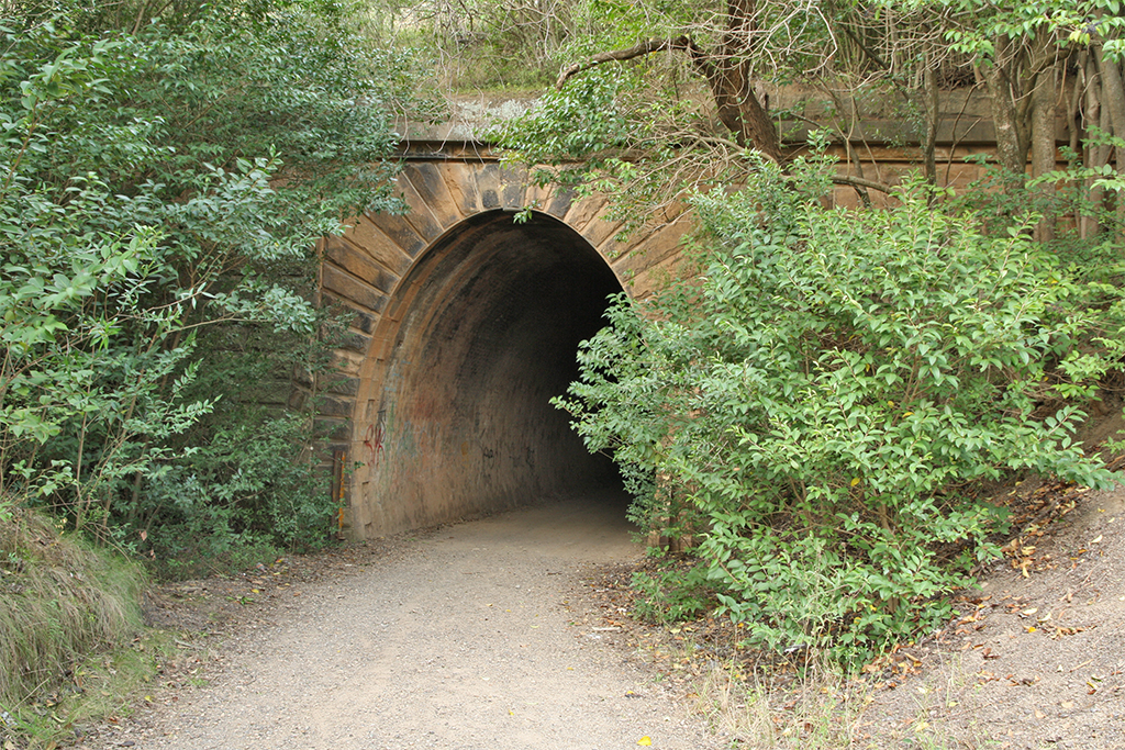
The viaduct is still in use by the railways. Ghost tours are conducted in some of the historic buildings and inside the disused railway tunnel on Redbank Range, where residents and visitors claim to have experienced paranormal activity. The abandoned tunnel was used to store mustard gas spray tanks during World War II [6].
The George IV Inn, reputedly constructed in 1839, is considered to be one of the oldest hotel buildings in Australia. The cellar contains remnants of convict shackles as prisoners being transported from Sydney to Berrima prison would often be held in Picton overnight. The barn behind the hotel may date back to 1810 and is possibly the oldest building in Picton - it is used for functions such as birthday and engagement parties. The hotel is also the location of Scharer's Little Brewery, one of the first microbreweries in Australia and winner of numerous awards for its Burragorang Bock and Scharer's Lager beers.
Transport
Picton railway station is on the Southern Highlands line with a relatively infrequent service with trains running every 30m (peak) – 2 hours (off peak).
The town is located on the Old Hume Highway.
Sport and recreation
Picton also has both senior and junior rugby league and soccer teams.
Picton is home to Australia's premier Skydiving centre Sydney Skydivers. Australia's largest turbine Drop Zone with over 40 years experience and over 1.5 Million skydives to date.
Pop culture
In October 2007, radio station Nova 96.9's Merrick and Rosso programme played a parody song called "The Picton song" which depicted Picton teenagers as promiscuous and engaging in underage sex in an attempt to get pregnant and claim the Australian Government's baby bonus scheme. This caused community outrage and many residents rang the station to complain. [7]
Nangarin Estate
Nangarin Vineyard Estate or simply Nangarin Estate is a modern village to the east and part of Picton. The estate is one of New South Wales' first residential vineyard projects. The village community manages and maintains the vineyards, residential construction and community facilities. The village is protected by legal covenants to ensure the community manages the village[8].
References
- ^ Australian Bureau of Statistics (25 October 2007). "Picton (Urban Centre/Locality)". 2006 Census QuickStats. http://www.censusdata.abs.gov.au/ABSNavigation/prenav/LocationSearch?collection=Census&period=2006&areacode=UCL165400&producttype=QuickStats&breadcrumb=PL&action=401. Retrieved 12 November 2009.
- ^ a b "Picton". Walkabout. 2005-11-05. http://walkabout.com.au/locations/NSWPicton.shtml. Retrieved 2006-11-19.
- ^ Ritchie, John; Diane Langmore (eds). "Harrison, Henry Colden Antill (1836 - 1929)". Australian Dictionary of Biography. Australian National University. http://www.adb.online.anu.edu.au/biogs/A040401b.htm. Retrieved 2006-12-25.
- ^ "Picton". The Wollondilly region of New South Wales. Stonequarry.com.au. 2005-11-05. http://www.stonequarry.com.au/towns/picton.html. Retrieved 2006-12-25.
- ^ "Wild weather claims life, homes". News.com.au. 2006-09-24. http://www.news.com.au/story/0,23599,20468177-2,00.html. Retrieved 2006-12-25.
- ^ Australian supervised
- ^ http://www.nova919.com.au/site/shows/merrick_rosso.aspx
- ^ http://www.nangarin.com/
Picton Gallery
-
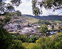
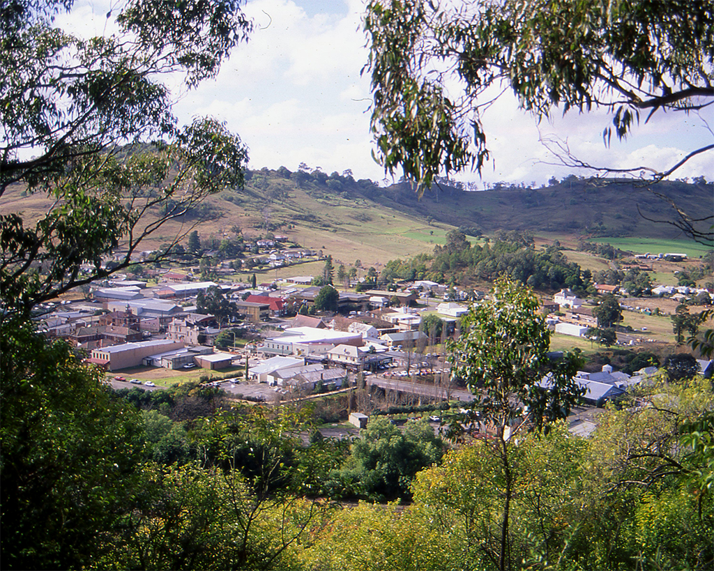
View from Reservoir Hill -

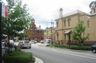
Argyle Street, looking north -
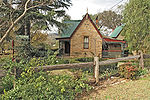
Tollgate Lodge -
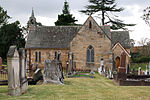
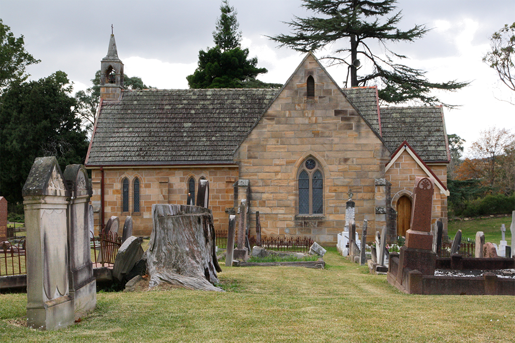
St Mark's Anglican Church -

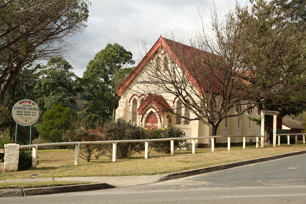
Uniting Church -
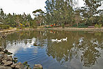
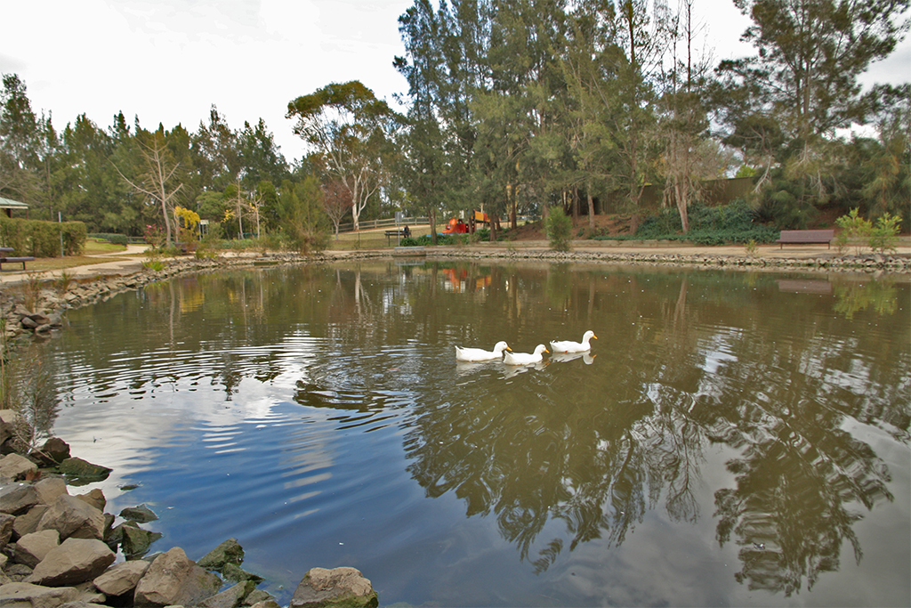
Botanic Gardens -
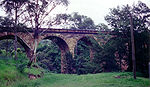
Picton railway viaduct -
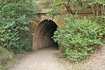
Redbank Range railway tunnel
('The Mushroom Tunnel')
Coordinates: 34°11′S 150°36′E / 34.183°S 150.6°E
Suburbs and localities within Wollondilly Shire · Macarthur · South-western Sydney · Sydney Appin · Bargo · Belimbla Park · Bingara Gorge · Burragorang · Brownlow Hill · Buxton · Camden Park · Cawdor · Couridjah · Douglas Park · Glenmore · Lakesland · Maldon · Menangle · Mount Hunter · Mowbray Park · Nattai · Nangarin · Oakdale · Orangeville · Picton · Pheasants Nest · Razorback · Silverdale · Tahmoor · Theresa Park · The Oaks · Thirlmere · Warragamba · Werombi · Wilton · Yanderra ·
YerranderieCategories:- Towns in New South Wales
- Towns in the Macarthur Region


Wikimedia Foundation. 2010.