- Menangle, New South Wales
-
Menangle
New South Wales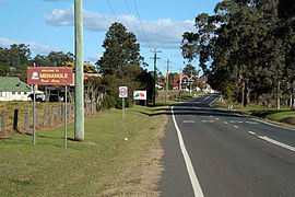
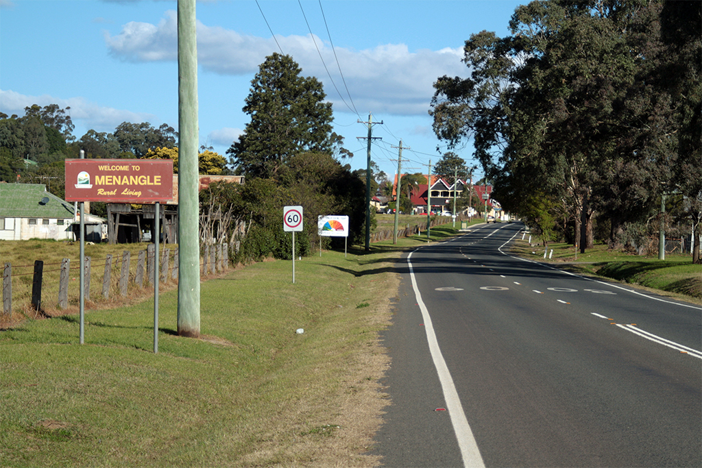
Entrance to Menangle village 
 Menangle
Population: 327 (2006 Census)[1] Postcode: 2568 Location: 69.5 km (43 mi) from Sydney CBD LGA: Wollondilly Shire Region: Macarthur State District: Electoral district of Wollondilly Federal Division: Division of Macarthur Suburbs around Menangle: Camden Park Menangle Park Menangle Park Cawdor Menangle Appin Razorback Douglas Park Appin Menangle (34°07′S 150°44′E / 34.117°S 150.733°E) is a village in the Macarthur Region of New South Wales, Australia.
Contents
Location
Menangle is part of the Wollondilly Shire. At the 2006 census, Menangle had a population of 327 people.[1]
History
The town's name is derived from an aboriginal word for 'a place of swamps and lagoons'.[2]
In 1806, Walter Davidson named his land grant in this district "Manangle". This property was later incorporated into the larger Macarthur Estate and the village grew to service the operations of Camden Park Estate.[3]
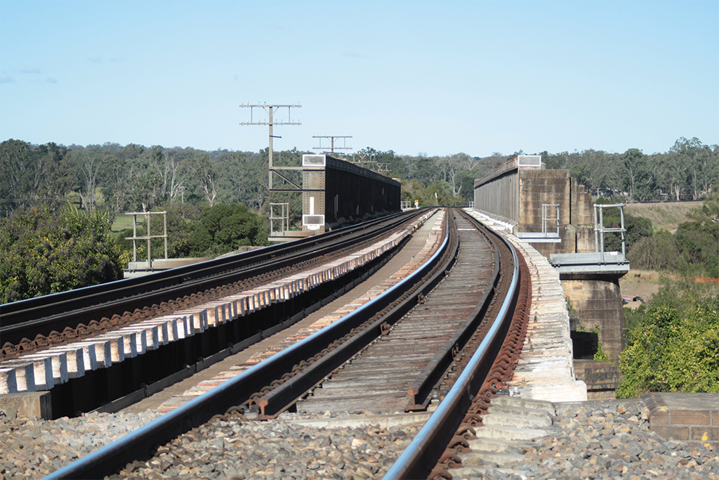
The opening of the railway in 1863[4] enabled overnight milk deliveries to the Sydney Market. The railway bridge over the Nepean River is one of the oldest in use in New South Wales today.[5] In 2003, the Viaduct underwent an intensive investigation after a report that it was in danger of collapse.[6]
In connection with the construction of Sydney Harbour Bridge, a tramway was constructed between the railway station and a sand-mining area on the banks of the Nepean River[7]; however, this tramway is not currently in service.[8]
The Village Today


Northern aspect
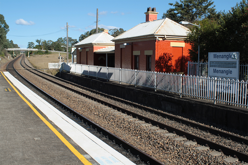
St James ChurchThe village is serviced by the Menangle railway station which is on Cityrail's Southern Highlands line.
Menangle has several heritage-listed buildings. These include Camden House,[9] The Menangle Store,[10] the Rotolactor,[11] Gilbulla,[12] The Pines, Menangle railway station[13], and the Menangle Railway Viaduct.[14]
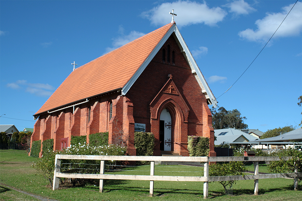
Menangle has two churches, St James Anglican and St Patrick's Catholic Church. Both churches are Heritage Listed. St Patrick's is 'a typical example of a "Simplified Gothic Revival" country church of its time.'[15] St James (1876–1896) 'has historical significance through its links with the Macarthur-Onslow family of "Camden Park" and "Gilbulla", and its associations with two leading architects, John Horbury Hunt and Sir John Sulman.'[16]
The primary school has been closed for more than twenty years and is awaiting restoration.[17]
The village's population was expanded in the 1990s with the release of Camden Park Land to Westcoast developers. A Development Control plan was created to manage the heritage of the village. Until this time, water was pumped from the Nepean River, however, in 1992 the developers provided a new water supply.[citation needed]
Australian band 'The Rubens', composed of three brothers and one childhood friend, all grew up in Menangle.
References
- ^ a b Australian Bureau of Statistics (25 October 2007). "Menangle (L) (Urban Centre/Locality)". 2006 Census QuickStats. http://www.censusdata.abs.gov.au/ABSNavigation/prenav/LocationSearch?collection=Census&period=2006&areacode=UCL151500&producttype=QuickStats&breadcrumb=PL&action=401. Retrieved 29 October 2009.
- ^ "Menangle". Geographical Names Board of New South Wales. http://www.gnb.nsw.gov.au/name_search/extract?id=anjtvqWAuj. Retrieved 29 October 2009.
- ^ St Patrick's Church history
- ^ Bayley, W. A. 1973. Picton-Mittagong Loop-Line Railway. p.11 Bulli: Austrail. ISBN 0 909597 14 6
- ^ "... typical of British bridge engineering of the 1860s, the iron spans having been fully imported. Additional supporting piers were later erected under the spans so that heavier engines could be used..." see Heritage Listing.
- ^ "Rail's red alert" Sydney Morning Herald 12 April, 2003
- ^ Eardley, Gifford. 1970. The Menangle Sand Company's Railway. Australian Railway Historical Society Bulletin, March, 1970 pp65-67
- ^ The National Library of Australia has an image in its collection titled: "Menangle Sand Co. 0-4-0T locomotive built by Davenport Loco Coy Davenport, Iowa 2' 0" gauge at Menangle January 1934" PIC P861/5097 LOC Box N8 Folder 1
- ^ Camden Park Heritage Listing
- ^ Menangle Store Heritage Listing
- ^ Rotolactor info. and image
- ^ Gilbulla Heritage Listing
- ^ Menangle Station
- ^ "Viaduct Heritage Listing (listing NSW5012102)". Australia Heritage Places Inventory. Department of Sustainability, Environment, Water, Population and Communities. http://www.heritage.gov.au/cgi-bin/ahpi/record.pl?NSW5012102.
- ^ St Patrick's Heritage Listing
- ^ St James Heritage Listing
- ^ Menangle Public School saved: Wollondilly Advertiser, 2008
Further reading
- Hawkey, Vera. 1976. A history of St. James Church of England, Menangle, 1876-1976. [Camden, N.S.W.] : [Anglican Parish of St. John]. ISBN 0909625050
- Menangle School 90th. Anniversary : souvenir book (1961)
- Menangle Underbridge Assessment : Review of Damage State Library of NSW. Retrieved June 2010.
- Moloney, J. J. 1929. Early Menangle. Newcastle, N.S.W. : The Australasian Society of Patriots, Dally [i.e. Dalley] Branch.
- Willams, Ken. 2009. Along the Menangle Road : a concise history of the land grants on Menangle Road between Menangle Bridge and the junction with Picton Road. Picton and District Historical and Family History Society. ISBN 0957992580
External links
- Menangle Community Website
- Durham Green Retirement Village, Menangle
- Elizabeth Macarthur Agricultural Institute
- 1930s photo of Gilbulla
- Menangle House history
- St James Church history
- St Patrick's church history
- Historic photo exhibition Macarthur Chronicle June, 2010
- Image of viaduct, in 1884, from State Library of NSW
- Gilbulla Conference Centre
- Menangle Virus, 1997
Menangle Gallery
-

St James Church -

St Patrick's Church -

Menangle Store -
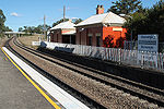
Heritage listed station buildings -
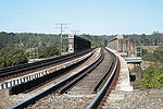
Railway Viaduct: deck -
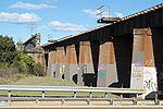
Railway Viaduct: northern approach -

Railway Viaduct: eastern side -

Railway Viaduct: western side
Suburbs and localities within Wollondilly Shire · Macarthur · South-western Sydney · Sydney Appin · Bargo · Belimbla Park · Bingara Gorge · Burragorang · Brownlow Hill · Buxton · Camden Park · Cawdor · Couridjah · Douglas Park · Glenmore · Lakesland · Maldon · Menangle · Mount Hunter · Mowbray Park · Nattai · Nangarin · Oakdale · Orangeville · Picton · Pheasants Nest · Razorback · Silverdale · Tahmoor · Theresa Park · The Oaks · Thirlmere · Warragamba · Werombi · Wilton · Yanderra ·
YerranderieCategories:- Towns in New South Wales
- Towns in the Macarthur Region


Wikimedia Foundation. 2010.