- Goulburn railway station, New South Wales
Cityrail Station alt|code=GUL|
station_name=Goulburn
servicearea=Southern Highlands Line|servicearea_color=#Southern Highlands line colour|servicearea_textcolor=white
town=Goulburn|street=Sloane St|distance=224.90|altitude=?|traintype=IntercityCountryLink |platforms=3|tracks=4|platform_arr=1 side
1 island|stationtype=Ground|gates=No|connect=Bus|disabled=No|facilities= [http://www.cityrail.info/facilities/facilities.jsp?n=112&giveOutput=true&facility= Link]Goulburn Railway Station is a station on the Main Southern railway line in
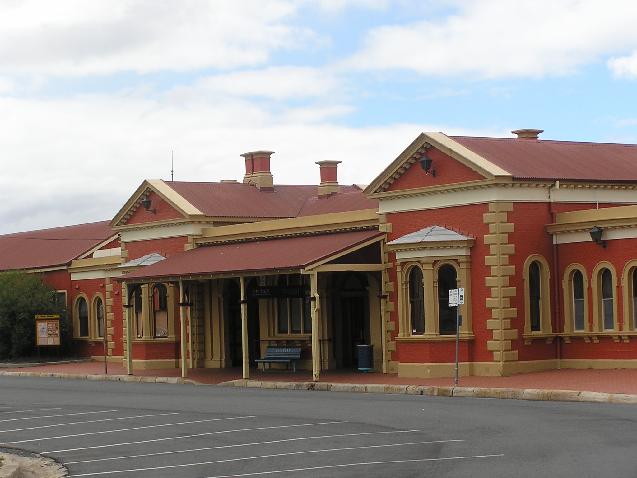
New South Wales ,Australia . It is located in the centre of the city of Goulburn and serves the city and its surrounding area. It is the terminus of the Southern Highlands services of theCityRail network and is also served byCountryLink 's Southern XPT and Xplorer trains betweenSydney andMelbourne ,Canberra and Griffith.History
The station buildings were opened in 1869.Fact|date=July 2007 The arrival of the railway in 1869, which was opened by the Governor Lord Belmore (an event commemorated by Belmore Park in the centre of the city), along with the completion of the line from Sydney to Albury in 1881 (and the connection with
Victorian Railways in 1883), was a boon to the town.Fact|date=July 2007 Later branchlines were constructed to Cooma (opened in 1889) and later extended further to Nimmitabel and then to Bombala, and to Crookwell and Taralga. Goulburn became a major railway centre with a roundhouse and engine servicing facilities and a factory which made pre-fabricated concrete components for signal boxes and station buildings. A large Railway Refreshment Room opened on the island platform in 1915, closing in 1986 with the withdrawal of the "Cooma Mail" train. [Banger C. "The Railway Refreshment Rooms of New South Wales 1855-1995. "ARHS Bulletin, Vol 54, no.790. August 2003.]ervices
With only three CityRail services on weekdays, and two on weekends, since a 2005 reduction in services, Goulburn station only sees trains in the early morning and evenings. A replacement bus service operates to Goulburn in the late morning, returning to Moss Vale in the early afternoon. Two CountryLink XPT services and two Xplorer services per day also use the station, heading to Melbourne and Canberra, the Saturday morning Canberra service also having a service to Griffith which divides from the Canberra service at the station. To comply with disabled access and so passengers do not have to cross the station footbridge, trains generally only use Platform 1 (for both directions). Platform 2 is used only occasionally.
Platform 1:
*Southern Highlands line colour>Southern Highlands Line - terminating services; intercity services to Moss Vale, Campbelltown, Glenfield and Central.
*CountryLink Southern - country services to Melbourne (2 per day), Canberra (2 per day), and Griffith (1 per week); country services to Sydney (4 per day).Platform 2:
*"This platform is not normally in use by passenger trains. Trains may use this platform during local trackwork or in emergencies."Platform 3:
*"This platform is not normally in use by passenger trains, and is usually in use as a freight siding. Trains may use this platform during local trackwork or in emergencies."Neighbouring stations
ee also
References
Wikimedia Foundation. 2010.