- Mimbridge
-
Coordinates: 51°20′14″N 0°34′50″W / 51.337261°N 0.58055878°W
Mimbridge 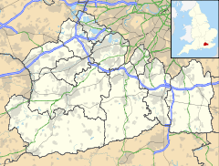
 Mimbridge
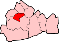
Mimbridge shown within SurreyOS grid reference SU9897560753 District Woking Shire county Surrey Region South East Country England Sovereign state United Kingdom Post town WOKING Postcode district GU24 8 Dialling code 01483 Police Surrey Fire Surrey Ambulance South East Coast EU Parliament South East England UK Parliament Woking List of places: UK • England • Surrey Mimbridge is a village and civil parish in the Woking district of Surrey, England. Its nearest town is Woking, which lies approximately 2.1 miles (3.4 km) south-east from the village, just off the A245 road.
Towns, villages and hamlets in the Woking District of Surrey, England  Brookwood · Byfleet · Castle Green · Horsell · Knaphill · Mayford · Mimbridge · Old Woking · Sheerwater · Sutton Green · Westfield · West Byfleet · WokingCategories:
- Surrey geography stubs
- Villages in Surrey

Wikimedia Foundation. 2010.