- Mayford
-
Coordinates: 51°17′45″N 0°34′02″W / 51.2958°N 0.5673°W
Mayford 
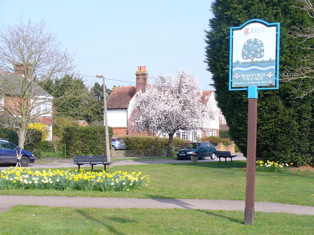
Mayford village green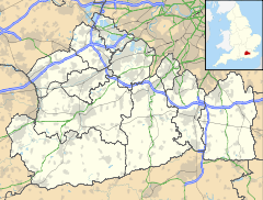
 Mayford
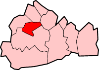
Mayford shown within SurreyPopulation 1,776 .[1] OS grid reference SU999561 District Woking Shire county Surrey Region South East Country England Sovereign state United Kingdom Post town Woking Postcode district GU22 Dialling code 01483 Police Surrey Fire Surrey Ambulance South East Coast EU Parliament South East England UK Parliament Woking List of places: UK • England • Surrey Mayford is a village in Woking borough of the county of Surrey, England. It is roughly 2½ miles south of Woking on Egley Road, part of the A320 between Woking and Guildford, Surrey. The village is mainly centred around the roundabout in the middle of the village. Mayford was mentioned in the Domesday Book in 1086, as "Maiford", and the same spelling was used in 1212.
Contents
Etymology
The name Mayford is supposed to be derived from the ford that used to cross the river Hoe. The 'May' part is believed to be short for mayweed, which grows around the River Hoe. Hawthorn trees were only called "May" from the 14th century onwards so this is unlikely to be the origin of the name.
Facilities and shops
Mayford includes the following:
- Two pubs - 'The Bird in Hand' and 'The Mayford Arms'.
- A Newsagents
- Male Barbers shop
- A Detention centre
- Garage
- the Woking Garden Centre.
Just outside the village is a railway line. This is popular with some local train spotters. By the railway there is also one of the few small greens in Mayford. There are two bridges across the railway line. Both are controlled by traffic lights. Mayford also has a few ponds on its small greens.
Wildlife
Mayford has a number of Hawthorn trees growing in the area. It also has a lot of Mayweed growing as well. A lot of the Mayweed and Hawthorn Trees grow on the edge of the River Hoe.
References
1. http://www.mayfordpond.org.uk/mayford.htm
External links
 Media related to Mayford at Wikimedia Commons
Towns, villages and hamlets in the Woking District of Surrey, England  Brookwood · Byfleet · Castle Green · Horsell · Knaphill · Mayford · Mimbridge · Old Woking · Sheerwater · Sutton Green · Westfield · West Byfleet · WokingCategories:
- Villages in Surrey
- Woking

Wikimedia Foundation. 2010.