Milestone Mountain

Milestone Mountain
Milestone Mountain

Milestone Mountain, July 1932 (East Side).
Elevation 13,644 ft (4,159 m) NAVD 88[1][2]
Prominence 711 ft (217 m) [2]
Parent peak Midway Mountain [3]
Listing SPS Mountaineers peak [4]
Location
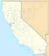
Milestone Mountain is located in California
Milestone Mountain
Location in California
Location Tulare County, California, USA
Range Great Western Divide, Sierra Nevada
Coordinates 36°38′05″N 118°29′07″W / 36.6346596°N 118.4853725°W / 36.6346596; -118.4853725Coordinates: 36°38′05″N 118°29′07″W / 36.6346596°N 118.4853725°W / 36.6346596; -118.4853725[5]
Topo map USGS Mount Brewer
Climbing
First ascent July 14, 1912 via Southwest Ridge, by William E. Colby, Francis Farquhar and Robert Price.[6]
Easiest route Southwest Ridge, East Side, or Northwest Face (all class 3 scrambles) [6]

Milestone Mountain is a thirteener on the Great Western Divide,[2] a sub-range of the Sierra Nevada. The summit marks a point on the boundary between Sequoia and Kings Canyon national parks. It is 0.6 miles (0.97 km) south of Midway Mountain and 3.8 miles (6.1 km) northeast of Triple Divide Peak. It takes its name from the shape of the obelisk on its peak, and has been called this since at least 1873.[7]

References

  1. ^ The NGVD 29 elevation of 13638 feet was converted to an NAVD 88 elevation.
  2. ^ a b c "Milestone Mountain, California". Peakbagger.com. http://www.peakbagger.com/peak.aspx?pid=2795. Retrieved 2009-09-10. 
  3. ^ "Mount Whitney". California Mountain Atlas. Peaklist.org. http://www.peaklist.org/CAmtnatlas/tables/whitney/whitney.html. Retrieved 2009-09-10. 
  4. ^ "Sierra Peaks Section List". Angeles Chapter, Sierra Club. http://angeles.sierraclub.org/sps/spslist.pdf. Retrieved 2009-09-10. 
  5. ^ "Milestone Mountain". Geographic Names Information System, U.S. Geological Survey. http://geonames.usgs.gov/pls/gnispublic/f?p=gnispq:3:::NO::P3_FID:228655. Retrieved 2009-09-10. 
  6. ^ a b Secor, R. J. (1999). The High Sierra: Peaks, Passes, and Trails (2nd ed.). Seattle: The Mountaineers. pp. 115–116. ISBN 0-89886-625-1. 
  7. ^ Farquhar, Francis P. (1926). Place Names of the High Sierra. San Francisco: Sierra Club. http://www.yosemite.ca.us/library/place_names_of_the_high_sierra/m.html. Retrieved 2009-09-10. 

External links

"MileStone Mountain". SummitPost.org. http://www.summitpost.org/page/151284. 


Wikimedia Foundation. 2010.

Игры ⚽ Поможем решить контрольную работу

Look at other dictionaries:

  • Mountain Mile — is an approximate 1.3 Mile (2.09 km) section of a purpose built graded road situated between the 27th Milestone and 29th Milestone road side marker s on the Snaefell Mountain Course used for the Isle of Man TT Races on the A18 Mountain Road in… …   Wikipedia

  • Milestone Motel — (Collingwood,Канада) Категория отеля: 2 звездочный отель Адрес: 327 First Street, L9 …   Каталог отелей

  • Snaefell Mountain Course — Mountain Course Localización Douglas, Isla de Man Eventos TT Isla de Man; Manx Grand Prix Longi …   Wikipedia Español

  • Snaefell Mountain Course — Mountain Course …   Deutsch Wikipedia

  • Snaefell Mountain Course — Motorsport venue Name = Mountain Course | Location = Douglas, Isle of Man Time = GMT Events = Isle of Man TT, Manx Grand Prix Length km = 60.72 Length mi = 37.733 Turns = 200+ Record time = 17:21.99 Record driver = John McGuinness Record team =… …   Wikipedia

  • 26th Milestone — Infobox TT course Name = 26th Milestone Caption = Latitude = 54.300 Longitude = 4.394 OSgridref = SC443921 Parish = Lezayre Distance = 26.00 Precedes = Gooseneck Follows = Guthrie s Memorial26th Milestone [ Manx Independent pp1 dated 3rd August… …   Wikipedia

  • 11th Milestone — Infobox TT course Name = 11th Milestone Caption = TT marker board for the 11th Milestone Latitude = 54.245 Longitude = 4.596 OSgridref = SC309863 Parish = German Distance = 11.3 Follows = Handley s Corner Precedes = Cronk y Voddy11th Milestone or …   Wikipedia

  • Slide Mountain (Ulster County, New York) — Infobox Mountain Name = Slide Mountain Photo = Slide Mountain Catskills.jpg Caption = Slide Mountain from Ashokan High Point Elevation = 4,180 feet (1,277 m) Location = New York, USA Range = Catskills Prominence = 3,300 feet (1005 m) Coordinates …   Wikipedia

  • Last Mountain-Touchwood — Circonscription électorale provinciale Données clés Province  Saskatchewan (   …   Wikipédia en Français

  • Dunagiri (mountain) — For the area in Uttarakhand, see Dunagiri. Dunagiri The Dunagiri from Kuari Pass Elevation …   Wikipedia

Share the article and excerpts

Direct link
Do a right-click on the link above
and select “Copy Link”